Maps of Carpathian Mountains

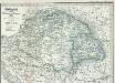
Ungarn, Siebenburgen und Galizien
1 : 3580000 Halič (Polsko a Ukrajina) Stein, Carl
Karte von Ungarn und Siebenbürgen
1 : 2056000 Maďarsko Cotta von Cottendorf, Johann Georg Pobuda, W. von der J.G. Cotta'schen geographischen Anstalt
Ungarn mit Slavonien und Kroatien, Siebenbürgen die Militairgrenze und Galizien
Schul-Atlas in 36 Karten Völter, Daniel Verlag der J.M. Dannheimer'schen Buchhandlung
[Ungarn, Galizien, Schlavonien, Croatien und Siebenbürgen]
Neuester Schul-Atlas Walch, Johann im Verlag bei Joh. Walch

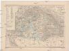
Galizien, Ungarn und Nebenländer
Neuer Handatlas über alle Theile der Erde Kiepert, Heinrich Verlag von Dietrich Reimer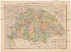
A Magyar szt. korona országainak közigazgatási és közlekedési térképe
1 : 1300000 Maďarsko Homolka, Josef Eggenberger féle könyvkereskedés
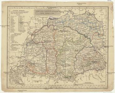
Neueste Karte von Ungarn, Galizien, Slavonien und Croatien, Siebenbürgen und dem Militairgrenzland
Grosser Hand-Atlas über alle Theile der Erde in 170 Karten Meyer, J. Verlag des Bibliographischen Instituts
Südöstliches Central-Europa
Ungarn
Ungarn mit seinen Nebenländern und Galizien
1 : 1600000 Dalmácie jižní (Chorvatsko) Kiepert, Heinrich Eulenstein, F. Geographisches Institut
Ungarn mit seinen Nebenländern und Galizien
1 : 1600000 Dalmácie jižní (Chorvatsko) Kiepert, Heinrich Blaschnek Verlag des Geographischen Institut
Ungarn mit seinen Nebenländern und Galizien
1 : 1600000 Dalmácie jižní (Chorvatsko) Kiepert, Heinrich Blaschnek Verlag des Geographisches Institut
Ungarn seit der Schlacht bei Mohacs 1526
1 : 3700000 Ungarn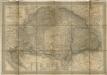
Magyar- Orság

Ungarn nebst Siebenbirgen, Sclavonien Croatien und Galizien
Ungarn
Carte particuliere de la Hongrie de la Transilvanie de la Croatie et de la Sclavonie
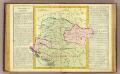
Hongrie.
1 : 2550000 Clouet, J. B. L. (Jean-Baptiste Louis), b. 1730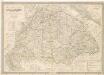
Die Kaiserlich Oesterreichischen Ungarischen Erbstaaten
Die Bezirke der Tendenz "A" vor 1875
Ungarn Wahlbezirk, Wahlverhalten
Ungarn's Bisthümer seit den Änderungen unter Maria Theresia
1 : 7400000 Ungarn Maria Theresia, Österreich, Erzherzogin
Austrian Empire.
1 : 1774080 Arrowsmith, John
Karpaten-Land
Donau-Karpaten-Gebiet, Ungarn
Ungarn, Galizien, Slavonien, Croatien, Siebenburgen.
1 : 2800000 Meyer, Joseph, 1796-1856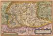
Ungariae Loca Praecipua Recens [Karte], in: Theatrum orbis terrarum, S. 268.
1 Karte aus Atlas Ortelius, Abraham
Karte der Königreiche Ungarn und Galizien
1 : 2000000 Halič (Polsko a Ukrajina) Artaria & Comp.
Karte der Königreiche Ungarn und Galizien
1 : 2000000 Sedmihradsko (Rumunsko) Artaria & comp.
Karte der Königreiche Ungarn und Galizien
1 : 2000000 Halič (Polsko a Ukrajina) Artaria & Comp.
Karte von Ungarn und Galizien
1 : 2000000 Halič (Polsko a Ukrajina) Fried, Franz Artaria & Comp.