Maps of Kazakhstan

Der westliche Theil von Mittel-Asien oder Turan mit einen Theile der angrenzenden Laender
1 : 5700000 Asie střední Weiland, Karl Ferdinand Geograph. Institut
Independent Tartary.
1 : 10600000 Tallis, J. & F.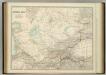
Central Asia.
1 : 4979779 Johnston, W. & A.K.
25-26. Kazakh SSR and Soviet Union Republics in Central Asia. The World Atlas.
1 : 5000000 USSR (Union of Soviet Socialist Republics).
K.8. Konstantinopel, uit: [Übersichtskarte von Europa 1:750.000]
1 : 750000 Wien : K.u.K. Militärgeographisches Institut
Tatarie et Turkistan
Nouvel atlas physique politique et historique de l'Empire ottoman et des états limitrophes en Europe, en Asie et en Afrique, en quarante feuilles Hellert, J.J. Bellizard, Dufour et Cie
Central Asia.
1 : 6589440 Stanford, Edward
Karte von Russisch-Asien vom Kaspischen Meere bis Kuldscha
Russland Russland / Asiatischer Teil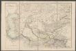
Central Asia
1 : 6000000 Arrowsmith, John Edward Stanford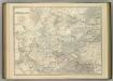
Central Asia.
1 : 4979779 Johnston, Alexander Keith
Feuille 21 (G III), uit: Carte géologique internationale de l'Europe : la carte, votée au congrès géologique international de Bologne en 1881, est exécutée conformément aux décisions d'une commission internationale, avec le concours des gouvernements, sous le dir. de M.M. Beyrich et Hauchecorne
Annotatie: Blad 48 gamme des couleurs; blad 49: bladwijzer en titelblad Heinrich Ernst Beyrich 1815-1896; Wi. Hauchecorne Berlin : Reimer / (Berlin: Institut lithographique)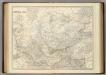
Central Asia.
1 : 4979779 Johnston, Alexander Keith
Nova maris Caspii et regionis Usbeck cum provincijs adjacentibus vera delineatio
1 Karte : Kupferdruck ; 48 x 58 cm Maas; Ghelen Homännische Erben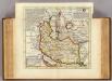
Persia, Caspian Sea, part of Independent Tartary.
1 : 13200000 Moll, Herman, d. 1732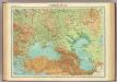
Southern Russia.
1 : 6000000 John Bartholomew and Son
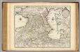
Turan oder Türkistan
1 : 5000000 Turkestán Kiepert, Heinrich Ritter, Carl D. Reimer
General'naja karta Orenbugskago kraja i častej Chivinskago i Bucharskago vlad"nij
1 : 2100000 Orenburg (Rusko : oblast) pri general'nom štabě orenburskago vojennago okruga
Administrativnaja Karta Evropejskoj časti C.C.C.P.

Tiefländer
Atlas der Geologie Zittel, K.v. ; Berghaus, Hermann Justus Perthes
Nova ac verissima Maris Caspii ante hac maximam fere partem nobis incognita ac regionum adjacentium delineatio : jussu invictissimi principis Petri Alexii fil. magni Russorum imperatoris
1 : 1500000 immenso labore et maximis sumptibus facta, atque ex autographo in lucem edita per Reinerum Ottens geographum Amstelaedam. Iacob Keyser sculp. Gedrukt t'Amsterdam : by de Wed. I. Ottens op de Nieuwen Dyk in de Wereldkaart
The Caspian Sea.
1 : 2900000 Arrowsmith, John
Vierte Revolution des Caspischen Meeres, oder Karte des Czar Peter des Grossen
1 Karte : Kupferdruck ; 20 x 29 cm Anville Philipp Heinrich Perrenon
Nova et accuratissima maris Caspii hactenus maximam partem nobis non satis cogniti ac regionum adjacentium delineat
1 Karte : Kupferdruck ; 48 x 56 cm Probst; Seutter anjezo in Verlag bey Iohann Michael Probst Chalcogr. in Augspurg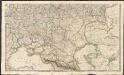
Russian Dominions
A new general atlas of modern geography, consisting of a complete collection of maps of the four quarters of the globe Wyld, James James Wyld

Nova maris Caspii et regionis Usbeck cum provincijs adjacentibus vera delineatio / in qua itinera re
1 : 4100000 1 Karte : Kupferdruck ; 47 x 57 cm Maas, Abraham [Homännische Erben]
Nova maris Caspii et regionis Usbeck cum provincijs adjacentibus vera delineatio / in qua itinera re
1 : 4100000 1 Karte : Kupferdruck ; 47 x 57 cm Maas, Abraham [Homännische Erben]
28-29. Uzbek SSR and Turkmen SSR. The World Atlas.
1 : 3000000 USSR (Union of Soviet Socialist Republics).
Mer Caspiene, Pays voisins.
1 : 3150000 L'Isle, Guillaume de, 1675-1726