Maps of Belarus

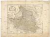
Polen vor der Theilung
1 : 1800000 Polsko Goldschmidt Goldschmidt
Poland, Lithuania
1 : 2650000 Lizars, Daniel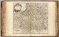
Pologne.
1 : 2400000 Robert de Vaugondy, Gilles, 1688-1766
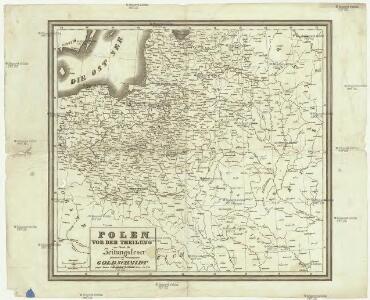
Charte von Polen
1 : 2300000 Bělorusko Kipferling, Karl Joseph Artaria
Dawna polska pod względem kościelnym ewangelickim (Zbory ewangelickie, zarówno reformowane jak augsburskie i arjańskie w dawnej Rzeczypospolitej
Polen Protestantismus Lit. W. Główczewski w Warszawie
Poland.
1 : 6400000 Seaman, James V.
Erste Theilung Polens 1772
Polen Teilung Polens <1772>
Poland, Lithuania.
1 : 2600000 Cary, John, ca. 1754-1835
Carte generale & itineraire de Pologne
1 : 5000000 Bělorusko Dorn, Sebastian Michel Gröll
Mappa Geographica Regni Poloniae
1 : 2900000 Mollova mapová sbírka Mayer, Tobias Homann, Johann Baptista - dědici
Erste Theilung Polens 1772
Polen Teilung Polens <1772>
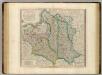
Mappa geographica regnorum Poloniae et Prussiae magnique ducatus Lithuaniae unacum provincia Russia rubra
1 : 2900000 Bělorusko Lidl, Joseph Anton Mayer, Tobias ab Josepho Antonio Lidl
Mappa Geographica Regnorum Poloniae et Prussiae
1 : 2900000 Mollova mapová sbírka Mayer, Tobias Lidl, Joseph Antonius
Polens Umwandelungen von 1772-1809
1 : 2100000 Bělorusko in der Dykischen Buchhandlung
Generalkarte von Polen, Litauen und den angrenzenden Ländern
Polen-Litauen Schraembl, Franz Anton
Carte Generale & Itineraire de Pologne
1 : 5000000 Mollova mapová sbírka Dorn, Sebastian Gröll, Michael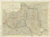
Polen unter Oestereich, Russland und Preussen getheilt
1 : 2100000 Evropa střední a východní Mollo, Tranquillo T. Mollo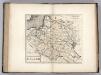
Poland.
1 : 3600000 Carey, Mathew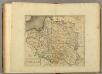
Poland.
1 : 3700000 Carey, Mathew
Poland, Shewing the Claims of Russia, Prussia & Austria.
1 : 3801600 Carey, Mathew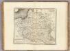
Poland, Shewing the Claims of Russia, Prussia & Austria.
1 : 3864960 Carey, Mathew
Poland, Shewing the Claims of Russia, Prussia & Austria.
1 : 3864960 Carey, Mathew
Kriegskarte des Koenigreichs Polen, nach den bewährtesten Hülfmitteln und den Theilungs-Tractaten vom Jahre 1773 und 1793 entworfen
1 : 2250000 entw. u. gest. von F. X. Hutter Augsburg : zu haben bey Joh. Walch
Das Königreich Pohlen und Grosherzogthum Litthauen
Litva
Mappa geographica Poloniae, in partes suas majores Austriac. Russic. et Borrusic
1 : 2920000 Polsko per Hommanianos Heredes
Mapa do geografji gospodarczej Polski
1 : 2800000 Polen Wirtschaftsgeografie Koszutski, Stanisław
Polen, nach seiner ersten und letzten, oder gänzlichen Theilung
1 : 2500000 entw. u. gest. von F. X. Hutter Augsburg : zu haben bey Joh. Walch
Karte von Polen
1 : 1900000 Bělorusko Reilly, Franz Johann Josef von Amon, Anton von Franz Ioh. Ios. von Reilly