Maps of Dieppe

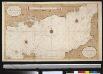
La plus grande partie de La Manche, qui contient les côtes d'Angleterre et celles de France les bords maritimes de Picardie
1 : 650000 Anglie Lotter, Tobias Conrad Tob. Conr. Lotter
La plus grande partie de la Manche
1 Karte : Kupferdruck ; 47 x 55 cm Lotter aux depens de Tob: Conr: Lotter geogr
La plus grande partie de la Manche
1 Karte : Kupferdruck ; 48 x 56 cm Seutter aux depens de Matthieu Seutter
La plus grande partie de la Manche
1 Karte : Kupferdruck ; 45 x 58 cm Ottens; Ottens chez R. et J. Ottens

Charte von England und Wallis, 4
1 Blatt : 62 x 53 cm Walch
Karte von England und Wallis, 4
1 Blatt : 62 x 53 cm Schrämbl
Ooster-deel Van 'T Canaal [Karte], in: De Nieuwe Groote Vermeerderde Zee-Atlas ofte Water-Werelt, S. 43.
1 Karte aus Atlas Doncker, Hendrick
Watershed map England, Wales 6.
1 : 760320 Letts, Son & Co.
Provinces meridionales de l'Angleterre ou côtes septentrionales de la Manche, 2
1 Blatt : 53 x 69 cm Le Rouge
Het oostelijkste gedeelte vant Kanaal vertoonende de kust van Engeland van Dover tot Portland
England Gerard van Keulen
England
1 : 778000 under the superintendence of the Society for the Diffusion of Useful Knowledge J. & C. Walker sculpt. London : Baldwin and Cradock
England & Wales SE.
1 : 633600 Stanford, Edward
England V.
1 : 765000 Society for the Diffusion of Useful Knowledge (Great Britain)
Warwicum, Northamtonia, Huntingdonia, Cantabrigia, Suffolcia, Oxonium, Buckinghamia, Bedfordia, Hartfordia, Essexia, Berceria, Middelsexia, Southa[m]tonia, Surria, Cantiu[m] & Southsexia
1 : 815000
England & Wales, south-eastern section; Channel Islands.
1 : 633600 John Bartholomew & Co.
Warwicum, Northamtonia, Huntingdonia, Cantabrigia, Suffolcia, Oxonium, Buckinghamia, Bedfordia, Hartfordia, Essexia, Berceria, Middelsexia, Southamptonia, Surria, Cantium & Southsexia. [Karte], in: Gerardi Mercatoris Atlas, sive, Cosmographicae meditationes de fabrica mundi et fabricati figura, S. 127.
1 Karte aus Atlas Mercator, Gerhard Montanus, Petrus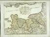
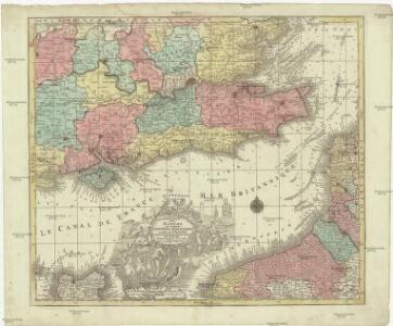
Duché et gouvernement de Normandie
1 Karte : Kupferdruck ; 37 x 50 cm Sanson; Cordier s.n.
Warwicum, Northhamtonia, Huntingdonia, Cantabrigia, Suffolcia, Oxonium, Buckinghamia, Bedfordia, Hartfordia, Essexia, Berceria, Middelsexia, Southhamptonia, Surria, Cantium & Southsexia. [Karte], in: Atlas, sive, Cosmographicae meditationes de fabrica mundi et fabricati figura, S. 122.
1 Karte aus Atlas Mercator, Gerhard
Carte des environs de Londres
1 Karte : Kupferdruck ; 48 x 66 cm Robert de Vaugondy; Arrivet; Fortin; Dussy; Browne chéz le Sr. Fortin ing.r mécanicien du roy rue de la harpe près la rue du Foin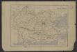
Bassin de la Tamise : et bassins secondaires du Blackwater, du Stour et du versant de la Manche
1 : 600000 Vuillemin, Alexandre Aimé 1812-1880 Paris : Imprimerie et librairie Delalain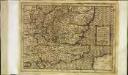
Warwicum Northhamtonia Hvntingdonia Cantabrigia, Svffolcia, Oxonivm, Bvckinghamia, Bedfordia Hartfordia Essexia Berceri Midelsexia, Sovthha[m]tonia Surria, Cantium Southsexia
1 Karte : Kupferdruck ; 17 x 24 cm Mercator Cloppenburgh
Warwicum, Northhamtonia, Huntingdonia, Cantabrigia, Suffolcia, Oxonium, Buckinghamia, Bedfordia, Hartfordia, Essexia, Berceria, Middelsexia, Southha[m]tonia, Surria, Cantiu[m] [et] Southsexia
1 Karte : Kupferdruck ; 35 x 45 cm Hondius; Mercator Henricus Hondius
Warwicum, Northhamtonia, Huntingdonia, Cantabrigia, Suffolcia, Oxonium, Buckinghamia, Bedfordia, Hartfordia, Essexia, Berceria, Middelsexia, Southha[m]tonia, Surria, Cantiu[m] [et] Southsexia
1 Karte : Kupferdruck ; 35 x 45 cm Hondius; Mercator Jodocus Hondius
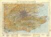
General Map (London Environs).
Cary, John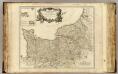
Normandie.
1 : 550000 Robert de Vaugondy, Gilles, 1688-1766
delineation of the strata of England and Wales, with part of Scotland
1 : 320000 Blatt 11 Smith, William Cary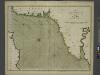
The sea-coasts of FRANCE from Calais to the River Seine
from The sea-atlas : containing an hydrographical description of most of the sea-coasts of the known parts of the world.