Maps of Denmark

Denmark and part of Norway (Denmark, Norge)
1 : 2000000 Dánsko Walker, C. Baldwin & Cradock
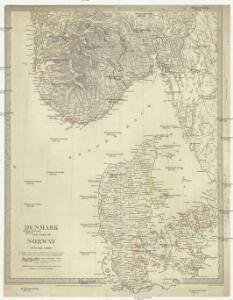
Denmark, pt. of Norway.
1 : 1770000 Society for the Diffusion of Useful Knowledge (Great Britain)
Denmark, S. Norway.
1 : 1774080 Letts, Son & Co.
Danemarc. Europe 8.
1 : 1641836 Vandermaelen, Philippe, 1795-1869
Spesielle kart 73: Dialektformers udbredelse i Kristianssands stift
1 : 2000000 A. B. Larsen Norges Geografiske Opmaaling
Carte de la mer de Dannemark et des entrées dans la mer baltique
1 Karte : Kupferdruck ; 59 x 85 cm s.n.
Spesielle kart 90-3: Rikstelegraf og telefonkart over det sydlige Norge
1 : 600000
Spesielle kart 86 sør: Riks-Telegraf og Telefonkart over det sydlige Norge
1 : 600000
Spesielle kart 42-1: Rigstelegraf- og Telefonkart over det sydlige Norge
1 : 800000
[Daenemark mit Schleswig, Holstein und Lauenburg auch Südl. Theil v. Schweden]
Hand-Atlas über alle Theile der Erde nach dem neuesten Zustande und über das Weltgebäude Stieler, Adolf bei Justus Perthes
Cimbricae Chersonesi nun Iutiae descirptio [Karte], in: Theatrum orbis terrarum, S. 205.
1 Karte aus Atlas Ortelius, Abraham Vrients, Jan Baptista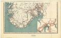
Spesielle kart 94-2: Riks-telegraf og telefonkart over det sydlige Norge 1916
1 : 600000
Totius Iutiae Generalis Accurata delincatio. [delineatio] [Karte], in: Novus atlas absolutissimus, Bd. 1, S. 134.
1 Karte aus Atlas Janssonius Offizin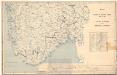
Spesielle kart 10: Kart over en befaret Jernbanelinie mellem Kongsberg og Stavanger
1 : 800000 J. Sejersted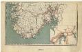
Spesielle kart 92-1: Riks-telegraf og telefonkart over det sydlige Norge 1914
1 : 600000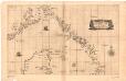
Museumskart 169: Kart over kysten fra Gøteborg til Arendal med nordspissen av Jylland
1 : 500000 Robert Dudley
Nova et accurata Tabula Episcopatuum Stavangriensis, Bergensis et Asloiensis Vicinarumque aliquot territoriorum. [Karte], in: Novus atlas absolutissimus, Bd. 1, S. 51.
1 Karte aus Atlas Janssonius Offizin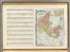
Denmark, Iceland.
1 : 1490000 Rand McNally and Company
Diocesis Stavangriensis, & partes aliquot vicinae [Karte], in: Novus Atlas, das ist, Weltbeschreibung, Bd. 1, S. 30.
1 Karte aus Atlas Blaeu, Joan Blaeu, Willem Janszoon
Dioecesis Stavangriensis, & partes aliquot vicinae [Karte], in: Theatrum orbis terrarum, sive, Atlas novus, Bd. 1, S. 44.
1 Karte aus Atlas Blaeu, Joan Blaeu, Willem Janszoon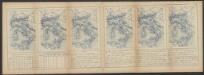
Dioecesis Stavangriensis, & partes aliquot vicinae [Karte], in: Le théâtre du monde, ou, Nouvel atlas contenant les chartes et descriptions de tous les païs de la terre, Bd. 1, S. 46.
1 Karte aus Atlas Blaeu, Willem Janszoon und Blaeu, Joan Blaeu, Willem Janszoon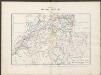
Nova et accurata Tabula Episcopatuum Stavangriensis, Bergensis et Asloiensis Vicinarumque aliquot territoriorum. [Karte], in: Gerardi Mercatoris et I. Hondii Newer Atlas, oder, Grosses Weltbuch, Bd. 1, S. 115.
1 Karte aus Atlas Mercator, Gerhard und Hondius, Jodocus Jansson, Jan
Denmark.
1 : 1837440 Tallis, J. & F.
Spesielle kart 154-1: Nattflykart, blad 1
1 : 500000
Spesielle kart 8: Postkart over de 5 sydlige Stifter. Sydlig del.
1 : 800000
DIOECESIS | STAVANGRIENSIS | & partes aliquot vicinæ | operâ L. SCAVENII, S.S.
Apud Joh. et Cornel. Blaeu.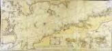
Söe=kaart over Kattegattet
1 Karte auf 2 Blatt : Kupferdruck ; 60 x 135 cm Akeleye; Schmidt s.n.
Spesielle kart 8: Postkart over de 5 sydlige Stifter. Sydlig del.
1 : 800000
Daenemark mit Schleswig, Holstein und Lauenburg auch Südl. Theil v. Schweden
Hand-Atlas über alle Theile der Erde nach dem neuesten Zustande und über das Weltgebäude Stieler, Adolf bei Justus Perthes