Maps of Ukraine
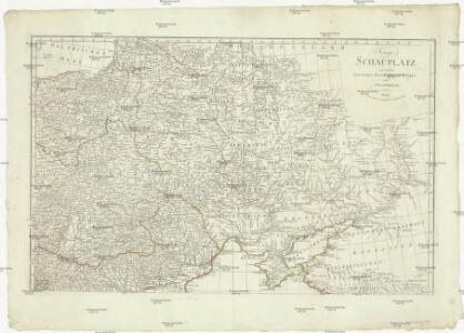
Kriegs Schauplatz zwischen Preussen Russland, der Türkey und Frankreich
Prusko Kunst und Industrie Comp.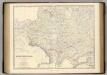
Russia SW, Poland.
1 : 3456000 Johnston, Alexander Keith, 1804-1871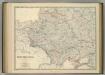
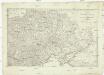
South-West Russia.
1 : 3456000 Johnston, Alexander Keith
Troisième partie de la carte d'Europe contenant le midi de la Russie, la Pologne et la Hongrie, la
1 : 2900000 1 Karte auf 2 Blatt : Kupferdruck ; 52 x 82 cm Anville, Jean Baptiste Bourguignon d' chez l'auteur au galeries du Louvre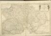


Karte von Polen und den ehemals dazu gehörigen Provinzen
1 : 8200000 Bělorusko Sotzmann, Daniel Friedrich von D.F. Sotzmann
Von dem künigreich Poland das in Sarmatia auch begriffen wirt
1 : 8600000 1 Karte : Holzschnitt ; Münster, Sebastian [Henricpetri]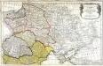
Dritter Theil der Karte von Europa welcher das südliche Russland Polen und Ungarn die europæische, und beinahe die ganze asiatische Türkei enthælt, 1
1 Blatt : 54 x 83 cm F.A. Schrämbl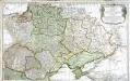
Troisième partie de la carte d'Europe contenant le midi de la Russie, la Pologne et la Hongrie, la Turquie y compris celle d'Asie presqu'entière, 1
1 Blatt : 53 x 84 cm chez l'auteur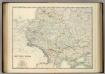
South-West Russia.
1 : 3456000 Johnston, Alexander Keith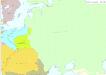
Osteuropa 1815
Osteuropa Kunz, Andreas ; Treiling, Thomas ; Moeschl, Joachim Robert
Karta teatra Sěvernoj vojny. Perīod 1707 - 1709 gg.
Russland Nordischer Krieg <1700-1721>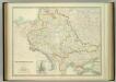
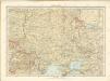
South-West Russia.
1 : 3456000 Johnston, W. & A.K.
Übersicht des österrechisch-russischen Kriegsschauplatzes
Sovětský svaz v mapách

Die Slaven nördlich von der Donau um 900
1 : 21000000 Osteuropa Slawen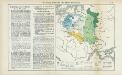
Nr. 15. Die Teilung Polens und seine spätere Entwicklung
Polen Teilungen Polens
Poland.
from Carey's general atlas, improved and enlarged : being a collection of maps of the world and quarters, their principal empires, kingdoms, &c.
Polen und Litthauen 1125-1386.
1 : 5000000 Spruner von Merz, Karl
Polen bis zu seinem Untergange 1795.
1 : 5000000 Spruner von Merz, Karl
Ruszland, Verbreitung der deutschen Sprache
Russland / Europäischer Teil Sprachverbreitung, Deutsch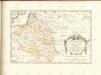

Polska za Władysława Łokietka roku 1333
Evropa jihovýchodní
Lechia za Bolesława Wstydliwego roku 1279
Evropa jihovýchodní
Polska czyli Lechia od Bolesława Krzywoustego między synów podzielona roku 1139
Evropa jihovýchodní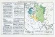
Die Teilung Polens und seine spätere Entwicklung
Polen Teilungen Polens
Russie occidentale, Pologne.
1 : 4060000 Picquet, C.
[Východoevropské státy]
Evropa východní
Landtafel des Ungerlands, Polands, Reüssen, Littaw, Walachei und Bulgarei
1 : 4800000 1 Karte : Holzschnitt ; 26 x 34 cm Münster, Sebastian [Bey den Henricpetrinischen]