Maps of Nógrád

Mappa comitatvs Neogradiensis
1 : 160000 Novohrad (Slovensko a Maďarsko) Mikoviny, Sámuel Nicolai, Georg David Christoph
C. Neogradiensis
Ungarn Komitat Nógrád
Nográd vármegye térképe
1 : 390000 Slovensko Kogutowicz, Manó Magyar Földrajzi Intézet
Neograder-Comitat
1 : 288000 Novohrad (Slovensko a Maďarsko)
Neograder-Comitat
1 : 288000 Novohrad (Slovensko a Maďarsko)
Neograder-Comitat
1 : 288000 Novohrad (Slovensko a Maďarsko)
Nógrád vármegye
1 : 376000 Novohrad (Slovensko a Maďarsko) Görög, Demeter Festetics, György Görög
Generální mapa ČSR

Salgo-Tarjan und Nagyszecseny.
from Spezialkarte der osterreichisch-ungarischen Monarchie.
Paszto und Apcz (Ungarn).
from Spezialkarte der osterreichisch-ungarischen Monarchie.
Balassa-Gyarmat und Ipoly-Sag.
from Spezialkarte der osterreichisch-ungarischen Monarchie.
Nograd und Waitzen.
from Spezialkarte der osterreichisch-ungarischen Monarchie.
Pásztó und Apcz
1 : 75000 Pásztó, Umland Geripp: Fwkr. Lendl. Terrain: Fwkr. Kotrtsch
Sklabiná
1 : 75000 Maďarsko Vojenský zeměpisný ústav
Sklabiná
1 : 75000 Maďarsko Vojenský zeměpisný ústav
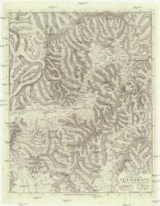
Sklabiná a Salgótarján
1 : 75000 Maďarsko Vojenský zeměpisný ústav
III. vojenské mapování 4763
1 : 75000
Losoncz (Ungarn).
from Spezialkarte der osterreichisch-ungarischen Monarchie.
III. vojenské mapování 4664/3
1 : 25000
III. vojenské mapování 4762
1 : 75000
III. vojenské mapování 4862
1 : 75000
Šahy
1 : 75000 Maďarsko Vojenský zeměpisný ústav
Šahy
1 : 75000 Maďarsko Vojenský zeměpisný ústav
Šahy
1 : 75000 Maďarsko Vojenský zeměpisný ústav
Lučenec
1 : 75000 Lučenec-oblast (Slovensko) Vojenský zeměpisný ústav
Lučenec
1 : 75000 Lučenec (Slovensko : oblast) Vojenský zeměpisný ústav
Lučenec
1 : 75000 Lučenec (Slovensko : oblast) Vojenský zeměpisný ústav
Lučenec
1 : 75000 Lučenec (Slovensko : oblast) Kartografické odd. při Min. nár. obrany
III. vojenské mapování 4663
1 : 75000