Maps of Asia

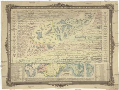
Vergleichendes Tableau der Länge der Ströme und der Grösse der Seen der Erde in geograph. Meilen zu 15 am Grad
země světa Desjardin, Constantin J. Bermann
Planiglob in Mercators Projection
země světa Berra, Marco bei Marco Berra
Mappe monde ou carte générale du globe terrestre
země světa Robert de Vaugondy, Didier Arrivet Rue du Jardin
Airways of the world on Mercator's projection
1 : 40600000 Briesemeister, William A. Aeronautic Maps Association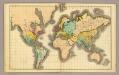
(World)
1 : 130000000 Willard, Emma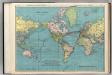
World on Mercator's Projection.
1 : 60000000 Rand McNally and Company
Planisphère terrestre
1 : 70000000 écrit par P. Rousset. Paris : J. Andriveau-Goujon, Éditeur, Rue du Bac, 21
Geographical Distribution of the Currents of Air
The physical atlas Johnston, Alexander Keith William Blackwood & Sons
Linien gleicher magnetischer Inklination (Isoklinen)
Atlas des Erdmagnetismus Neumayer, Georg Justus Perthes
Verbreitung der Vögel I.
Atlas der Tierverbreitung Marshall, William Justus Perthes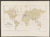
Atlas über die Entwicklung von Industrie und Handel der Schweiz in dem Zeitraume vom Jahr 1770 bis zum Jahr 1870
1 : 500000 Orientierungsblatt Absatzgebiete Wartmann, Hermann Wurster Randegger & Co.
The "time and tide" map of the Atlantic charter / [cartography] London Geographical Institute
1 : 450000 Annotatie: Bevat de 8 punten van het Atlantisch charter The London Geographical Institute, London London : Philip & Son
Charte über die verschiedenen jezt auf der Erde herrschenden Religionen
země světa im Verlage des Landes Industrie Comptoirs
Carte réduite d'apres celle de Laperouse
1 : 90000000 země světa La Pérouse, Jean-François de Galaup
Atlas über die Entwicklung von Industrie und Handel der Schweiz in dem Zeitraume vom Jahr 1770 bis zum Jahr 1870
1 : 500000 Absatzgebiete des Schweizerischen Ausfuhrhandels 1820 Wartmann, Hermann Wurster Randegger & Co.
Verbreitung der Vögel II.
Atlas der Tierverbreitung Marshall, William Justus Perthes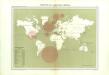
Atlas du Comité central des houilleres de France: Cartes des bassins houillers de la France, de la Grande-Bretagne, de la Belgique et de l'Allemagne
Vertheilung der wichtigsten physiologischen Pflanzengruppen in den Vegetationsgebieten der Erde
1 : 85000000 Engler, Adolf Wagner & Debes
Atlas über die Entwicklung von Industrie und Handel der Schweiz in dem Zeitraume vom Jahr 1770 bis zum Jahr 1870
1 : 500000 Absatzgebiete des Schweizerischen Ausfuhrhandels 1770 Wartmann, Hermann Wurster Randegger & Co.
[Geographische Verbreitung der Menschen-Rassen]
Zweiter Band, enthaltend in vier Abtheilungen die Vertheilung der Organismen: 5. Pflanzen-Geographie, 6. Thier-Geographie, 7. Anthropographie, 8. Ethnographie Humboldt, Alexander von Verlag von Justus Perthes
[Zoological Geography, Geographical Division & Distribution of Carnivora]
The physical atlas Johnston, Alexander Keith William Blackwood & Sons
DIE ERDE in Zwey Halbkugeln der östlichen und westlichen
země světa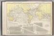
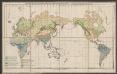
Steamship Routes of The World.
1 : 60000000 Rand McNally and Company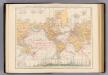
Weltverkehrs, Meeresstromungen.
1 : 90000000 Andree, Richard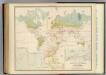
Health, disease.
1 : 67000000 Johnston, Alexander Keith, 1804-1871
Planisphere physique.
1 : 60000000 L'Isle, Guillaume de, 1675-1726
Weltkarte zur Uebersicht der vorzügluchsten Varietaeten des Menschen, nach Blumenbach'schen Systeme
1 : 82300000 entworfen und gezeichnet von C.F. Weiland nach Bory de St. Vincent entworfen und gezeichnet von C.F. Weiland Weimar : Im Verlage des Geograph. Instituts
Geographische Verbreitung der Menschen-Rassen.
1 : 140000000 Berghaus, Heinrich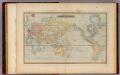
Mercator's Chart.
1 : 91000000 Lucas, Fielding Jr.