Maps of Linz
Karte der Eisenbahn zwischen Budweis und Linz zur Verbindung der Donau mit der Moldau
1 : 140000 České Budějovice-Linec (železniční trať) Weiss, F. M. Schönerer
Umgebung von Linz und Enns
1 : 75000 Enns (Rakousko) Kartogr. Inst.
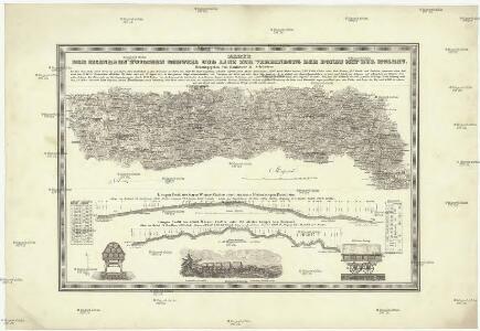
Plan der k.k. Chaussée und der im Bau bergriffenen Eisenbahn von Budweis bis zum Scheidungspunkte bei Leopoldschlag
1 : 73500 České Budějovice-Linec (železniční trať) Pilarski, V. Casimir Frühwirt, E. K. in der Kunsthandlung des H.F. Müller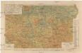
Karte des Bezirkes Kaplitz
1 : 150000 Kaplice-oblast (Český Krumlov, Česko) A. Haase
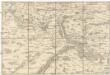
Umgebungskarte von Linz
1 : 75000 Linec (Rakousko : oblast) K. u. k. Militärgeographisches Institut
Schulwandkarte des politischen Bezirkes Krumau Blatt 4

Schulwandkarte des politischen Bezirkes Krumau Blatt 4

Schulwandkarte des politischen Bezirkes Krumau Blatt 2

[Karte von Linz mit der nächsten Umgebung]
Linec-oblast (Rakousko)
Umgebungskarte von Linz
1 : 30000 Linec (Rakousko : oblast)


Bestandeskarte der zum Plansker Complexe der Herrschaft Krumau gehörigen Reviere Neuhof u. Mistelholz
1 : 20000 Borová (Chvalšiny, Česko) Meinhard, Carl
[Mapový list]
1 : 25000 Čechy (Česko) Vojenský zeměpisný ústav
Gradkartenblatt
1 : 25000 Čechy (Česko) Gerstner, Eduard von
III. vojenské mapování 4553/3
1 : 25000
[Mapový list]
1 : 25000 Zvíkovské Podhradí-oblast (Česko) Vojenský zeměpisný ústav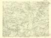
III. vojenské mapování 4453/1
1 : 25000

Gradkartenblatt
1 : 25000 Zvíkovské Podhradí-oblast (Česko) Gerstner, Eduard von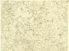
III. vojenské mapování 4453/3
1 : 25000
III. vojenské mapování 4553/1
1 : 25000
[České Budějovice a okolí]
České Budějovice-oblast (Česko)
Podrobná mapa Království českého
1 : 100000 Rožmberk nad Vltavou (Česko) Srp, Jan Jaroslav Bursík
Topographische Karte ... Herrschaft Krummau ...

[Gradkartenblatt]
1 : 25000 Lipno (Česko : vodní nádrž : oblast) Kartographisches Institut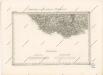
Special - Karte des Koenigreiches Boehmen