Maps of Appennini

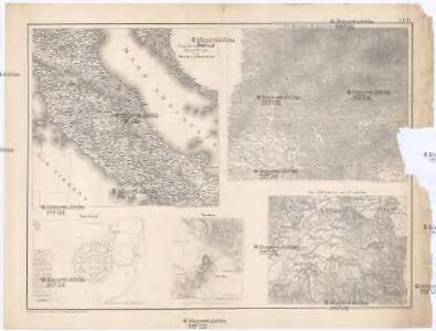
Zu den Ereignissen in Neapel und Spanisch-Tascana und zur Occupation des Kirchenstaates
Neapol (Itálie : oblast) K.k. Generalstabes
Generalkarte von Zentraleuropa

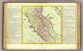
Statvs ecclesiastici nec noc magni dvcatvs Toscaniae nova tabvla geographica
1 : 2780000 Papežský stát Mayer, Tobias curantibus Homannianis Heredibus
Statvs ecclesiastici nec noc magni dvcatvs Toscaniae nova tabvla geographica
1 : 2780000 Toskánsko (Itálie) Mayer, Tobias curantibus Homannianis Heredibus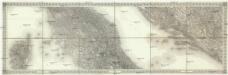
[Mittlere Italien]
1 : 576000 Itálie střední
Statvs Ecclesiastici nec non Magni Dvcatvs Toscanae nova Tabvla Geographica
1 : 930000 Mollova mapová sbírka Mayer, Tobias Homann, Johann Baptista - dědici
Oesterreichisch-Ungarische Monarchie


Etat de l'eglise et duché de Toscane
1 : 1740000 Toskánsko (Itálie) Bonne, Rigobert André
Status Ecclesiastici nec non Magni Ducatus Toscanae nova tabula geographica
1 : 930000 secundum principia legitimae delineationis descripta a Tob. Majero curantibus Homannianis Heredibus. Norimbergae : Homanniani Heredes
X, uit: General-Karte von Mittel-Europa in 12 Blättern, im Masse 1:1.200.000 / entworfen, bearb. und hrsg. von Josef Schlacher
1 : 1200000 Annotatie: Blad 6 ontbreekt; Annotatie geografische gegevens: 21 maatstokken op blad 9; Legenda op blad 9 Wien : K.K. Militär Geografisches Institut
Status Ecclesiastici nec non magni dvcatvs Toscanae nova tabvla geographica
1 : 937000 Papežský stát Mayer, Tobias curantibus Homannianis Heredibus
STATVS ECCLESIASTICI nec non MAGNI DVCATVS TOSCANAE NOVA TABVLA GEOGRAPHICA
1 : 960000 Papežský stát Mayer, Tobias curantibus Homannianis Heredibus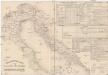
Etablissements der kaiserlichen königlichen Kriegsmarine
Jaderské moře-oblast
Rajon dějstvīj russkago flota v vojnu s Francīej 1806-1807 gg. v Adrīatikě
Südeuropa Adria Seeschlacht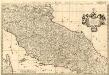
Estat du Grand Duc de Toscane, & Estats de l'Eglise
1 : 690000 Mollova mapová sbírka Sanson, Nicolas Covens, Johannes I
Estats de L'Eglise et de Toscane. [Karte], in: Atlas nouveau, contenant toutes les parties du monde [...], Bd. 2, S. 132.
1 Karte aus Atlas Sanson, Nicolas Jaillot, Alexis Hubert und Mortier, Pieter
Estats de l'Eglise et de Toscane
1 : 780000 Mollova mapová sbírka Jaillot, Jean-Baptiste-Michel Renou de Chauvigné dit Jaillot, Jean-Baptiste Michel
Kirchenstaat
1 : 1100000 Itálie střední Biller, Bernhardt bey Tranquillo Mollo
Kirchenstaat
1 : 1100000 Itálie střední Biller, Bernhardt bey Tranquillo Mollo
Stato della Chiesa
1 : 1000000 Itálie střední Hondius, Henricus sumptibus Henrici Hondii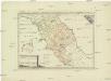
Postkarte von Mittel Italien
Itálie střední Ponheimer, Kilian im von Reillyschen Landkarten und Kunstwerke Verschleiss Komptoir
Bassins du Tibre, de l'Arno, et du Garigliano : (Italie centrale)
1 : 2120000 Vuillemin, Alexandre Aimé 1812-1880 Paris : Delalain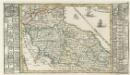
Italien Eigendlich also genandt
1 : 2900000 Mollova mapová sbírka Bodenehr, Gabriel Bodenehr, Gabriel
Continentis Italiae Pars Media, Seu Prima Meridionalis; Ecclesiae Status Tredecim, et Magni Ducatus Toscani Dominium ac Territoria exhibens
1 : 870000 Mollova mapová sbírka Schenk, Pieter Schenk, Peter II
[Italien, Blatt 2]
Adolf Stieler's Handatlas über alle Theile der Erde und über das Weltgebäude Stieler, Adolf Justus Perthes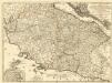
Etats de l'Eglise
1 : 850000 Mollova mapová sbírka Nolin, Jean-Baptiste Nolin, Jean Baptiste II.
Status Ecclesiastici Magnique Ducatus Florentini
1 : 870000 Mollova mapová sbírka Homann, Johann Baptist Homann, Johann Baptista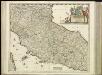
[31][31] Status Ecclesiasticus et Magnus Ducatus Thoscanae, uit: Atlas sive Descriptio terrarum orbis
Annotatie: Gedigitaliseerde versie. Amsterdam. Heiloo : Picturae (vervaardiger), 2015. tiff-bestand. Gedigitaliseerd: 07-01-2015; Origineel: Universiteitsbibliotheek Vrije Universiteit (XL.05127.-) ; Netherlands; Titelpagina ontbreekt Wit, Frederik de Amsterdam : Frederick de Wit