Maps of Southern Finland
Ostsee
1 : 400000 Baltské moře Reichs-Marine-Amt
Afteekening van de Oostzee of Oost Finsche Boodem vertoonende de vaart van Revel tot St. Petersburgh int groot
Gulf of Finland Gerard van Keulen
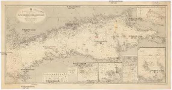
Oost-Zee Streckende van Dageroort tot Wyborgh [Karte in 2 Teilen], in: De Nieuwe Groote Vermeerderde Zee-Atlas ofte Water-Werelt, S. 27.
1 Karte aus Atlas Doncker, Hendrick
Afteekening van t agterste gedeelte van de Oost Zee van t eijlant Dago tot Schansternij
Gulf of Finland Gerard van Keulen
Kronstadt, Wiborg, Wesenberg
1 : 750000 Kronštadt (Rusko) K. u. k. Militärgeographisches Institut
Afteekening van de Finsche Boodem in de Ost Zee of vaarweg van 't Hoogland tot voor St. Petersborgh
Gulf of Finland Gerard van Keulen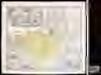
Ingermanlandiae seu Ingriae novissima tabula / luci tradita per Homannianos Heredes
1 : 390000 1 Karte : Kupferdruck ; 46 x 55 cm Rostovčev, Aleksej Ivanovič Homännische Erben
Ostsee
1 : 150000 Baltské moře Reichs-Marine-Amt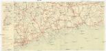
Finnland Straßenkarte
1 : 200000 Finsko Gen St d H Abt f Kr Kart u Verm W IV Mil Geo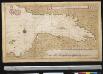
Afteekening van Seeskar en Biorkon tot Schans ter Nije of St. Petersborgh
Russia Gerard van Keulen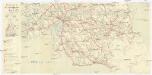
Finnland Straßenkarte
1 : 200000 Finsko Gen St d H Abt f Kr Kart u Verm W IV Mil Geo
<Plan Kronshtatskoĭ bukhty s S. Peterburgom : i beregami Finskago zaliva do Krasnoi Gorki>
1 : 125000 Beggrov, A izdanīe A. Beggrova
Kaart van de Zweedse en Russische krygs-verrigtingen in Finland A° 1788
1 : 155000 P. v. Eeusom jnr. sculp.
[Okrestnosti Sankt-Peterburga]
1 : 85000 Petrohrad-oblast (Rusko)
Narva
1 : 200000 KV. ST. Topo-Hüdrograafia Osakonna Väljaanne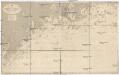
Ostsee
1 : 50000 Baltské moře Reichs-Marine-Amt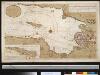
Afteekening van de vaert na St. Petersburg vant eijland Rattesari tot voor St. Petersburgh
Russia Wijbe Sibes Gerard van Keulen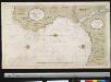
Afteekening van de rivier van Narva
Estonia Gerard van Keulen
Finskoj zalip ot Kronštata do Sanktpeterburga s lěžaščimi po derěgai zadapnymi domami
1 : 58300 Finský záliv Seutter, Matthäus Matthaeus Seutter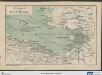
Karte der Umgegend von St. Petersburg
St. Petersburg, Umland
[St. Petersburg und Umgegend]
1 : 600000 Sankt Petersburg, Umland
Ostsee
1 : 50000 Baltské moře Reichs-Marine-Amt
Die Umgegend von St. Petersburg
1 : 630000 Sankt Petersburg
<Plan Sanktpeterburga v t͡sarstovanie imperatrit͡sy Elisavety Petrovny, 1753>
s.n.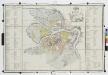
Planʺ stolichnago goroda St. Peterburga = Plan de la ville capitale S. Petersbourg / gr. Al. Savinkov.
From Russia
Nevskaja del'ta
Russland Newa Geografie
Kr. Sveaborg i okrestnosti putej vokrug Gel'singforsa
Finnland Suomenlinna Russisch-Schwedischer Krieg <1808-1809>
Kronstadt. Nördliches und südliches Fahrwasser
Russland Kronštadt
<St. Petersburg = Sanktpeterburga>
1 : 31000 Clarke, W. B Edward Stanford