Maps of Piteå kommun

Ostsee
Baltské moře Reichs-Marine-Amt
Ostsee
1 : 200000 Baltské moře Reichs-Marine-Amt
Island
Island Milbauer, Emanuel Vlastimil Walch, Johann
Ostsee
1 : 200000 Baltské moře Reichs-Marine-Amt
Finnland Straßenkarte
1 : 400000 Finsko Gen St d H Abt f Kr Kart u Verm W IV Mil Geo
Eisenbahnkarte von Finnland
Finnland Eisenbahnnetz
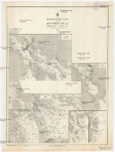
Spesielle kart 101-1: Postkart over det nordlige Norge
1 : 1000000 K. Gleditsch
Karte von Finnland
1 : 2400000 Evropa Finland Steamship
Partie, Suede, Norwege. Europe 4.
1 : 1641836 Vandermaelen, Philippe, 1795-1869
Postkarte von Finnland und Norrland
Finsko jižní Ponheimer, Kilian im von Reillyschen Landkarten und Kunstwerke Verschleiss Komptoir
Spesielle kart 89-1: Rikstelegrafens og private telefonselskapers linjeruter i det nordlige Norge
Ukjent
Karta Finljandīi s pokazanīem granic Rosīi i Švecīi po raznym dogovorom
1 : 600000 Finnland Nordischer Krieg <1700-1721>
Magni ducatus Finlandiae Russiae partim, partim Sueciae subjecti, sinus item Bothnici ac Finnici nova et accurata delineatio
1 : 1600000 Finsko Lotter, Tobias Conrad sumptibus Tobiae Conradi Lotter
MAGNVS DVCATVS | FINLANDIÆ
Auct. Andrea Buræo Sueco. [Amsterdam : Joan Blaeu]
Spesielle kart 42-2: Rigstelegraf- og Telefonkart over det nordlige Norge
1 : 800000
Magnus Ducatus Finlandiae Nova et accurata delineatio. [Karte], in: Novus atlas absolutissimus, Bd. 1, S. 48.
1 Karte aus Atlas Janssonius Offizin
Suomi
1 : 1000000 Finsko Maanmittaushallituksen kivipaino
La République de Finlande
1 : 2000000 Finsko F. Tilgmann
Spesielle kart nr 4: Postkart over Norge
1 : 3600000
No.15. Karta Evropeyskaia Rossiia. Sheet 1
1 : 2000000 Shokalskago,Iu. M.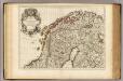
Courones du Nord (nord)
1 : 2600000 L'Isle, Guillaume de, 1675-1726
Spesielle kart 18 Nord-øst: Telegrafkart over Norge
1 : 1000000 Den Private Opmaaling, Kristiania
Spesielle kart 106-1: Norges Forsvarsforening N.F.F. overiktskart over foreningens kredse
1 : 1000
Das Grossfürstenthum Finland
1 : 2600000 Finsko Meissner, G. Benjamin Hermelin, S.G.
Suomi
1 : 2000000 Finsko Maanmittaushallituksen kivipaino
Suomi
1 : 2000000 Finsko Maanmittaushallituksen kivipaino
LAPPONIA
Auct. Andrea Buræo | Sueco. [Amsterdam : Joan Blaeu]
Distribution des dépôts quaternaires en Finlande
1 : 2000000 Sederholm, J.J. F. Tilgman
Spesielle kart 160: Kommunekart over Norge med jurisdiksjonsinndeling
1 : 1000