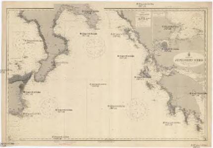
Maps of Peloponnese, West Greece and Ionian Sea
Mittelmeer
1 : 750000 Středozemní moře Reichs-Marine-Amt
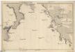
Het incomen van de Golf van Venetien vertoonende de Zuijdcust van Cicilia, Calabrian, Griekenland en Morea int groodt seer naeukeurig opgesteld
Italy Gerard van Keulen
[Europäische Türkey in IV Blättern]
Grosser Hand-Atlas über alle Theile der Erde in 170 Karten Meyer, J. Verlag des Bibliographischen Instituts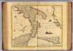
Naples et Sicile.
1 : 1240000 Covens et Mortier
The Ionian Islands and Malta.
1 : 410000 Arrowsmith, John
[Die Balkan-Halbinsel, Blatt 3]
Adolf Stieler's Handatlas über alle Theile der Erde und über das Weltgebäude Stieler, Adolf Justus Perthes
Europ. Turkey III.
1 : 1740000 Grassl, J. (Joseph)
[Italien, Blatt 4]
Adolf Stieler's Handatlas über alle Theile der Erde und über das Weltgebäude Stieler, Adolf Justus Perthes
Greece and the Ionian Islands.
1 : 1584000 Arrowsmith, John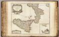
Roy. de Naples sud, Malte.
1 : 950000 Robert de Vaugondy, Gilles, 1688-1766
Greece, Ionian Islands.
1 : 950000 Arrowsmith, John
Turkey in Europe, N. Greece.
1 : 1457280 Letts, Son & Co.
Graeciae antiquae
1 : 1000000
Graeciae antiquae specimen geographicum
1 : 1000000 Řecko Anville, Jean-Baptiste Bourguinon d' Berndt, Johann Christoph Officina Weigelio-Schneideriana
Greece.
1 : 950400 Stanford, Edward
Graecia
Schul-Atlas der alten Welt bei Justus Perthes
Graecia, Epirus, post bella Persia.
1 : 1400000 Menke, Th.
Graeciae Antiquae specimen geographicum.
1 : 1020000 Anville, Jean Baptiste Bourguignon d, 1697-1782
Carte particuliere des Iles Ioniennes et de la Morée
Jónské ostrovy (Řecko) Bocage, Jean-Denis Barbié du Luther, Th.
Graecia Antiqua.
1 : 2250000 Anville, Jean Baptiste Bourguignon d, 1697-1782
Greece.
1 : 917000 Johnston, W. & A.K.
Griechenland.
starověké Řecko Berthe, L. Nipočić, Vasilij F. Tempský
Calabraie Descrip. Per Prosperum Parisium Sonsent. [Karte], in: Theatrum orbis terrarum, S. 237.
1 Karte aus Atlas Ortelius, Abraham
Calabraie Descrip. Per Prosperum Parisium Sonsent. [Karte], in: Theatrum orbis terrarum, S. 332.
1 Karte aus Atlas Ortelius, Abraham Vrients, Jan Baptista
Magna Graecia sive Extrema Italia ad Orientem
1 : 1300000 Mollova mapová sbírka Covens, Johannes Covens, Johannes I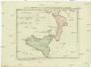
Postkarte von Calabrien und Sicilien
Kalábrie (Itálie) Benedict, Anton im von Reillyschen Landkarten und Kunstwerke Verschleiss Komptoir
Graecia.
1 : 1250000 Kiepert, Heinrich, 1818-1899
Graeciae pars borealis.
1 : 3100000 Fenner, Rest.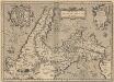
Itala nam tellus Graecia Maior erat. Ouid. 4. Fast. [Karte] Diomedeae insulae. [Nebenkarte], in: Theatrum orbis terrarum, S. 499.
1 Karte aus Atlas Ortelius, Abraham Vrients, Jan Baptista