Maps of District of Rimavská Sobota

Zipser Comitat
1 : 280000 Spiš (Slovensko)
C. Gömöriensis
Slowakei Komitat Gemer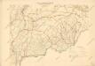
Bez titulu: mapy slovenských krajů

Kraj banskobystrický
Stolice Zvolen a Gemer
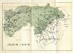
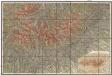
Komitat Altsohl, Komitat Gemer, ethnische Gruppe
Československo v mapách

Leutschau 121, uit: Special-Karte von Mittel-Europa / nach amtlichen Quellen bearbeitet von W. Liebenow
1 : 300000 titelvariant: W. Liebenow's Mittel-Europa; Annotatie: Titel boven de bladen: W. Liebenow's Mittel-Europa Johannes Wilhelm Liebenow 1822-1897 Frankfurt a. M. : Ludwig Ravenstein
Rima-Szombat 135, uit: Special-Karte von Mittel-Europa / nach amtlichen Quellen bearbeitet von W. Liebenow
1 : 300000 titelvariant: W. Liebenow's Mittel-Europa; Annotatie: Titel boven de bladen: W. Liebenow's Mittel-Europa Johannes Wilhelm Liebenow 1822-1897 Frankfurt a. M. : Ludwig Ravenstein
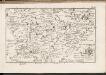
Gömör vármegye és a' vele törvényesen egyesült Kis-Honti kerület
1 : 240000 Gemer (Slovensko : oblast) Ráisz, Christ. Benedicti, Hieronymus Görög
C. Tornensis
Ungarn Komitat Torna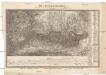
Die Central-Karpaten
1 : 200000 Karpaty Sydow, A. von Wolff
Kirchen, Klöster und Burgen in spätromanischer Zeit (nach V. Mancl)
Zips Baudenkmal
Deutsches Volksgebiet in der Zips
Zips ethnische Gruppe, Deutsche
C. Scepusiensis
Slowakei Komitat Zips
Mappa physico-geographica Carpatorum principalium e quibus Wagus et Dunajetz origines trahunt
1 : 190000 Tatry (Polsko a Slovensko) Bojtár, St.
Mappa Comitatvs Neogradiensis Methodo Astronomico-Geometrica concinnata
1 : 166600 Mollova mapová sbírka Mikoviny, Sámuel Nicolaï, Georg David Christoph
Jonction du Waag au Poprad
1 : 420000 Poprad-oblast (Slovensko)
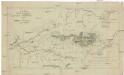
Vysoké Tatry
Podrobná mapa Vysokých Tater
1 : 25000 Vysoké Tatry, pohoří-oblast (Polsko a Slovensko) Čs. voj. zeměpisný ústav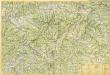
Slovenské rudohorie

Arlo und K.Terenne (Ungarn).
from Spezialkarte der osterreichisch-ungarischen Monarchie.
Nagy-Rocze und Rimm-Banya (Ungarn).
from Spezialkarte der osterreichisch-ungarischen Monarchie.
Slovenský raj

Quellencebiet Der Cran.
from Spezialkarte der osterreichisch-ungarischen Monarchie.
Hohe Tatra.
from Spezialkarte der osterreichisch-ungarischen Monarchie.
Umgebung von Zakopana
1 : 115000 Liptovský Mikuláš-oblast (Slovensko) Kummersberg, Carl von Artaria


