Maps of Queensland

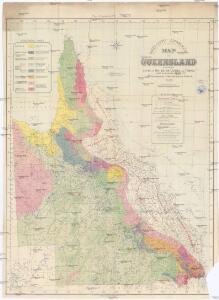
Map of Queensland
1 : 2534400 Austrálie Water supply department
Queensland
1 : 6000000 Queensland Greenfield, W. H. Geological Survey Office, Department of Mines
Map of Queensland showing annual rainfall to end of 1899
1 : 3300000 Queensland Water supply department
Queensland.
1 : 4088064 Stanford, Edward
Map of Queensland
1 : 4030000 Queensland Outridge printing company
Map of Queensland
1 : 3000000 Queensland Gordon & Gotch
Map of Queensland showing annual rainfall to end of 1906
1 : 3200000 Queensland Water supply department
Queensland, Australia. Coal Resources of the World.
1 : 4598000 Dunstan, B.
Map of Queensland
1 : 2000000 Austrálie Water supply department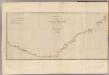
New South Wales.
1 : 4500000 Hawkesworth, John, 1715?-1773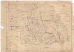
Sketch map shewing rabbit board districts and rabbit proof fence, Queensland
1 : 2000000 Queensland Surveyor General's Office
Approximate iso-potential lines of artesian pressure
1 : 1950000 Austrálie Water supply department
Eastern Queensland.
1 : 2500000 John Bartholomew & Co.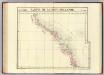
Partie, Nouv.- Hollande. Oceanique no. 45.
1 : 1641836 Vandermaelen, Philippe, 1795-1869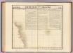
Partie, Nlle. Hollande. Oceanique no. 38.
1 : 1641836 Vandermaelen, Philippe, 1795-1869
Cape Tribulation-Endeavour Straits.
1 : 2200000 Hawkesworth, John, 1715?-1773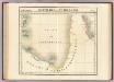
Partie, Nlle. Hollande. Oceanique no. 37.
1 : 1641836 Vandermaelen, Philippe, 1795-1869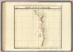
Partie, Nle. Hollande. Oceanique no. 51.
1 : 1641836 Vandermaelen, Philippe, 1795-1869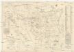
Sketch map of the Croydon & Etheridge goldfields
1 : 370000 Greenfield, W. H. Geological Survey Office, Department of Mines
Kennedy 2-mile map
1 : 130000 Survey Office, Dept. of Public Lands
Sketch map of Cape York peninsula
1 : 380000 Cape York (Queensland) Greenfield, W. H. Geological Survey Office, Department of Mines
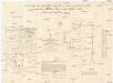
The catchment areas of the Brisbane River and of the Logan and Albert Rivers &c
1 : 376000 Surveyor general's office
Copper mining district of Cloncurry, north western Queensland
1 : 380000 Ball, L. C. Geological Survey of Queensland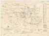
Sketch map of the Etheridge goldfield
1 : 380000 Queensland Greenfield, W. H. Geological Survey
Map of east & west Moreton
1 : 380000 Queensland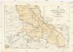
Sketch map of goldfields in the vicinity of Charters Towers
1 : 250000 Geological Survey Office, Department of Mines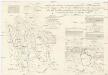
Sketch map of portions 6 to 13 & 15 to 32 parish of Greenup, portions 8 to 11 parish of Plassey and portions 174 to 177 parish of Coolmunda countries of Clive & Bentinck
Survey Office, Department of Public Lands
Sketch map of east central Queensland
1 : 230000 Queensland Greenfield, W. H. Geological Survey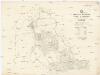
Parish of Herberton, county of Cardwell
1 : 32000 Queensland Costello, J. R. Survey Office, Dept. of Public Lands