Maps of gmina Stubno

Mościska
1 : 75000 Polsko Januszewski K. u. k. militärgeographisches Institut
Mosciska.
from Spezialkarte der osterreichisch-ungarischen Monarchie.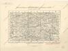
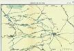
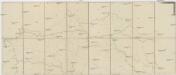
Uebersichtsblatt zum Kriegsspielplan der umgebung von Grodek
Nr. 6a. Kämpfe in Ostgalizien. Zwischen San und Bug
Galizien Weltkrieg <1914-1918>, Ostfront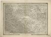
General-Karte des Königreiches Galizien und des Herzogthumes Bukovina


Lubaczow.
from Spezialkarte der osterreichisch-ungarischen Monarchie.
Jaworow und Crodek.
from Spezialkarte der osterreichisch-ungarischen Monarchie.
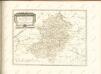
Sambor.
from Spezialkarte der osterreichisch-ungarischen Monarchie.
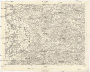
Jaworów und Gródek
1 : 75000 Ukrajina Charlemont K. u. k. Militärgeographisches Institut
Rawa Ruska.
from Spezialkarte der osterreichisch-ungarischen Monarchie.
[Przemyśl]
1 : 350000 Przemyśl Belagerung, Weltkrieg <1914-1918>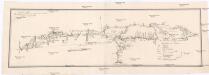
Projectirte Strasse von Billiz bis Lemberg
1 : 560000 Bielsko-Biała (Polsko) Gross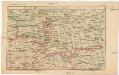
Strecke
Ivano-Frankivsk (Ukrajina) K. k. Österreichische Staatsbahnen
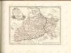
Ost Galizien
Halič (Polsko a Ukrajina) Liesganig, Joseph m Verlage des Kunst- und Industrie- Comptoirs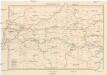
Galizien, Westlicher Theil
1 : 700000 Halič (Polsko a Ukrajina) Karl Fr. Pfau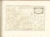

Übrige Länder der ehemaligen Österreich-Ung. Monarchie
1 : 900000 Halič (Polsko a Ukrajina) Koch, Wilhelm Opitz, Carl Arnd
Augustissimo Romanor. Imperatori Iosepho I. Hungaria Regi Invictissimo Mappam Hanc Regni Hungariae
1 : 540000 Mollova mapová sbírka Müller, Johann Christoph
Bez titulu: Šest listů speciálních map Ukrajiny

Ost Galizien
Halič (Polsko a Ukrajina) Liesganig, Joseph m Verlage des Kunst- und Industrie- Comptoirs
Sbírka map a diagramů použitých na mírových konferencích v Paříži v letech 1919 - 1920

Pohlen, Rußland, Gallicien, Wolhinien, Podolien. Ungarn. Ungvárer Comitat
Ungarn Verkehrsweg
Strassen- und Eisenbahnkarte des oesterreichischen Kaiserthumes
1 : 864000 Blatt 4 Schaller, G. K.K. Militärisch-Geografisches Institut, Karten-Evidenthaltungs-Abteilung
Sheet IV: Karte Des Oesterreichischen Kaiserstaates.
1 : 576000 Scheda, Josef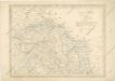
Strassen und Eisenbahnkarte des oesterreichischen Kaiserthumes

Strategische Übersichts-Karte des polnisch-litaurischen Armee-Bewegungraumes
Halič
Halič (Polsko a Ukrajina)