Maps of Québec
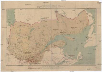
Carte de la province de Quebec
1 : 3120000 Québec (Québec) Rinfret, Gustave Taché, Eugene-Étienne The Canada Eng. & Litho.
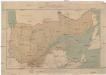
Canada, N.B., N.S.
1 : 5100000 Hall, S. (Sidney)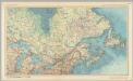
Canada - Ontario, Quebec, and Maritime Provinces. Pergamon World Atlas.
1 : 5000000 Polish Army Topography Service
Canada East (Lower).
1 : 1750000 Mitchell, Samuel Augustus
Canada East (Lower).
1 : 1750000 Mitchell, Samuel Augustus
Partie orientale de la Nouvelle France ou du Canada avec l'isle de Terre-Neuve et de Nouvelle Escosse, Acadie et Nouv. Angleterre avec fleuve de St. Laurence
1 : 3500000 representé par T. Conr. Lotter dressé par Alb. Charl Seutter ; Tob. Conr. Lotter sc. Augsburg : T. C. Lotter
A Map Of Cabotia.
1 : 1457000 Whittle, J.
Map of the Seat of War in North America.
1 : 4118400 Melish, John
Map of the Seat of War in North America.
1 : 4118400 Melish, John
A GENERAL MAP OF THE NORTHERN BRITISH COLONIES IN AMERICA
1 : 3800000 New Jersey Holland, Samuel
Canada.
1 : 7300000 Lucas, Fielding Jr.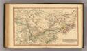
Canada.
1 : 11000000 Fenner, Rest.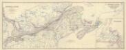
Composite: Canada.
1 : 2065500 Johnston, Alexander Keith, 1804-1871
N. section U.S.
1 : 4200000 Melish, John
A general map of the northern British colonies in America: which comprehends the province of Quebec, the government of Newfoundland, Nova-Scotia, New-England and New-York / from the maps published by the Admiralty and Board of Trade, regulated by the astronomic and trigonometric observations of Major Holland, and corrected from Governor Pownall's late map 1776.
from Parts Samuel Holland,
Northern section of the United States, including Canada &c. / by John Melish, 1816; grav. af. C. F. Himberg.
from Parts John Melish; C. F. Himberg,
Canada.
1 : 9000000 Tanner, Henry S.
Map of the seat of war in North America / J. Melish del.; H. S. Tanner dirext.
from Parts John Melish; Henry S. Tanner,
[Québec]
1 : 30000000 Québec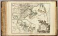
Nouvelle France ou le Canada.
1 : 4000000 Robert de Vaugondy, Gilles, 1688-1766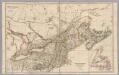
Upper Canada &c.
1 : 2154240 Arrowsmith, John
A new map of the province of Quebec in North America, drawn from the best authorities
1 : 6500000
Map of the European and North American Railway : showing its connection with the railways of the United States & Canada
1 : 1625000 Morton, A. C., engineer Bowen & Co.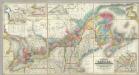
Map Of The Provinces Of Canada.
1 : 887040 Bouchette, Joseph
Canada &c.
1 : 7350000 Lucas, Fielding Jr.
Canada Eastern.
1 : 5000000 Andree, Richard; Times (London, England)
(East sheet) Map of the Provinces of Upper & Lower Canada with parts of the United States of America &c.
1 : 2300000 Faden, William, 1750?-1836
Canada, Louisiane et terres angloises / par le Sr. d'Anville ...
from Parts
Parte orientale de la Nouvelle France ou du Canada
1 : 3580000 Kanada východní Bellin, Jacques-Nicolas par les Heritiers de Homan