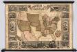
Maps of United States

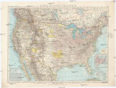
Vereinigte Staaten
1 : 10000000 Nové Skotsko Elfert, Paul Geogr. anstalt von Wagner & Debes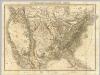
Die Vereinigten Staaten von Nord-America.
1 : 8000000 Bromme, Traugott
Vereinigte Staaten Von Nordamerika

[Vereinigte Staaten von Nord-America und Canada]
Schul-Atlas über alle Theile der Erde nach dem neuesten Zustande, und über das Weltgebäude Stieler, Adolf bei Justus Perthes
Etats Unis.
1 : 10000000 Vivien St Martin, L.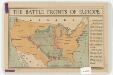
The battle fronts of Europe
1 : 2500000 Map of battle fronts drawn to scale upon a map of the United States showing relative distances of fronts. Roberts & Leete. London : Stanford's Geographical Establishment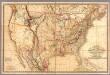
Fredonia Or The United States of North America.
1 : 570000 Laurie, Richard Holmes
Etats-Unis de l'Amerique en 1860.
1 : 12000000 Garnier, F. A., 1803-1863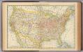
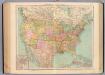
United States.
1 : 10560000 Rand McNally and Company
Vereinigte Staaten von Nord-America
1 : 13000000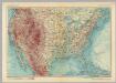
United States of America. Pergamon World Atlas.
1 : 10000000 Polish Army Topography Service
Map of the United States, constructed from the latest authorities / J.H. Young, sc.
from Whole
American Continent: United States, British Possessons, West Indies, Mexico, Central America
1 : 4435200 Rosa, R.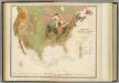
Geol. map U.S.
1 : 10000000 Rogers, Henry Darwin
The course of the River St. Laurence : from Lake Ontario, to Manicouagan Point ; United States of America.
from St. Lawrence River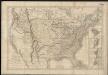
Carte générale des États-Unis de l'Amérique avec les plans des principales villes
1 : 7500000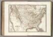
Etats-Unis d'Amerique.
1 : 9300000 Lapie, M. (Pierre), 1779-1850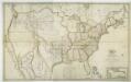
Map of the United States with the contiguous British & Spanish possessions / compiled from the latest & best authorities by John Melish; engraved by J. Vallance & H.S. Tanner.
from Whole John Melish; J. Vallance; Henry S. Tanner,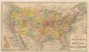
Routen der Missouri - Pacific, sowie der Wabash St. Louis und Pacific Eisenbahnen
127-28. Stati Uniti.
1 : 10000000 Touring club italiano
United States with the contiguous British & Spanish Possessions.
1 : 3801600 Melish, John
Composite: United States with the contiguous British & Spanish Possessions.
1 : 3801600 Melish, John
Map of the United States: with the contiguous British & Spanish possessions / compiled from the latest & best authorities by John Melish; engraved by J. Vallance & H.S. Tanner.
from Whole John Melish; J. Vallance; Henry S. Tanner,
United States of America.
1 : 22000000 Colton, G.W.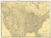
Rand McNally new official railroad map of the United States and southern Canada
1 : 5258880 Kanada Rand McNally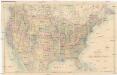
Stanford's General Map of the United States
1 : 5274720 Spojené státy americké Stanford, Edward Edward Stanford
Vereinigte Staaten von Nord-America
Stieler's Hand-Atlas Stieler, Adolf bei Justus Perthes
Verein-Staaten Von Nord-America, Mexico, Yucatan U. A.
1 : 13400000 Stulpnagel, F.v.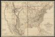
Fredonia or the United States of North-America : including also Cabotia, or the Canadian provinces; the Western Territory to the Pacific Ocean; and the northern part of the Mexican States
1 : 5700000