Maps of Santa Barbara
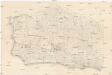
[Santa Barbara County]
Kalifornie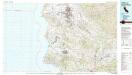
Santa Maria
1 : 100000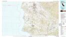
Santa Maria
1 : 100000
Santa Ynez
1 : 125000
Santa Ynez
1 : 125000
Santa Ynez
1 : 125000
Santa Ynez
1 : 125000
Santa Ynez
1 : 125000
Lompoc
1 : 125000
Lompoc
1 : 125000
Lompoc
1 : 125000
Lompoc
1 : 125000
Lompoc
1 : 125000
Cuyama
1 : 100000
Cuyama
1 : 100000
Santa Barbara, Calif.
1 : 20000 Bache, A. D.
Gibraltar Dam
1 : 62500
Gibraltar Dam
1 : 62500
Lompoc
1 : 62500
Lompoc
1 : 62500
Los Olivos
1 : 62500
San Rafael Mtn
1 : 62500
San Rafael Mtn
1 : 62500
Lompoc
1 : 62500
Lompoc
1 : 62500
Los Olivos
1 : 62500
Los Olivos
1 : 62500
San Rafael Mtn
1 : 62500
San Rafael Mtn
1 : 62500
Salisbury Canyon
1 : 62500
Santa Maria
1 : 62500
Santa Maria
1 : 62500
Santa Maria
1 : 62500
Tepusquet Peak
1 : 62500
McPherson Peak
1 : 62500
Tepusquet Peak
1 : 62500
Tepusquet Peak
1 : 62500
McPherson Peak
1 : 62500
McPherson Peak
1 : 62500
![[Santa Barbara County]](https://images-2.georeferencer.com/images/iiif/660955596148/full/,300/0/native.jpg)

