Maps of Mozambique

Map of Portuguese East Africa
1 : 3000000 Afrika východní Mining and Industrial Publications of Africa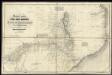
Special Map of South-East Africa to Dr. David and Charles Livingstone's new mission travels

Übersichtskarte von Ost-Central-Afrika

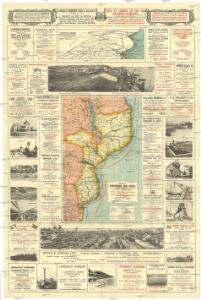
Mozambique (Limpopo Zanzibar) Scale, 1 : 2,000,000
Mozambique. (Limpopo. Zanzibar.) Scale, 1 : 2,000,000. Compiled at the Royal Geographical Society under the direction of the Geographical Section, General Staff. This map forms part of the collection of maps in a case issued to accompany the Manual of Portuguese East Africa," compiled by the Naval Staff of the Admiralty." London : War Office
Mocaranga. Afrique 49.
1 : 1641836 Vandermaelen, Philippe, 1795-1869
Versuch einer geologischen Karte des Njassagebietes
1 : 1000000 Annotatie: Bijlage (Krt. 1) bij: Mitteilungen aus den deutschen Schutzgebieten, Erganzungheft Nr. 10 (1914) Berlin : Mittler
Orographische Skizze des Njassagebietes
1 : 1000000 Annotatie: Bijlage (Krt. 2) bij: Mitteilungen aus den deutschen Schutzgebieten, Erganzungheft Nr. 10 (1914) Berlin : Mittler
Mononomatapa. Afrique 46.
1 : 1641836 Vandermaelen, Philippe, 1795-1869
Partie, la Caffrerie. Afrique 52.
1 : 1641836 Vandermaelen, Philippe, 1795-1869
Geologische Übersicht der Reisen des Bergassessors W. Bornhardt im Nyassa-Gebiet
1 : 500000 Geographische Verlagshandlung Dietrich Reimer (Ernst Vohsen)
Geologische Übersicht der Reisen des Bergassessors W. Bornhardt zwischen Kilwa-Kivindye und dem Rovuma
1 : 500000 Geographische Verlagshandlung Dietrich Reimer (Ernst Vohsen)
Geologische Übersicht der Reise des Bergassessors W. Bornhardt von der Lindi-Bucht zum Nyassa
1 : 500000 Ost-Blatt Geographische Verlagshandlung Dietrich Reimer (Ernst Vohsen)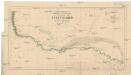
Podrobná mapa plavby Dr. Holuba po středním toku Zambesijském od zátoky Makubské až ku slapu Nambveskému v jižní zemi Barocké
1 : 185200 Zambezi J. Otta
Geologische Übersicht der Reise des Bergassessors W. Bornhardt von der Lindi-Bucht zum Nyassa
1 : 500000 West-Blatt Geographische Verlagshandlung Dietrich Reimer (Ernst Vohsen)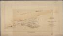
Costa Oriental d'Africa, Provincia de Moçambique. Reconhecimento hydrographico da Bahia de Bazaruto
1 : 200000 Libonne : Commissão de cartographia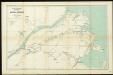
The German Portuguese border region at the mouth of Ruvuma River. Surveyed in February 1895 by Dr. Franz Stuhlmann

Netzbild der Triangulationen 1:1 000 000
1 : 1000000 Afrika východní Dietrich Reimer
[Map of the Nyassa expedition by Governor Oberst Freiherr von Schele:] Nyassa Expedition IV

Charte von Nieder Guinea und den angrenzenden ländern Sud Afrika's : nach den neuesten und besten Hülfsmitteln
1 : 6750000 Reinecke, J. C. M. (Johann Christoph Matthias), 1770-1818 Im Verlage des Industrie Comptoirs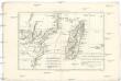
Le canal de Mosambique, l'isle de Madagascar, les etats du Monomotapa et les royaumes voisins
1 : 9600000 Madagaskar Bonne, Rigobert André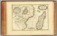
Afrique, cote orientale.
1 : 7000000 Bonne, Rigobert, 1727-1794
Die Ostküste Süd-Africa's nebst der Insel Madagascar, den Comoren, Sechellen, Amiranten und Mascarenischen Inseln
1 : 5480000 entworfen von C.F. Weiland gestochen von Mädel med. Weimar : Geographisches Institut
Die Ostküsten süd Africa nebs der Insel Madagascar, den Comoren, Sechellen, Amiranten und Mascarenischen Inseln
1 : 5000000 Komory Weiland, Karl Ferdinand Geograph. Instituts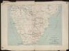
Itinéraire de Mr et Mme Coillard du Pays des Bassoutos au Zambèze
1 : 12100000 [Paris] : Société de géographie
Spezial-Karte von Afrika
1 : 4000000 Blatt 10 Habenicht, Hermann Perthes
Spezial - karte von AfricaSektion Delacoa Bai (10)
1 : 4000000 1 full d'1 mapa en 10 fulls i estoig Hermann Habenicht; Justus Perthes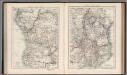
Central Africa (West). Central Africa (East).
1 : 10383000 W. & A.K. Johnston Limited
CHARTE von einem Theile der OST-KÜSTE VON Africa
Afrika východní
Charte von einem Theile der Ost-Küste von Africa
Afrika východní