Maps of Észak-Magyarország
Neubertova generální automapa Republiky československé
1 : 200000 Debrecín (Maďarsko : oblast) Soukup, Jan V. Neubert a synové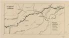
Sbírka map a diagramů použitých na mírových konferencích v Paříži v letech 1919 - 1920
Sbírka map a diagramů použitých na mírových konferencích v Paříži v letech 1919 - 1920

C. Borsodiensis
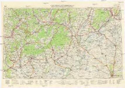
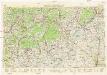
Ungarn Komitat Borsod
Borsoder Comitat
1 : 288000
Borsoder Comitat
1 : 288000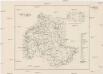
Comitat Heves
1 : 288000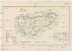
Comitat Gran
1 : 288000 Ostřihom (Maďarsko)
Gömörer Comitat
1 : 288000 Gemer (Slovensko : oblast)
Gömörer Comitat
1 : 290000 Revúca (Slovensko : oblast)
Gömörer Comitat
1 : 288000 Revúca-oblast (Slovensko)
Comitat Heves
1 : 290000
Borsod vármegye
1 : 410000 Görög, Demeter Biller, Bernhard Görög
Comitat Abaúj-Torna
1 : 290000 Košice (Slovensko : oblast)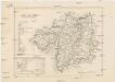
Comitat Abaúj-Torna
1 : 288000 Košice-oblast jižní (Slovensko)
Gömör vármegye és a' vele törvényesen egyesült Kis-Honti kerület
1 : 240000 Gemer (Slovensko : oblast) Ráisz, Christ. Benedicti, Hieronymus Görög
Rima-Szombat 135, uit: Special-Karte von Mittel-Europa / nach amtlichen Quellen bearbeitet von W. Liebenow
1 : 300000 titelvariant: W. Liebenow's Mittel-Europa; Annotatie: Titel boven de bladen: W. Liebenow's Mittel-Europa Johannes Wilhelm Liebenow 1822-1897 Frankfurt a. M. : Ludwig Ravenstein
Miskolcz 136, uit: Special-Karte von Mittel-Europa / nach amtlichen Quellen bearbeitet von W. Liebenow
1 : 300000 titelvariant: W. Liebenow's Mittel-Europa; Annotatie: Titel boven de bladen: W. Liebenow's Mittel-Europa Johannes Wilhelm Liebenow 1822-1897 Frankfurt a. M. : Ludwig Ravenstein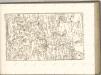

Nógrád vármegye
1 : 376000 Novohrad (Slovensko a Maďarsko) Görög, Demeter Festetics, György Görög
Stolice Novohrad
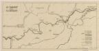
Komitat Nógrád ethnische Gruppe
Nográd vármegye térképe
1 : 390000 Slovensko Kogutowicz, Manó Magyar Földrajzi Intézet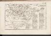
C. Zempliniensis. Tab. II
Slowakei Komitat Zemplín
Stolice Abauj-Torna a Boršod
Abaúj-Torna, Komitat Borsod, ethnische Gruppe
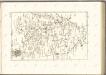
Mappa Comitatvs Neogradiensis Methodo Astronomico-Geometrica concinnata
1 : 166600 Mollova mapová sbírka Mikoviny, Sámuel Nicolaï, Georg David Christoph
Heves vármegye térképe
1 : 390000 Kogutowicz, Manó Magyar Földrajzi Intézet
A Dunavölgy Átnézeti Térképe, Carte d ́ensemble del la Vallée du Danube VIII.

C. Neogradiensis
Ungarn Komitat Nógrád