Maps of Finland Proper
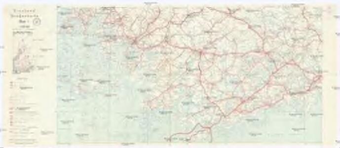
Finnland Straßenkarte
1 : 200000 Finsko Gen St d H Abt f Kr Kart u Verm W IV Mil Geo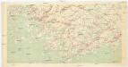
[Suomi tiekartta 1:200 000]
1 : 200000 Finsko
Finnische Schärenküste
1 : 2000000 Finnland Schärenküste
Ostsee
1 : 100000 Baltské moře Reichs-Marine-Amt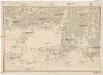
Ostsee
1 : 100000 Baltské moře Reichs-Marine-Amt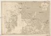
Ostsee
1 : 100000 Baltské moře Reichs-Marine-Amt
K vojně so Švecīej 1808 - 1809 gg. Karta prochoda okolo ostrova Kimito
Finnland Kimito Seeschlacht Russisch-Schwedischer Krieg <1808-1809>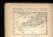
Proryv galernago flota 26 ījulja 1714 goda.
Ostsee Nordischer Krieg <1700-1721> Seeschlacht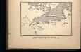
Proryv galernago flota 27 ījulja 1714 goda.
Ostsee Nordischer Krieg <1700-1721> Seeschlacht
Schema k dějstvījam u Ganguta v ījulě 1714 g.
Finnland Hanko Nordischer Krieg <1700-1721>
Ostsee
1 : 50000 Baltské moře Reichs-Marine-Amt
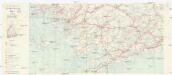
Tammerfors, Helsingfors, Reval
1 : 750000 Helsinky (Finsko) K. u. k. Militärgeographisches Institut
Die finnischen Schären
1 : 2000000 Finnland Schärenküste
Ostsee
1 : 150000 Baltské moře Reichs-Marine-Amt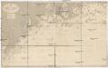
Ostsee
1 : 50000 Baltské moře Reichs-Marine-Amt
Sinus Finnici delineatio geographica / ex quam plurimis subsidiis novissimis stereographice tradita
1 : 1000000 1 Karte auf 2 Blatt : Kupferdruck ; 44 x 81 cm Mayer, Tobias [Homännische Erben]
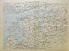
Nova Totius Livoniae accurata Descriptio. [Karte], in: Novus atlas absolutissimus, Bd. 1, S. 67.
1 Karte aus Atlas Janssonius Offizin
Nova Totius Livoniae accurata Descriptio. [Karte], in: Gerardi Mercatoris et I. Hondii Newer Atlas, oder, Grosses Weltbuch, Bd. 1, S. 121.
1 Karte aus Atlas Mercator, Gerhard und Hondius, Jodocus Jansson, Jan
Von Riga nach St. Petersburg
1 : 2600000 Baltikum
Die finnischen Seen
Finnland Seengebiet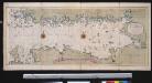
Nieuwe afteekening van de Finlandse Golff
Gulf of Finland Abraham Maas Gerard van Keulen
Nieuwe kaart van de Finnissche Golf benevens de omliggende provintien : naar de beste kaarten en sterrekundige waarnemingen geteekend in 't Konigl. Landmeeters Comtoir te Stockholm
1 : 1200000 C. van Baarsel sculp. te Amsterdam : bij J. Covens en Zoon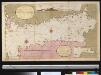
Afteekening van t agterste gedeelte van de Oost Zee van t eijlant Dago tot Schansternij
Gulf of Finland Gerard van Keulen
Oost-Zee Streckende van Dageroort tot Wyborgh [Karte in 2 Teilen], in: De Nieuwe Groote Vermeerderde Zee-Atlas ofte Water-Werelt, S. 27.
1 Karte aus Atlas Doncker, Hendrick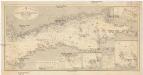
Ostsee
1 : 400000 Baltské moře Reichs-Marine-Amt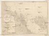
Ostsee
1 : 200000 Alandské ostrovy (Finsko : souostroví) Reichs-Marine-Amt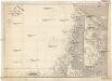
Ostsee
1 : 200000 Baltské moře Reichs-Marine-Amt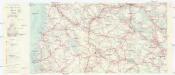
Finnland Straßenkarte
1 : 200000 Finsko Gen St d H Abt f Kr Kart u Verm W IV Mil Geo