Maps of Szabolcs-Szatmár-Bereg
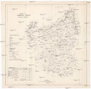
Szabolcser Comitat
1 : 280000 Szabolcs-Szatmár-Bereg (Maďarsko)
Szabolcser Comitat
1 : 280000 Szabolcs-Szatmár-Bereg (Maďarsko)
C. Zempliniensis. Tab. II
Slowakei Komitat Zemplín

Nyiregyhaza und Hajdu-Nans.
from Spezialkarte der osterreichisch-ungarischen Monarchie.
Kis-Varda und Vasaros-Nameny.
from Spezialkarte der osterreichisch-ungarischen Monarchie.
Nagy-Kálló und Nyir-Bátor
1 : 75000 Nagykálló, Nyírbátor Geripp: J. Schwarz. Terrain: Oberlt. Julius Bressa
Tokaj
1 : 75000 Maďarsko Palitschek, Rudolf K. u. k. Militärgeographisches Institut
Kis-Várda und Vásáros-Namény
1 : 75000 Kisvárda, Vásárosnamény Geripp: Feldw. Rücker. Terrain: Oberlt. Schlichting
Nagy-Kallo und Nyir-Bator.; Spezialkarte der osterreichisch-ungarischen Monarchie.
from Spezialkarte der osterreichisch-ungarischen Monarchie. Austro-Hungarian Monarchy. Militärgeographisches Institut.,
Tokai.; Spezialkarte der osterreichisch-ungarischen Monarchie.
from Spezialkarte der osterreichisch-ungarischen Monarchie. Austro-Hungarian Monarchy. Militärgeographisches Institut.,
Nyirecyháza und Hajdú-Nánás
1 : 75000 Hajdúnánás, Umland Geripp: Official K. Höller
Tokaj
1 : 75000 Maďarsko Vojenský zeměpisný ústav
A bodrogkereszturi csata vazlata (1849 april 22- és 23-án)
Ungarn Bodrogkeresztúr Schlacht Ungarn / Revolution <1848-1849>
Saros-Nagypatak und Satoralja-Ujhely.
from Spezialkarte der osterreichisch-ungarischen Monarchie.
Čop a Mándok
1 : 75000 Maďarsko Vojenský zeměpisný ústav
Čop a Mándok
1 : 75000 Maďarsko Vojenský zeměpisný ústav
Slov. Nové Mesto a okolí
1 : 75000 Vojenský zeměpisný ústav
III. vojenské mapování 4668
1 : 75000
Mándok
1 : 75000 Szabolcs-Szatmár-Bereg
III. vojenské mapování 4667
1 : 75000
Čejkov a Sárosnagypatak
1 : 75000 Maďarsko Vojenský zeměpisný ústav
Mandok und Csap (Ungarn).; Spezialkarte der osterreichisch-ungarischen Monarchie.
from Spezialkarte der osterreichisch-ungarischen Monarchie. Austro-Hungarian Monarchy. Militärgeographisches Institut.,
Sáros-Nagypatak und Sátoralja-Ujhely
1 : 75000 Maďarsko Bernhauer K. u. k. Militärgeographisches Institut
Mándok und Csap
1 : 75000 Maďarsko Charlemont K. u. k. Militärgeographisches Institut
Debreczen.
from Spezialkarte der osterreichisch-ungarischen Monarchie.
III. vojenské mapování 4667/4
1 : 25000
III. vojenské mapování 4668/3
1 : 25000
[Gradkartenblatt]
1 : 25000 Slovensko Vojenský zeměpisný ústav