Maps of Region of Central Greece
[Golfe de Corinthe]
Korintský záliv (Řecko : oblast) Koeppelin [sic]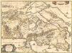
Attica, Mecarica, Corinthiaca, Boeotia, Phocis, Locri. [Karte], in: Novus atlas absolutissimus, Bd. 10, S. 131.
1 Karte aus Atlas Janssonius Offizin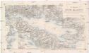
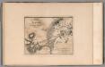
Der Meerbusen von Korinth oder Lepanto
1 : 200000 Korintský záliv (Řecko : oblast) Stanley, Owen Mannsell, A. L. Depot de la guerre
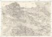
Boeotien
1 : 291000 Řecko Müller, Karl Otfried Gleditsch
Attica Megarica Corinthiaca Boeotia Phocis Locri
Atika, poloostrov (Řecko) Velius, Theodorus Hondius, Henricus sumptibus Henrici Hondii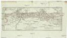
Corinth, Sicyon, Phliasia und Achaia
1 : 640000 Achaia (Řecko) Barbié du Bocage, Jean Denis
Achaia vetvs et nova
1 : 400000 Achaia (Řecko) Homann, Johann Baptist Homann, Johann Christoph â Io. Bapt. Homanno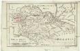
Boeotia
1 : 435000 Barbié du Bocage, Jean Denis
Phocis und Doris
1 : 435000 Barbié du Bocage, Jean Denis
Italien und Balkanhalbinsel. Nebenkarten II. 1. Athen und der Isthmus von Korinth
Attika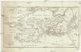
Plan des Treffens bey Salamis
1 : 110000 Salamís, ostrov (Řecko) Barbié du Bocage, Jean Denis
Plan von Thermopylae auf die Zeit des Einfalls des Xerxes in Griechenland angewendet
1 : 80000 Barbié du Bocage, Jean Denis
Versuch über die umliegenden Gegenden von Delphi
1 : 100000 Delfy (Řecko) Barbié du Bocage, Jean Denis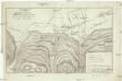
Versuch über das Treffen bey Plataea
1 : 39000 Barbié du Bocage, Jean Denis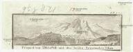
Prospect von Delphi und den beyden Parnassischen Felsen
Delfy (Řecko)
Plan der Akademie und der umliegenden Gegend
1 : 12000 Athény (Řecko) Barbié du Bocage, Jean Denis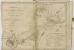
Plan of the environs of Athens. No. 8
1 : 56000 Barbie du Bocage, Jean Denis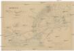
Athenae cum portibus Piraeo et Phalereo et regione adjacente in usum scholarum descripta
Athény (Řecko) Köb, Kajetano
Plan der umliegenden Gegend von Athen
1 : 55000 Athény-oblast (Řecko) Barbié du Bocage, Jean Denis Choiseul-Gouffier, Marie-Gabriel-Florent-Auguste
Athen
1 : 150000 Athen
Umgebungen von Athen
Athény (Řecko) F. Tempsky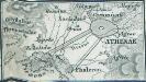
[Athenae-Piraeus]
Athen, Piräus, Antike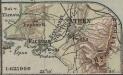
[Athen]
1 : 625000 Athen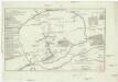
Plan von Athen
1 : 12000 Athény (Řecko) Barbié du Bocage, Jean Denis

Griechenland
1 : 2000000 Griechenland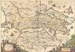
Achaiae Nova & accurata Descriptio. [Karte], in: Novus atlas absolutissimus, Bd. 10, S. 102.
1 Karte aus Atlas Janssonius Offizin
Epirus, Thessalia et Hellas
Griechenland, Thessalien
![[Golfe de Corinthe]](https://images-2.georeferencer.com/images/iiif/867042623258/full/,300/0/native.jpg)

