Maps of Corinthia Regional Unit
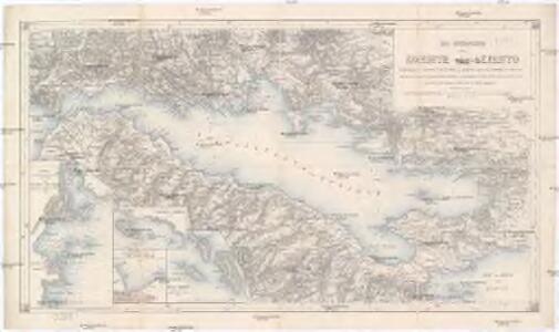
Der Meerbusen von Korinth oder Lepanto
1 : 200000 Korintský záliv (Řecko : oblast) Stanley, Owen Mannsell, A. L. Depot de la guerre
Corinth, Sicyon, Phliasia und Achaia
1 : 640000 Achaia (Řecko) Barbié du Bocage, Jean Denis
Achaia vetvs et nova
1 : 400000 Achaia (Řecko) Homann, Johann Baptist Homann, Johann Christoph â Io. Bapt. Homanno
Italien und Balkanhalbinsel. Nebenkarten II. 1. Athen und der Isthmus von Korinth
Attika
Versuch über die umliegenden Gegenden von Delphi
1 : 100000 Delfy (Řecko) Barbié du Bocage, Jean Denis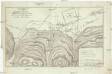
Versuch über das Treffen bey Plataea
1 : 39000 Barbié du Bocage, Jean Denis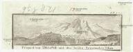
Prospect von Delphi und den beyden Parnassischen Felsen
Delfy (Řecko)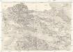
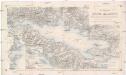
[Golfe de Corinthe]
Korintský záliv (Řecko : oblast) Koeppelin [sic]
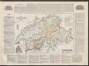
[Griechenland]
1 : 2500000 Griechenland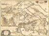
Attica, Mecarica, Corinthiaca, Boeotia, Phocis, Locri. [Karte], in: Novus atlas absolutissimus, Bd. 10, S. 131.
1 Karte aus Atlas Janssonius Offizin
Attica Megarica Corinthiaca Boeotia Phocis Locri
Atika, poloostrov (Řecko) Velius, Theodorus Hondius, Henricus sumptibus Henrici Hondii
Arcadia
1 : 640000 Arkádie (Řecko) Barbié du Bocage, Jean Denis
Boeotien
1 : 291000 Řecko Müller, Karl Otfried Gleditsch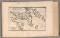
Attica, Megaris and part of the Island of Euboea. No. 9
1 : 66000 Barbie du Bocage, Jean Denis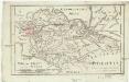
Boeotia
1 : 435000 Barbié du Bocage, Jean Denis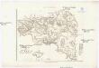
Karte von Attika
1 : 33000 Atika, poloostrov (Řecko) Müller, Karl Otfried Gleditsch
Phocis und Doris
1 : 435000 Barbié du Bocage, Jean Denis
Greece 1:100,000, Tripolis
Sheet K7 of the map series: Greece. (Albania) 1 : 100,000. M.D.R. 610. [G.S.G.S. 4439] [London] : War Office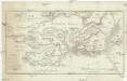
Plan des Treffens bey Salamis
1 : 110000 Salamís, ostrov (Řecko) Barbié du Bocage, Jean Denis


MOREA | olim | PELOPONNESVS
Guilj. Blaeu exc.
Morea olim Peloponnesus. [Karte], in: Novus Atlas, das ist, Weltbeschreibung, Bd. 3, S. 344.
1 Karte aus Atlas Blaeu, Joan Blaeu, Willem Janszoon

Morea olim Peloponnesus [Karte], in: Novus atlas absolutissimus, Bd. 5, S. 289.
1 Karte aus Atlas Janssonius Offizin
Morea olim Peloponnesus [Karte], in: Gerardi Mercatoris et I. Hondii Newer Atlas, oder, Grosses Weltbuch, Bd. 2, S. 333.
1 Karte aus Atlas Mercator, Gerhard und Hondius, Jodocus Jansson, Jan
Morea ilim Peloponnesus. [Karte], in: Theatrum orbis terrarum, sive, Atlas novus, Bd. 3, S. 294.
1 Karte aus Atlas Blaeu, Joan Blaeu, Willem Janszoon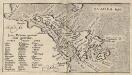
Insular. Aliquot Aegaei Maris Antiqua Descrip.[:] Euboea, Insula.[Karte], in: Theatrum orbis terrarum, S. 517.
1 Karte aus Atlas Ortelius, Abraham Vrients, Jan Baptista
Morea olim Peloponnesus [Karte], in: Gerardi Mercatoris Atlas, sive, Cosmographicae meditationes de fabrica mundi et fabricati figura, S. 490.
1 Karte aus Atlas Mercator, Gerhard Montanus, Petrus