Maps of Valais/Wallis
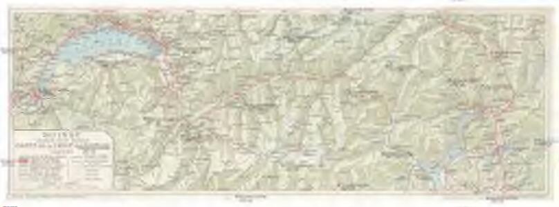
Carte de la Ligne du Simplon
1 : 450000 Švýcarsko Geogr. Anstalt Kümmerly & Frey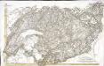
[Südwestschweiz]
1 Karte : Kupferdruck ; 43 x 70 cm s.n.
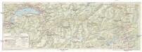
Geologische Kartenskizze der Alpen zwischen St. Gotthard & Montblanc
1 : 350000 Alpy (pohoří) Schmidt, Carl Ernst Finckh
Carte d'une partie des cantons de Berne de Fribourg du païs de Veau et du Valais &c
1 Blatt : Covens et Mortier
Nova Helvetiae tabula geographica, 3
1 Blatt : Pieter Schenk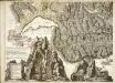
Nova Helvetiae tabula geographica, 3
1 Blatt : Johann Jakob Scheuchzer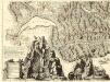
Nova Helvetiae Tabula Geographica
1 : 290000 Mollova mapová sbírka Scheuchzer, Johann Jakob Huber, Johann Heinrich Scheuchzer, Johann Jakob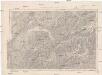
Generalkarte der Schweiz
1 : 250000 Švýcarsko Müllhaupt, H. Eidg. Landestopographie
Les Suisses Leurs Alliés et Leurs Suiets]
1 : 250000 Mollova mapová sbírka Jaillot, Alexis-Hubert Jaillot, Alexis Hubert
Postkarte der schweizerischen Eidgenossenschaft
1 : 300000 Südwest-Blatt Dufour, Guillaume Henri ; Stengel, Johann Rudolf ; Mohr, Ernst Rudolf Wurster
Atlas novus Reipublicae Helveticae
1 Atlas ([40] Bl., 97 S.) bey Orell, Gessner und Compagnie, Zürich
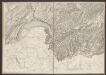
Partie meridionale des cantons de Berne et de Fribourg, le Valais, la seigneurie de Geneve, les balliages d'Orbe et de Schwarzenburg
1 Karte : Kupferdruck ; 47 x 65 cm Jaillot chez l'auteur joignant les grands Augustins aux deux globes
Partie meridionale des cantons de Berne et de Fribourg, le Valais, la seigneurie de Geneve, les balliages d'Orbe et de Schwarzenburg
1 Karte : Kupferdruck ; 47 x 65 cm Jaillot chez l'auteur joignant les grands Augustins aux deux globes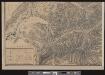
Keller's Wandkarte der Schweiz in 8 Blättern
1 : 200000 1 Karte auf 8 Bl. dessinée et publiée par H. Keller ; auf Stein gezeichnet v. J. Heer-Grubermann ; Lith. von J. Tribelhorn Keller, Zürich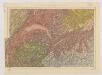
Carte du phénomène erratique et des anciens glaciers du versant nord des Alpes Suisses et de la chaîne du Mont-Blanc
1 : 250000 Südwest-Blatt Favre, Alphonse Imp. par l'Etabl. topogr. de Wurster, Randegger et Cie.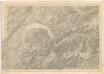
Karte der Schweiz... Blatt III.
Officielle Eisenbahn-Karte der Schweiz
1 : 250000 Südwest-Blatt Müllhaupt, Hans Heinrich [Eidg. Stabsbureau]
Schweiz
1 : 390000 Südwest-Blatt [s.n.]
Karte der Schweiz
1 : 250000 1 Karte auf 4 Bl. [Verlag nicht ermittelbar], [Erscheinungsort nicht ermittelbar]
[Schweiz]
1 : 390000 Südwest-Blatt Ziegler, Jakob Melchior [s.n.]
[Distanzenkarte der Schweiz]
1 : 250000 4 Karten nach dem topographischen Atlasse des Eidgenössischen Generalstabes reduziert unter der Direction des Generals G. H. Dufour ; gest. von H. Müllhaupt Eidg. Stabsbureau, Bern
Officielle Eisenbahn-Karte der Schweiz
1 : 250000 4 Karten gest. v. H. Müllhaupt Eidg. Stabsbureau, [Bern]
<<Der>> Canton Wallis
1 : 450000 1 Karte gez. u. gest. v. J. Scheuermann Orell Füssli & Comp., Zürich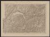
Officielle Eisenbahn-Karte der Schweiz
1 : 250000 Südwest-Blatt [s.n.]
Karte der Militärkreise
1 : 250000 1 Karte auf 4 Blättern Eidg. Stabsbüreau, [Bern]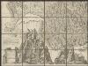
Nova Helvetiae tabula geographica illustrissimis et potentissimis cantonibus et rebuspublicis reformatae religionis Tigurinae, Bernensi, Glaronensi, Basiliensi, Scaphusianae, Abbatis Cellanae
1 : 230000 1 Karte auf 4 Bl. dominis suis clementissimis humillime dicata a Ioh. Iacobo Scheuchzero Tigurino ; Ioh. Melch. Füsslin ornamenta pinx. ; Ioh. Henr. Huber et Eman. Schalch sculps. [Hofmeister], [Zürich]
<<Der>> Canton Wallis
1 : 450000 1 Karte gez. u. gest. v. J. Scheuermann Orell Füssli & Comp., Zürich
<<Der>> Canton Wallis
1 : 450000 1 Karte gez. u. gest. v. J. Scheuermann Orell Füssli & Comp., Zürich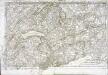
Partie occidentale et meridionale de la Suisse et païs de Vallais
1 Karte : Kupferdruck ; 46 x 72 cm Monti chez F. Monty