Maps of Var
Carta d'Italia speciale per automobilisti, ciclisti e touristi
1 : 250000 Francie jihovýchodní Istituto Italiano d'arti grafiche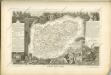
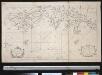
Afteekening van de Golfe de Grimaut, St. Tropez, Freius, Napoule en Antibes, aen de kust van Provence
France Gerard van Keulen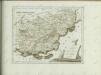

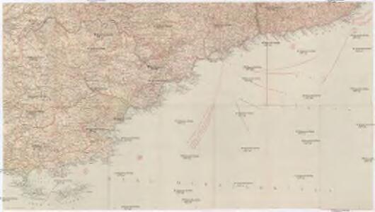
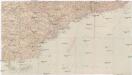
[Atlas départemental : La France et ses colonies] No. 80 Var
1 : 670000 publ. par Michel fils ainé [dressé par A. Lorrain, et gravé par H. Dandeleux] Versailles [etc.] : Barreswil et Andrieux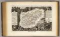
Dept. Du Var.
1 : 571000 Levasseur, Victor.
Excursions routières & maritimes au Départ de Nice
Nice Centre d'Excursions
Carte générale du département des Alpes Maritimes
1 : 125000 Alpy francouzské (pohoří) Gavini, M. Conte-Grandchamps, M. E. Andriveau-Goujon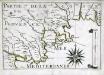
Partie de la coste de Provence
1 Karte : 22 x 33 cm de Fer
Carte routiere, vélocipédique, kilometrique des Alpes-Maritimes
1 : 100000 Rochemonteix, Adolphe de Erhard Freres
[Antibes]
1 Blatt : 56 x 63 cm s.n.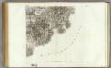
169 Antibes.
1 : 86400 Cassini family; Cassini, Cesar-Francois, 1714-1784
Pianta di Villa franca con parte della riviera di Gjenova
Mollova mapová sbírka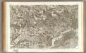
154 Lorgues.
1 : 86400 Cassini family; Cassini, Cesar-Francois, 1714-1784
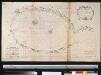
De eijlande van Eres
France Gerard van Keulen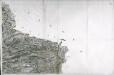
[Vence]
1 Blatt : 56 x 89 cm Aldring s.n.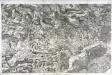
[Lorgues]
1 Blatt : 56 x 88 cm Aldring s.n.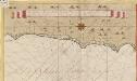
Een gedeelte van de kust van Provence in de Middelanse Zee tussen C. St. Remo en Caap delle Melle int groodt
Italy Gerard van Keulen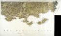
[Toulon]
2 Blätter : zus. 56 x 99 cm s.n.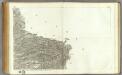
168 Vence.
1 : 86400 Cassini family; Cassini, Cesar-Francois, 1714-1784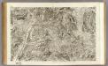
153 Digne.
1 : 86400 Cassini family; Cassini, Cesar-Francois, 1714-1784
Parte del Piemonte
1 : 230000 Mollova mapová sbírka
Carte de la France... Feuille XXVII - 33
Afteekening van de Baij of Golf van Eres of Hiere in de Middelandsche Zee aen de kust van Provence int groodt
France Gerard van Keulen
Carte d'une partie de la cote de Provence de la Rade et des Îles dHyeres
Provence (Francie)
De reeden van Eres
France Gerard van Keulen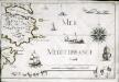
Partie de Provence
1 Karte : 22 x 33 cm de Fer
Les isles d'Hyeres et le fort de Brigançon, et autres forces de Provence etc
Provence (Francie) Allard, Carel C. Allard
182 (169+) Tour de Camarat.
1 : 86400 Cassini family; Cassini, Cesar-Francois, 1714-1784