Maps of Komáromi járás

Ács
1 : 75000 Maďarsko Vojenský zeměpisný ústav
III. vojenské mapování 4960
1 : 75000
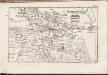
Ács und Totis
1 : 75000 Ács (Ungarn), Tata (Ungarn) Geripp: Feldw. Watterich. Terrain: Wachtmst. Edl. v. Palitschek
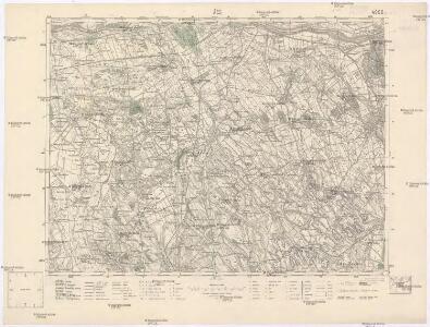
Komárom (Újváros) és Tata
1 : 25000 Maďarsko M. Kir. Állami Térképszeti Intézet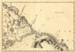
Raab - Neudorff
Mollova mapová sbírka Marsili, Luigi Ferdinando
III. vojenské mapování 4960/1
1 : 25000
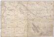
Nagyigmánd
1 : 25000 Maďarsko M. Kir. Állami Térképszeti Intézet
Schlacht bei Komorn am 11ten Juli 1849
1 : 61500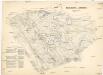
Schlacht bei Komorn am 11ten Juli 1849
1 : 61500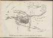
Komárom összes mellék-erőditéseinek s környékének vázlata 1849-ik évi állapotban
Ungarn Komorn
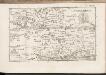
Acs und Totis.
from Spezialkarte der osterreichisch-ungarischen Monarchie.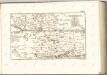
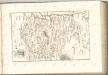
C. Comaromiensis
Ungarn Komitat Komorn (Ungarn)
Komárom vármegye térképe
1 : 360000 Kogutowicz, Manó Magyar Földrajzi Intézet
Komorn 148, uit: Special-Karte von Mittel-Europa / nach amtlichen Quellen bearbeitet von W. Liebenow
1 : 300000 titelvariant: W. Liebenow's Mittel-Europa; Annotatie: Titel boven de bladen: W. Liebenow's Mittel-Europa Johannes Wilhelm Liebenow 1822-1897 Frankfurt a. M. : Ludwig Ravenstein
Generální mapa ČSR

Komárom Vármegye
1 : 340000 Slovensko jižní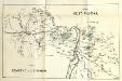
Stolice Pešť-Pilišská. Stolice Komárno a Ostřihom
Komitat Komárom-Esztergom, Komitat Pest-Pilis-Solt-Kiskun, ethnische Gruppe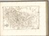
C. Jauriniensis
Ungarn Komitat Raab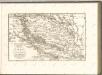

Übersichtskarte zu den Operationen vor u. nach der Schlacht bei Raab
Special Karte von Ungarn
1 : 14400 Györ (Maďarsko : oblast) K.K. Militärisch-Geographisches Institut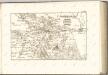

Comitat Stuhlweissenburg
1 : 300000
Comitat Stuhlweissenburg
1 : 280000 Székesfehérvár (Maďarsko)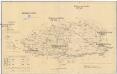
Komorner Comitat
1 : 290000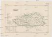
Komorner Comitat
1 : 288000 Komárno (Slovensko)