Maps of Píla
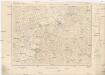
[Kartenblatt]
1 : 25000 Slovensko Reichsamt für Landesaufnahme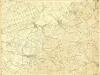
III. vojenské mapování 4658/2
1 : 25000
Dürnkrut und Bösing
1 : 75000 Dürnkrut, Bösing Schrift u. Gerippe v. Feldw. König. Terrainschraffirung v. Lieut. Kuźmin
Malacky
1 : 75000 Malacky-oblast (Slovensko) Vojenský zeměpisný ústav
Malacky
1 : 75000 Malacky (Slovensko : oblast) Vojenský zeměpisný ústav
Malacky
1 : 75000 Malacky (Slovensko : oblast) Vojenský zeměpisný ústav
III. vojenské mapování 4658
1 : 75000
Durnkrut und Bosing.
from Spezialkarte der osterreichisch-ungarischen Monarchie.
III. vojenské mapování 4658/4
1 : 25000
Malé Karpaty severná časť

Landshut, Sasvar und Hohenau.
from Spezialkarte der osterreichisch-ungarischen Monarchie.
III. vojenské mapování 4658/1
1 : 25000
[Kartenblatt]
1 : 25000 Malacky (Slovensko : oblast) Reichsamt für Landesaufnahme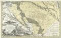
Comitatvs Posoniensis Germanis Presbvrg dicti Delineatio Geographica
1 : 150000 Mollova mapová sbírka Homann, Johann Baptist Alber, Johann Eberhard Homann, Johann Baptista - dědici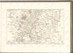
C. Posoniensis. Tab. I
Slowakei Komitat Preßburg
C. Nitriensis. Tab. II
Slowakei Komitat Neutra
Bratislava okolie
Ober-Neutraer Comitat
1 : 280000 Nitra-oblast (Slovensko)
COMITATVS POSONIENSIS Germanis PRESBVRG dicti Delineatio Geographica
1 : 113000 Bratislava-oblast (Slovensko) Mikoviny, Sámuel curantibus] Homannianis [Heredibus
Poszony vármegye térképe
1 : 300000 Bratislava (Slovensko : oblast) Kogutowicz, Manó Magyar Földrajzi Intézet
Mappa Comitatvs Posoniensis
1 : 240000 Mollova mapová sbírka Nicolaï, Georg David Christoph
Generalkarte 1:200 000 zum Kriegsspielplan von Poisdorf
1 : 200000 Poysdorf (Rakousko) K.u.k militär-geographisches Institut
Lundenburg 133, uit: Special-Karte von Mittel-Europa / nach amtlichen Quellen bearbeitet von W. Liebenow
1 : 300000 titelvariant: W. Liebenow's Mittel-Europa; Annotatie: Titel boven de bladen: W. Liebenow's Mittel-Europa Johannes Wilhelm Liebenow 1822-1897 Frankfurt a. M. : Ludwig Ravenstein
Mappa Comitatvs Posoniensis
1 : 250000 Mollova mapová sbírka Bel, Matej Nicolaï, Georg David Christoph Bel, Matej
Comitat Pressburg
1 : 280000 Bratislava-oblast (Slovensko)
Comitat Pressburg
1 : 300000 Bratislava (Slovensko : oblast)
Stolice Prešpurk a Nitra
Bratislava, Nitra, ethnische Gruppe
Karte der Kaiser Ferdinands-Nordbahn
Brno-oblast (Česko) R. v. Waldheim
![[Kartenblatt]](https://images-2.georeferencer.com/images/iiif/857637973425/full/,300/0/native.jpg)

