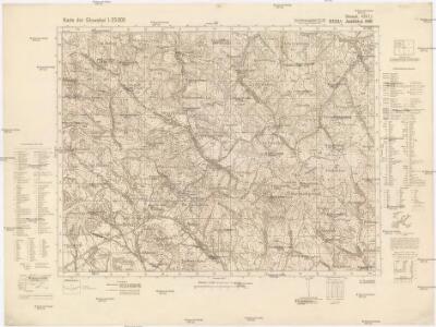
Maps of Grab
Jasliśka NW
1 : 25000 Polsko Reichsamt für Landesaufnahme
[Gradkartenblatt]
1 : 25000 Slovensko Vojenský zeměpisný ústav
Dukla-Pasz (Galizien).
from Spezialkarte der osterreichisch-ungarischen Monarchie.
III. vojenské mapování 4267
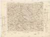
1 : 75000
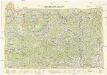
Dukelský průsmyk
1 : 75000 Polsko Vojenský zeměpisný ústav
Průsmyk Dukelský
1 : 75000 Polsko Vojenský zeměpisný ústav
Jaslo und Dukla.
from Spezialkarte der osterreichisch-ungarischen Monarchie.
Bartfa und Muszyna.
from Spezialkarte der osterreichisch-ungarischen Monarchie.
Bardiov a okolí
1 : 75000 Bardejov (Slovensko : oblast) Vojenský zeměpisný ústav
Bardejov
1 : 75000 Bardejov (Slovensko : oblast) Vojenský zeměpisný ústav
Bardejov
1 : 75000 Bardejov (Slovensko : oblast) Vojenský zeměpisný ústav
[Gradkartenblatt]
1 : 25000 Slovensko Vojenský zeměpisný ústav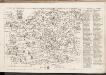
C. Sarosiensis
Slowakei Šariš
Terrae sev Comitatvs Scepvsiensis Tabvla
1 : 190000 Mollova mapová sbírka Kray de Rokus, Paul Puschner, Johann Georg Bel, Matej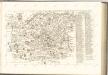

Sanok 108, uit: Special-Karte von Mittel-Europa / nach amtlichen Quellen bearbeitet von W. Liebenow
1 : 300000 titelvariant: W. Liebenow's Mittel-Europa; Annotatie: Titel boven de bladen: W. Liebenow's Mittel-Europa Johannes Wilhelm Liebenow 1822-1897 Frankfurt a. M. : Ludwig Ravenstein
Comitat Sáros
1 : 290000 Šariš (Slovensko : oblast)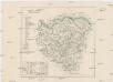
Comitat Sáros
1 : 280000 Šariš-oblast (Slovensko)
Übersichtskarte von Mitteleuropa 1:300 000
1 : 300000 Levoča-oblast (Slovensko) Reichsamt für Landesaufnahme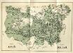
Stolice Spiš. Stolice Šaryš
Šariš, Komitat Zips, ethnische Gruppe
Die vom 2. bis 7. Mai 1915 abends erreichten Linien
1 : 515000 Polen Tarnów Weltkrieg <1914-1918> Verl. Gerhard Stalling, Oldenburg
Generalkarte von Zentraleuropa
Neubertova generální automapa Republiky československé
1 : 200000 Košice (Slovensko : oblast) Soukup, Jan V. Neubert a synové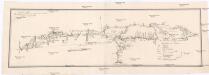
Projectirte Strasse von Billiz bis Lemberg
1 : 560000 Bielsko-Biała (Polsko) Gross
West Galizien
Bochnia (Polsko) Müller, Karl Metzburg, Georg Ignaz von im Verlage des Kunst und Industrie Comptoirs
West Galizien
Halič (Polsko a Ukrajina) Müller, Karl Metzburg, Georg Ignaz von im Verlage des Kunst und Industrie Comptoirs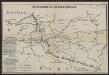
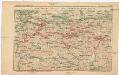
Übersichtskarte des Kampfgeländes
1 : 650000 Polen Tarnów Weltkrieg <1914-1918> Verl. Gerhard Stalling, Oldenburg
Slovensko
Strecke
Krakov (Polsko) K. k. Österreichische Staatsbahnen