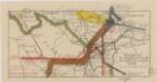
Maps of Przyborów
Babia Góra SW
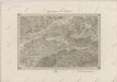
1 : 25000 Babia hora (Oravské Beskydy, Polsko a Slovensko) Reichsamt für Landesaufnahme
III. vojenské mapování 4163/3
1 : 25000
[Gradkartenblatt]
1 : 25000 Orava (Polsko a Slovensko) Vojenský zeměpisný ústav
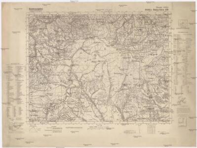
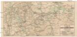
Maków und Podvilk
1 : 75000 Maków Podhalański, Podwilk Geripp: Offiz. Spitzer u. Assist. Irblich. Terrain: Vorst. Adler u. Oblt. Fenz
III. vojenské mapování 4163
1 : 75000
Maków und Podvilk
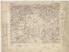
1 : 75000 Oravská Polhora-oblast (Slovensko) Adler K. u. k. Militärgeographisches Institut
Makow und Podvilk.
from Spezialkarte der osterreichisch-ungarischen Monarchie.
Polhora
1 : 75000 Oravská Polhora-oblast (Slovensko) Vojenský zeměpisný ústav
Polhora a Maków
1 : 75000 Oravská Polhora (Slovensko : oblast) Vojenský zeměpisný ústav
Polhora a Maków
1 : 75000 Oravská Polhora (Slovensko : oblast) Vojenský zeměpisný ústav
Auschwitz u. Sator
1 : 2000000 Herzogtum Auschwitz
Ducatus Oswieczensis, Et Zatoriensis, Descriptio. [Karte], in: Theatrum orbis terrarum, S. 375.
1 Karte aus Atlas Ortelius, Abraham Vrients, Jan Baptista
Ducatus Oswieczensis, Et Zatoriensis, Descriptio. [Karte], in: Theatrum orbis terrarum, S. 280.
1 Karte aus Atlas Ortelius, Abraham

Stolice Orava a Liptov
Komitat Arva, Komitat Liptau, ethnische Gruppe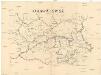
Orawa i Spisz
Orava (Polsko a Slovensko)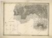
General-Karte des Königreiches Galizien und des Herzogthumes Bukovina

[Rechterblad], uit: Podrobná mapa Vysokých Tater
1 : 25000 Annotatie: Opname 1896/97, gedeeltelijk herzien 1931; Annotatie geografische gegevens: Inzet: Pérehled oblasti Tater. - 1:200.000 [Praag : Vojenský Zeméepisný Ústav]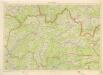
Kraj Žilinský

Silésie de Teschen
1 : 200000 Cieszyn-oblast (Polsko) Čs. voj. zeměpis. ústav
Silésie de Teschen
Cieszyn-oblast (Polsko) Čs. voj. zeměpis. ústav
Silésie de Teschen
Cieszyn-oblast (Polsko) Čs. voj. zeměpis. ústav
Generalkarte von Zentraleuropa

Kraj žilinský
Karte der Kaiser Ferdinands-Nordbahn
Brno-oblast (Česko) R. v. Waldheim
Die im Stadtbuch von Zipser Neudorf genannten Orte
Zips, Spišská Nová Ves, Stadtbuch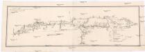
Projectirte Strasse von Billiz bis Lemberg
1 : 560000 Bielsko-Biała (Polsko) Gross
Stredoslovenský kraj
II. vojenské mapování 10
1 : 144000