Maps of Neustift im Stubaital

Schrankogel
1 : 50000 Stubaiské Alpy (Itálie a Rakousko : pohoří) Deutscher und Oesterreichischer Alpenverein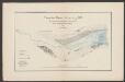
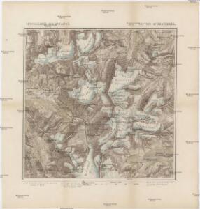
Zunge des Alpeiner Ferners i. J. 1892
1 : 7500 Hess, H. [Lindauer]
Oetzthal & Stubai
1 : 50000 Nordost-Blatt Simon, Simon Deutscher u. Oesterreichischer Alpen-Verein
Feuerstein
1 : 50000 Stubaiské Alpy (Itálie a Rakousko : pohoří) Deutscher und Oesterreichischer Alpenverein
Otzthal.
from Spezialkarte der osterreichisch-ungarischen Monarchie.
Uebersichts-Karte des Oetzthaler Gletscher-Gebietes
1 : 144000 Sonklar von Innstädten, Carl ; Berghaus, Hermann Justus Perthes
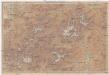
Nördl. Oetzthaler- und Stubaier Alpen, Nordwest. Kalkalpen
1 : 130000 Alpy rakouské (pohoří) Maschek, R. Meuer, Julius Artaria
Uebersichtskarte des Oetzthaler Gletscher-Gebietes
1 : 144000 Ötztalské Alpy (Itálie a Rakousko : pohoří) Berghaus, Hermann Sonklar, Karl von Justus Perthes
194. Mittenwald, uit: Topographische Uebersichtskarte des Deutschen Reiches / herausgegeben v. d. Kartogr. Abt. d. Königl. Preuß. Landesaufnahme
1 : 200000 titelvariant: Topogr. Übersichtskarte des Deutschen Reiches; Annotatie: Titel boven bladen ook: Topogr. Übersichtskarte des Deutschen Reiches; Annotatie geografische gegevens: Op elk blad twee maatstokken: 10 Kilometer = 5,5 cm; 1 geogr. Meile = 3,6 cm; Legenda onder op elk blad Königlich Preußische Landesaufnahme. Kartographische Abtheilung [S.l : Königlich Preußische Landesaufnahme, Kartographische Abtheilung]
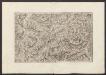
Per Inclyti Circuli Suevici Supremorum Ordinum
1 : 160000 Mollova mapová sbírka Pfeffel, Johann Andreas Homann, Johann Baptista - dědici
Per Inclyti Circuli Suevici Supremorum Ordinum :
1 : 160000 Mollova mapová sbírka Pfeffel, Johann Andreas Pfeffel, Johann Andreas I.
Solden und St. Leonhard (Tirol).
from Spezialkarte der osterreichisch-ungarischen Monarchie.
Skiroutenkarte der Ötztaler Alpen
1 : 50000 Ötztalské Alpy (Itálie a Rakousko : pohoří) Kuntscher, Karl Artaria
Timbler Joch
1 : 50000 Východní Alpy (pohoří) Haushofer, Karl Hoffmann, Carl J. Lindauer'sche Buchhandlung
Timbler Joch
1 : 50000 Východní Alpy (pohoří) Haushofer, Karl Hoffmann, Carl Deutscher und Oesterreichischer Alpenverein
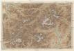
Habicht
1 : 50000 Stubaiské Alpy (Itálie a Rakousko : pohoří) Deutscher und Oesterreichischer Alpenverein
Spezialkarte der Ostalpen

Nördl. Oetzthaler- und Stubaier Alpen, nordwest. Kalkalpen
1 : 130000 Meurer, Julius ; Maschek, R. Verlag Artaria & Co.
[Stubaier Alpen]
1 : 100000 Stubaiské Alpy (Itálie a Rakousko : pohoří) Freytag & Berndt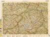
B.Z. - Karte von Oesterreich
Militair Karte von Süd-Deutschland in 20 Sectionen
1 : 400000 18. Section Coulon, Alois von A. von Coulon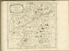

Meran
1 : 200000 1 Karte entworfen und bearbeitet von Woerl ; in Stein gestochen unter seiner Leitung ; Lithographie von B. Herder Herder, Freiburg im Breisgau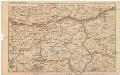
Strecke
Bludenz (Rakousko) K. k. Österreichische Staatsbahnen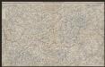
Engadin-Orientbahn
1 : 250000 1:250 000 Schweiz Eidgenössisches Topographisches Bureau Eidg. Topographisches Bureau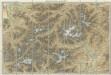
Karte der West - Tiroler und Engadiner – Alpen
Karte der West-Tiroler und Engadiner Alpen
1 : 250000 Engadin (Švýcarsko) Ravenstein, Ludwig L. Ravenstein
Vorarlberg - Oetzthaler Alpen - Brenner
1 : 850000 Bibliographisches Institut
Generalkarte von Zentraleuropa