Maps of Alps
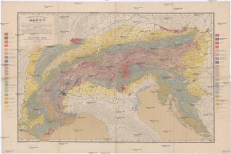
Geologische Übersichtskarte der Alpen
1 : 1000000 Alpy (pohoří) Noe, Franz Suess, Eduard Ed. Hölzel's geographisches Institut
Geologische Übersichtskarte der Alpen
1 : 1000000 Noë, Franz Ed. Hölzel
Ed. Hölzels große Handkarte der Grenzländer Österreich-Ungarn Italien
1 : 1000000 Itálie Hölzel, Eduard Ed. Hölzel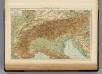
Alps.
1 : 2500000 Andree, Richard; Times (London, England)
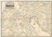
Alpenländer
Atlas der Geologie Zittel, K.v. ; Berghaus, Hermann Justus Perthes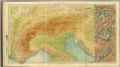
17-19. Alpi fisiche.
1 : 1500000 Touring club italiano
Das Gebiet der Alpen
Alpy Benecke Bormann, E. Ignaz Fuchs
Alpengebiet
Volksschul-Atlas über alle Teile der Erde Lange, Henry Druck und Verlag von Georg Westermann
Alpenlander.
1 : 1250000 Berghaus, Hermann
Strassen Karte der Alpen und des nördlichen Apennin
1 : 1850000 Alpy (pohoří) Berghaus, Hermann Justus Perthes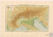
Höhenschichtenkarte der Alpen
Sprachkarte der Alpen
1 : 2000000 Wäber, Adolf ; Leuzinger, Rudolf [Verlag der Expedition des Jahrbuches des S.A.C.]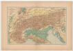
Carta delle Alpi / dir. G. Garollo ; Francesco Vallardi
1 : 2500000 G. Garollo Francesco Vallardi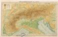
Höhenschichtenkarte der Alpen
Alps. Pergamon World Atlas.
1 : 2500000 Polish Army Topography Service
Alpenland
E. von Sydow's Schul-Atlas in sechs und dreissig Karten Sydow, Emil von bei Justus Perthes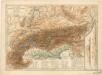
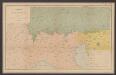
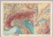
Physikalische Karte der Alpen und ihrer Vorlande
Italien
Itálie severní
Permanente und feldmässige Befestigungen
Mannheim (Německo) K.k. Generalstabes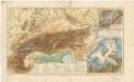
Alpy

Danubii fluminis (â fontibus prope Doneschingam usq. Posonium urbem designati) pars superior
1 : 1982000 Bavorsko (Německo) Homann, Johann Baptist Ioh. Bapt. Homano
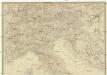
Ober und Mittel Italien
Carta postale ed itineraria dell'Italia
Itálie Botte, A. F. Deyé A.F. Botte
Carta postale ed itineraria dell' Italia
Chorvatsko Botte, A.F.
Exactissima Tabula, qua tam Danubii Fluvii Pars Superior
1 : 2100000 Mollova mapová sbírka Visscher, Nicolaes Jansz. Visscher, Nicolaus
Exactissima Tabula, qua tam Danubii Fluvii Pars Superior
1 : 2100000 Mollova mapová sbírka Visscher, Nicolaes Jansz. Visscher, Nicolaus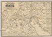
Carta postale et itineraria dell'Italia
Itálie severní Botte, A. F. Deyé A.F. Botte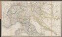
[Post und Reisekarte von Italien und den nördlich angrenzenden Alpenländern]
1 : 1800000 Roost, Johann Baptist J.G. Cotta
Danubii fluminis (à fontibus prope Doneschingam usq[ue] Posonium urbem designati) pars superior
1 Karte : Kupferdruck ; 46 x 54 cm Homann Johann Baptist Homann