Maps of Arabian Peninsula

Africa orientale
1 : 14000000 Afrika východní Antonio Vallardi
Terrenos adjacentes aos rios Zambeze e Chire : desde as suas ultimas cachoeiras até ao mar / mappa coordinado por Alfonso de Moraes Sarmento
1 : 465000 Annotatie geografische gegevens: Opname: 1877-1880 Sarmento, Alfonso de Moraes [S.l. : s.n.]
Carte Particuliere De La Mer Rouge &c. Levée Par Ordre Expres des Roys de Portugal sous qui on en a Fait la Decouverte. [Karte], in: Atlas nouveau, contenant toutes les parties du monde [...], Bd. 2, S. 228.
1 Karte aus Atlas Sanson, Nicolas Jaillot, Alexis Hubert und Mortier, Pieter
Untitled

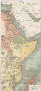
Ost-Africa, Madagascar.
1 : 12900000 Radefeld, Carl Christian Franz, 1788-1874
Ost-Africa und Madagascar
Grosser Hand-Atlas über alle Theile der Erde in 170 Karten Meyer, J. Verlag des Bibliographischen Instituts
Etiópia (Abesszínia)
1 : 5000000 Annotatie geografische gegevens: Aansluitende inzetkrt: [Socotra]; Inzetkrt.: Afrika. - 1:50.000.000. Etiópia fontosabb törzsei. - [1:20.000.000] Budapest : M. Kir. Állami Térképészet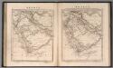
Arabia
1 : 11000000 Arrowsmith, Aaron Jr.
Le royaume d'Adel
1 : 9600000 Jemen Bonne, Rigobert André
Missions catholiques du nord-est de l'Afrique comprenant l'Egypte, l'Abyssinie, le Soudan et la région du Haut-Nil
1 : 4000000 Vuillot, Paul 18..-19.. [Lyon : Oeuvre de la propagation de la foi]
91. Arabia.
1 : 10000000 Touring club italiano
116-17. Eritrea, Etiopia, Somalia.
1 : 5000000 Touring club italiano
Ethiopia, Somalia, Kenya, Uganda, Rwanda, Tanzania, Burundi. Pergamon World Atlas.
Polish Army Topography Service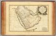
Arabie.
1 : 9300000 Bonne, Rigobert, 1727-1794
Ostafrika – Vých. Afrika

Arabien
1 : 5700000 entworfen und gezeichnet von C.F. Weiland Weimar : Verlag des Geograph. Instituts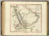
Arabia, Egypt, Abyssinia, Red Sea.
1 : 6500000 Cary, John, ca. 1754-1835
Abessinien
1 : 5000000 Afrika východní Josef Ulbricht
Arabia et Arabicus sinus
1 : 5700000 Arabský poloostrov Reichard, Christian Gottlieb Campius, D. a D. Campio
Arabia.
1 : 13800000 Darton, William
[Kaart], uit: Colonie dell'Africa Orientale Italiana
1 : 4000000 Annotatie: Ondertitel op omslag: Eritrea - Somalia Italiana - Etiopia - Somalia Francese e Britannica; Annotatie geografische gegevens: Inzetkrt.: [Omgevingskaart]. - 1:50.000.000 Milano : Vallardi
ARABIA.
[Amsterdam : Joan Blaeu]
Arabiae Felicis, Petraeae et Desertae nova et accurata delineatio. [Karte], in: Novus atlas absolutissimus, Bd. 6, S. 102.
1 Karte aus Atlas Janssonius Offizin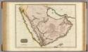
Arabia.
1 : 4500000 Pinkerton, John, 1758-1826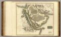
Arabia, Egypt, Abyssinia, Red Sea.
1 : 6500000 Thomson, John
Abessinien
1 : 5000000 Etiopie G. Freytag & Berndt
Persia, Arabia, &c.
1 : 10600000 Mitchell, Samuel Augustus
Persia, Arabia, &c.
1 : 10600000 Mitchell, Samuel Augustus
Egypte, Nubie et Abissinie
1 : 9600000 Egypt Bonne, Rigobert