Maps of Sevastapol

Special-Karte der Halbinsel Krymm [sic]
1 : 350000 Handtke, Friedrich C. Flemming
Specialkarte der Halbinsel Krymm
1 : 350000 entworfen und gezeichnet von F. Handtke Glogau : Flemming
Halbinsel Krymm
Grosser Hand-Atlas über alle Theile der Erde in 170 Karten Meyer, J. Verlag des Bibliographischen Instituts
Krymm Halbinsel.
1 : 640000 Radefeld, Carl Christian Franz, 1788-1874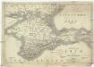
Karte der Krym oder des Taurischen Chersones
1 : 1070000 Krym (Ukrajina) J.J. Weber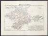
Crimea o penisola Taurica
1 : 600000 Marzolla, Benedetto [Verlag nicht ermittelbar]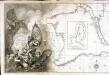
Carte de la mer noire et de la mer d'Asow, 1
1 Blatt : 57 x 86 cm s.n.
Carte de la Crimée
1 : 1900000 1 Karte : Kupferdruck ; 17 x 21 cm Bellin, Jacques Nicolas [Bellin]
Caucausus & Crimea.
1 : 5000000 Fullarton, A. & Co.
[Taurien oder Crim]
1 Karte : Kupferdruck ; 18 x 13 cm [Trattner]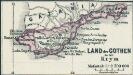
Land der Gothen in der Krym
1 : 2500000 Krim Goten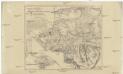
Karte vom südwestlichen Theile der Krim mit Sevastopol
1 : 170000 Krym (Ukrajina) Petermann, August Justus Perthes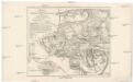
Karte von südwestlichen Theile der Krim mit Sebastopol
1 : 170000 Krym (Ukrajina) Petermann, August Justus Perthes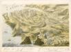
bez titulu: soubor panoramat – Krymská válka

Plan der Umgebung von Ssewasstopol mit Angabe der Stellungen und Belagerungs-Arbeiten der verbündeten Armeen
1 : 40000 Sewastopol (Region) Krimkrieg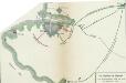
Die Belagerung von Sebastopol vom 14. September 1854 bis 11. September 1855
Sewastopol Sewastopol / Belagerung
Die Belagerung von Sebastopol vom 14. September 1854 bis 11. September 1855
Sewastopol Sewastopol / Belagerung
Plan der reede en haven van Sebastopol, volgens Russische opnemingen
1 : 50000 door A. J. Bogaerts, lithograaph te Breda Breda : Boogaerts
Schlacht an der Alma am 20.ten September 1854
1 : 40000 Alma (Fluss) Schlacht an der Alma
Belagerung von Sebastopol
1 : 175000 Sewastopol Sewastopol / Belagerung
Positiekaart van de oorlogsvoerende legers in de Krim
1 : 40000 lith. van J. H. Schuhkrafft Amsterdam : Jager
Stanford's New Map of Sebastopol
1 : 47000 Sevastopol (Ukrajina) Wetherall, D. A. Edward Stanford
Plan von der Festung Sewastopol
1 : 44000 Sevastopol (Ukrajina) Birck, C. S. Schropp
Sévastopol
1 : 95000 Krym (Ukrajina) Sagansan, L.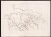
Plan d'ensemble des tranchées indiquant la marche journalière des attaques
1 : 10000 Siége de Sébastopol : journal des opérations du génie : avec un atlas in-folio de 15 planches Niel, Adolphe Librairie Militaire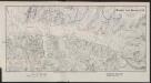
Hafen von Sebastopol
Ukraine Russland Sewastopol Militär Hafen
Carte générale des travaux d'attaque et de défense devant Sébastopol jusqu'au 8 Septembre 1855
1 : 16000 Amyot, rue de la Paix
Travaux de Contre-Approches des Russes
1 : 10000 Siége de Sébastopol : journal des opérations du génie : avec un atlas in-folio de 15 planches Niel, Adolphe Librairie Militaire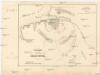
Schlachtplan der Festung Sebastopol
1 : 76000 Sevastopol (Ukrajina) Kolitz, Ed.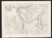
![Special-Karte der Halbinsel Krymm [sic]](https://images-2.georeferencer.com/images/iiif/371425806520/full/,300/0/native.jpg)

