Maps of Northwest
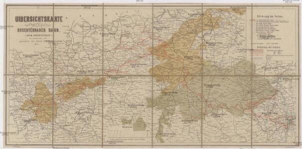
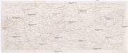
Uibersichtskarte der a. p. Buschtěhrader Bahn (Böhm. Nordwestbahn)
1 : 288000 Buštěhradská dráha (Česko : zaniklá železniční trať) Dobrohlaw, Johann Johann Dobrohlaw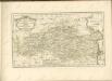
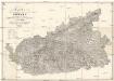
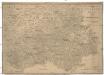
Karte der nordwestlichen Theiles von Böhmen
1 : 229000 Františkovy Lázně (Česko) k. k. Direction der administrativen Statistik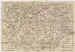
Mittelbach's Strassenprofilkarte des Gebietes der böhmischer Bäder und des Erzgebirges für Rad- und Motorfahrer
1 : 300000 Krušné hory (Česko a Německo) Mittelbach's Verlag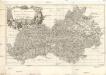
REGIO EGRANA et PROVINCIA SATECENSIS
Cheb-oblast (Česko) Bernardi, Augustin Augustin Bernardi
Regio Egrana et A. provincia Satecensis
Cheb-oblast (Česko) Müller, Johann Christoph Johan Christoph Winkler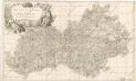
Regio Egrana et A. Provincia Satecensis

Karte des Saazer Kreises im Koenigreiche Boehmen
Žatec-oblast (Louny, Česko) Wostrý, Karl Ferd. Ritt. von Schönfeld's Witwe et Comp.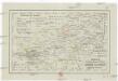
Charte ehemaliger Burgen & Vesten im Elbogner und Saazer Kreise Böhmens
1 : 550000 Loket-oblast (Sokolov, Česko) Heber, Franz Alexander C.W. Medau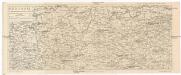
Rudohoří
1 : 288000 Krušné hory-oblast (Česko a Německo) Líčka, Josef Smrček, Antonín nákladem Františka Řivnáče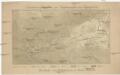
Orientirungskartchen zur Hydrographie des Egergebietes
Krušné hory (Česko a Německo)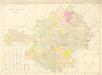
Žatecký kraj, mapa podle panství

Spezial Karte für Verkehr, landwirtschaftliche, Montan u. gewerbliche Industrie des Bezirkes der Handels und Gewerbekammer Eger
1 : 150000 Aš-oblast (Česko) Daniel, N. R. Lechner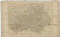
Saatzer Kreis und Egerische-Gebiet
1 : 180000 Cheb-oblast (Česko) Berndt, Johann Christoph Anto. Elsenwanger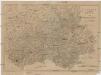
Saatzer Kreis und Egerische-Gebiet
1 : 180000 Cheb-oblast (Česko) Berndt, Johann Christoph Anto. Elsenwanger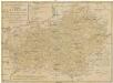
Regni Bohemiae circulus Satecensis
1 : 220000 Žatec-oblast (Louny, Česko) Müller, Johann Christoph editus curis Homannianorum Heredum
Regni Bohemiae circulus Satecensis
1 : 220000 Žatec-oblast (Louny, Česko) Müller, Johann Christoph editus curis Homannianorum Heredum
Regni Bohemiae circulus Satecensis
1 : 220000 Žatec-oblast (Louny, Česko) Müller, Johann Christoph editus curis Homannianorum Heredum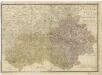
Elbogner dan Saatzer Kreis und Egerische = Gebiet
Das Erzgebirge
1 : 288000 Krušné hory (Česko a Německo : oblast) Líčka, Josef Smrček, Ant. Franz Řivnáč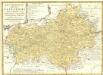
Regni Bohemiae Circulus Satecensis
1 : 225000 Mollova mapová sbírka Müller, Johann Christoph Homann, Johann Baptista - dědici
Der Satzer Creis in dem Königreiche Böhmen gelegen
1 : 530000 Karlovarský kraj (Česko) Schreiber, Johann Georg Joh. George Schreibers see. Wittbe
Reisehandbuch für das Königreich Böhmen

Geognostisch-Montanistische Übersichts-Karte des Egerer Handelskammer-Gebietes
1 : 290000 Cheb-oblast (Česko) Hickmann, Anton L. Egerer Handelskammer
Übersichts-Karte der bedeutendsten Industrial-Unternehmungen nebst Angabe des Waldterrains
1 : 290000 Cheb-oblast (Česko) Hickmann, Anton L. Egerer Handelskammer
Karte des Saazer Kreises im Koenigreiche Boehmen

Elbogner dan Saatzer Kreis und Egerische-Gebiet
1 : 240000 Loket-oblast (Sokolov, Česko) Berndt, Johann Christoph Peter franza [sic]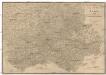
Elbogner dan Saatzer Kreis und Egerische-Gebiet
1 : 240000 Loket-oblast (Sokolov, Česko) Berndt, Johann Christoph Peter franza [sic]
Elbogner dan Saatzer Kreis und Egerische Gebiet
1 : 240000 Loket-oblast (Sokolov, Česko) Berndt, Johann Christoph Peter Franza
Elbogner dan Saatzer Kreis und Egerische Gebiet
1 : 240000 Loket-oblast (Sokolov, Česko) Berndt, Johann Christoph Peter Franza
Elbogner dan Saatzer Kreis und Egerische Gebiet
1 : 240000 Loket-oblast (Sokolov, Česko) Berndt, Johann Christoph Peter Franza