Maps of Pelopónnisos
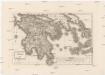
Peloponesus et Cyclades
1 : 710000 Kyklady (Řecko) Reichard, Christian Gottlieb Campius, D. a D. Campio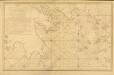
Carte des Côtes de la Grèce depuis Navarin en Morée
Carte des Côtes de la Grèce depuis Navarin en Morée, jusqu'au Cap Doro ... avec la partie de l'Archipel qu comprend les Îles Cyclades, dressée d'après les observations astronomiques et nautiques de M. de Chabert. [Paris] : Dépôt Général ... de la Marine
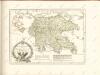
Graeciae pars australis.
1 : 2100000 Fenner, Rest.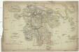
Graeciae
1 : 730000 Peloponés (Řecko) Berra, Marco M. Berra
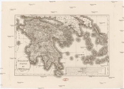
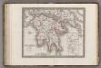
Regnum Moreae accuratissime divisum in provincias Saccaniam, Tzaconiam, Caliscopium et ducatum Clarensae, una cum insulis Cephalonia, Zacyntho Cythera, AEgina et Sidra
1 : 585000 Achaia (Řecko) Lotter, Georg F. sumptibus Tobiae Conradi Lotter
Alt Griechenland
Athény-oblast (Řecko) Loewenberg, Julius Kt., I. V.
Morée
Nouvel atlas physique politique et historique de l'Empire ottoman et des états limitrophes en Europe, en Asie et en Afrique, en quarante feuilles Hellert, J.J. Bellizard, Dufour et Cie
Greece.
1 : 1140480 Letts, Son & Co.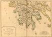
Carte de la Morée anciennement Peloponnèse, 1785
Carte de la Morée anciennement Peloponnèse, 1785. Gravé par L.A. Dupuis ... Lieues communes de France, 20[ = 128 mm] [Paris]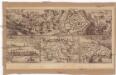
Coron
Koroni (Řecko) Zedtwitz, Curt Drda, Josef Jan Alois
Peloponnese Attique.
1 : 1080000 Monin, C.V.
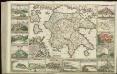
Morea ilim Peloponnesus. [Karte], in: Theatrum orbis terrarum, sive, Atlas novus, Bd. 3, S. 294.
1 Karte aus Atlas Blaeu, Joan Blaeu, Willem Janszoon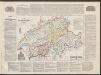
Morea olim Peloponnesus. [Karte], in: Le théâtre du monde, ou, Nouvel atlas contenant les chartes et descriptions de tous les païs de la terre, Bd. 3, S. 304.
1 Karte aus Atlas Blaeu, Willem Janszoon und Blaeu, Joan Blaeu, Willem Janszoon
Morea olim Peloponnesus. [Karte], in: Novus Atlas, das ist, Weltbeschreibung, Bd. 3, S. 344.
1 Karte aus Atlas Blaeu, Joan Blaeu, Willem Janszoon
Morea olim Peloponnesus [Karte], in: Gerardi Mercatoris Atlas, sive, Cosmographicae meditationes de fabrica mundi et fabricati figura, S. 490.
1 Karte aus Atlas Mercator, Gerhard Montanus, Petrus
Morea olim Peloponnesus [Karte], in: Gerardi Mercatoris et I. Hondii Newer Atlas, oder, Grosses Weltbuch, Bd. 2, S. 333.
1 Karte aus Atlas Mercator, Gerhard und Hondius, Jodocus Jansson, Jan

Morea olim Peloponnesus [Karte], in: Novus atlas absolutissimus, Bd. 5, S. 289.
1 Karte aus Atlas Janssonius Offizin
MOREA | olim | PELOPONNESVS
Guilj. Blaeu exc.
Regnum Moreae, accuratissime divisum in provincias Saccaniam, Tzaconiam, Caliscopium et ducatum Clarensae, una cum insulis Cephalonia, Zacyntho Cythera, Aegina et Sidra
1 : 580000 sumptibus Tobiae Conradi Lotter Georg Friderich Lotter, sculpsit Aug. Vind : [T.C. Lotter]
Peloponnesus
Peloponnes Verwaltungsgliederung
Southern Greece, with the adjacent Islands
1 : 1100000 Arrowsmith, Aaron Jr.
Morea
1 : 3000000 Peloponnes
Graecia heroum tempore
Griechenland, Mittelmeerraum, Antike
Regnum Moreae accuratissime divisum in provincias Saccaniam, Tzaconiam, Caliscopium et ducatum Clarensae
1 : 590000 Achaia (Řecko) Lotter, Georg F. sumptibus Tobiae Conradi Lotter
[82][82] Peloponnesus hodie Morea Regnum, ..., uit: Atlas sive Descriptio terrarum orbis
Annotatie: Gedigitaliseerde versie. Amsterdam. Heiloo : Picturae (vervaardiger), 2015. tiff-bestand. Gedigitaliseerd: 07-01-2015; Origineel: Universiteitsbibliotheek Vrije Universiteit (XL.05127.-) ; Netherlands; Titelpagina ontbreekt Wit, Frederik de Amsterdam : Frederick de Wit
Peloponesvs sive Morea
1 : 1100000 Peloponés (Řecko) Laurenberg, L.