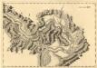
Maps of Zabari Municipality

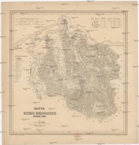
Karta okružija Požarevačkog kiježestva Serbije
1 : 190000 Požarevac (Srbsko) Medoviđ, A. Rerichč, P.
Petrovac.; Spezialkarte der osterreichisch-ungarischen Monarchie.
from Spezialkarte der osterreichisch-ungarischen Monarchie. Austro-Hungarian Monarchy. Militärgeographisches Institut.,
Alt-Moldova.
from Spezialkarte der osterreichisch-ungarischen Monarchie.
Alt-Moldova
1 : 75000 Moldova-Nouă Gemeindegebiet Geripp: Offic. W. Ahl. Terrain: Oberlt. K. Schwarz
Lambert-Cholesky sheet 1946 (Coronini)
1 : 20000 Romanian military topographic map sheet under Lambert-Cholensky projection Direcția Topografică Militară geo-spatial.org Direcția Topografică Militară
Karta okružija Požarevačkog knjažestva Serbije
Požarevac (Srbsko) Medoviđ, A. Rerichč, P.
Nördliches Moravatal (Serbien)
Serbien, Moravatal
Palanka.; Spezialkarte der osterreichisch-ungarischen Monarchie.
from Spezialkarte der osterreichisch-ungarischen Monarchie. Austro-Hungarian Monarchy. Militärgeographisches Institut.,
Temes-Kubin
1 : 75000 Kovin Geripp: Oberjäger Rogozinski u. Contract-Arbeiter L. Schubert. Terrain: Oberlt. Klenowski u. Offic. Leitner
Temes-Kubin.; Spezialkarte der osterreichisch-ungarischen Monarchie.
from Spezialkarte der osterreichisch-ungarischen Monarchie. Austro-Hungarian Monarchy. Militärgeographisches Institut.,
Zagubica.; Spezialkarte der osterreichisch-ungarischen Monarchie.
from Spezialkarte der osterreichisch-ungarischen Monarchie. Austro-Hungarian Monarchy. Militärgeographisches Institut.,
Nordost-Serbien
Serbien
Bulgaria
Mollova mapová sbírka Hoffmann, Johannes Hoffmann, Johann
Die Shiffahrt auf der Donau von der Spitze Syrmiens bis in das Schwarze Meer
Bělehrad (Srbsko)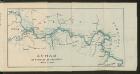
Dunav od Beograda do Radujevca
1 : 750000 Belgrad, Radujevac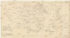
Carte militaire et itineraire du royaume de Servie
1 : 640000 Srbsko Löschenkohl, Johann Hieronymus
Eigendliche Vorstellung des zwischen denen Key; und ein Corpo von 30000 Turken unter anführung des Seras Kiers von Widdin den 29. Jull. 1739 in dem Banat von Temeswar unweit Banzova glüklich vorbey gegangenen treffen nebst beygefugter Karten des aldortigen Terrain auf 14 Meilen
Mollova mapová sbírka
Théatre de la Guerre dans le Bannat de Temeswar
1 : 510000 Mollova mapová sbírka Briffaut, Etienne Briffaut, Etienne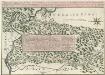
Theatre de la Guerre sur la Timock 1737
Mollova mapová sbírka Briffaut, Etienne Briffaut, Stephan
Kragujevac
1 : 200000 Kragujevac (Srbsko) Kartografska radionica
Kragujevac
1 : 200000 Kragujevac (Srbsko) Kartografska radionica
Vermehrte und Verbesserte Landkarten des Königreichs Ungarn :
1 : 500000 Mollova mapová sbírka Stier, Martin Böner, Johann-Alexander Endter, Martin
Serbisch-rumänische Grenze
1 : 600000 Banat Grenze
Jižní část krašovské stolice s českými osadami
Banat Tschechen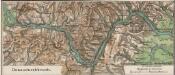
Donaudurchbruch
1 : 500000 Eisernes Tor, Donau (Region)
Berzaszka und O-Ogradina.
from Spezialkarte der osterreichisch-ungarischen Monarchie.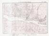
Lambert-Cholesky sheet 2046 (Liubcova)
1 : 20000 Romanian military topographic map sheet under Lambert-Cholensky projection Direcția Topografică Militară geo-spatial.org Direcția Topografică Militară
Kragujevac.; Spezialkarte der osterreichisch-ungarischen Monarchie.
from Spezialkarte der osterreichisch-ungarischen Monarchie. Austro-Hungarian Monarchy. Militärgeographisches Institut.,
Carte der Zugrundrichtung der türk. Tscheiken des Lagers bei Borecz den 16. Sept. 1789
1 Karte : Kupferdruck ; 12 x 17 cm [Trattner]