Maps of Alaska
Počtovaja karta rossijskoj imperii
1 : 7100000 Sibiř (Rusko) Frolov
Partie orientale de l'Empire de Russie en Asie / dressée, d'après les cartes de l'Atlas Russien pa
1 : 8500000 1 Karte auf 2 Blatt : Kupferdruck ; 46 x 58 cm Robert de Vaugondy, Didier [Verlag nicht ermittelbar]
U.S.S.R. - Eastern Siberia and Far East. Pergamon World Atlas.
1 : 10000000 Polish Army Topography Service
Asiat. Russland.
1 : 33000000 Radefeld, Carl Christian Franz, 1788-1874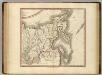
Russian Empire east.
1 : 9400000 Cary, John, ca. 1754-1835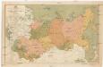
Map of the asiatic part of USSR
1 : 12000000 Rusko východní Mezhdunarodaya Kniga
Russie orientale.
1 : 13000000 Bonne, Rigobert, 1727-1794
Russia In Asia.
1 : 30000000 Finley, Anthony
Carte Generale de la Russie d'Asie ou Siberie.
1 : 14300000 Vivien de St Martin, L.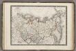
Siberie ou Russie d'Asie.
1 : 18000000 Monin, C.V.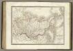
Siberie, Russie d'Asie.
1 : 13500000 Lapie, M. (Pierre), 1779-1850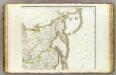
L'Asie 2.
1 : 9500000 Brue, Adrien Hubert, 1786-1832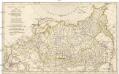
Partie de l'empire de Russie comprise en Asie
1 : 6070000 Irkutsk (Rusko) Anville, Jean-Baptiste Bourguinon d' Delahaye, Guillaume-Nicolas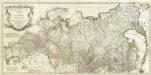
Asie 3.
1 : 7150000 Anville, Jean Baptiste Bourguignon d, 1697-1782
Karta znergoresursov i zlektrifikacii aziatskoj časti Sojuza SSR
1 : 20000000 Rusko východní Kuzbass, A.
Russia In Asia.
1 : 23760000 Tallis, J. & F.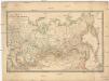
Karta azijatskoj Rossii i turkestanskago kraja
1 : 10500000 Beringův průliv Izdanije Kartografičeskago Zavedenija A. Il'jina
Nieuwe Kaart van Tartarie / door Isaak Tirion. J. Keyser get. en gesn
1 : 1660000 1 Karte : Kupferdruck ; 27 x 34 cm Keyser, Jacob Tirion
Regiones Sub Polo Arctico. [Karte], in: Novus Atlas, das ist, Weltbeschreibung, Bd. 1, S. 19.
1 Karte aus Atlas Blaeu, Joan Blaeu, Willem Janszoon
Asie Boreale.
1 : 16500000 Garnier, F. A., 1803-1863
Composite: Russie.
1 : 13000000 Bonne, Rigobert, 1727-1794
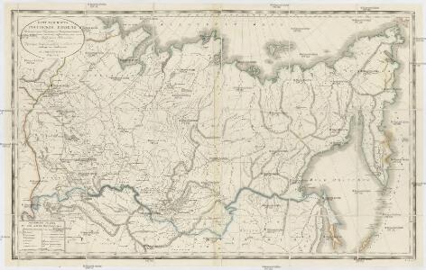
Carte géographique contenant le royaume de Siberie divisée en trois départemens, savoir: Tobolskago, Ienisseiskago, Irkvtskago
1 Karte auf 2 Blättern : Kupferdruck ; 48 x 104 cm Lotter; Lotter Lotter
Carte géographique contenant le royaume de Siberie divisée en trois départemens, savoir: Tobolska
1 : 7000000 1 Karte auf 2 Blättern : Kupferdruck ; 48 x 104 cm Lotter, Tobias Conrad [Lotter]
Carte de l'Empire de Russie en Europe et en Asie / par M. Bonne, Ingénieur-Hydrographe de la Marine
1 : 26000000 1 Karte : Kupferdruck ; 21 x 32 cm Bonne, Rigobert [Verlag nicht ermittelbar]
Northern Asia - Asiatic Russia.
1 : 16600000 Sharpe, J.
Nuova Carta della Tartaria / fat[t]a in Amsterdam per Isak Tirion
1 : 18000000 1 Karte : Kupferdruck ; 27 x 33 cm Tirion, Isaak Isak Tirion [erschienen: Giambattista Albrizzi]
(Russia in Asia 2)
1 : 10454400 Letts, Son & Co.
Russian empire / Neele sculp.
1 : 22000000 1 Karte : Kupferdruck ; 21 x 27 cm Neele, Samuel John S. & G. Neele
Tartaria, sive Magni Chami imperium / ex credendis amplissimi viri D.ni Nicolai Witsen, cos: amst: a
1 : 10000000 1 Karte : Kupferdruck ; 46 x 58 cm Allard, Carel [Allard]