Maps of okres Frýdek-Místek

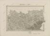
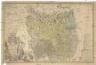
Der Teschner Kreis
1 : 200000 Český Těšín-oblast (Česko) Schenkl, Conrad Philipp Winiker, Karel Carl Winiker
Der Teschner Kreis
1 : 200000 Český Těšín-oblast (Česko) Schenkl, Conrad Philipp Carl Winiker
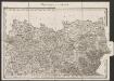
[Die Markgraftschaft Mähren]
1 : 200000 Český Těšín-oblast (Česko) Schenkl, Conrad Philipp Carl Winiker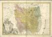
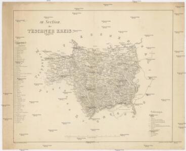
Principatvs Sielasiae Teschinensis nova et accurata
1 : 116000 Mollova mapová sbírka Wieland, Johann Wolfgang Homann, Johann Baptista - dědici
Sbírka map a diagramů použitých na mírových konferencích v Paříži v letech 1919 - 1920
Principatvs Silesiae Teschinensis nova et accurata delineatio
1 : 130000 Těšínské Slezsko Wieland, Johann Wolfgang ab Homannianis Heredibus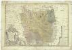
Principatvs Silesiae Teschinensis nova et accurata delineatio distincte insimul exhibens
1 : 125000 Těšínské Slezsko Wieland, Johann Wolfgang Homannianos Heredes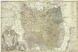
Principatvs Silesiae Teschinensis
1 : 115000 Těšínské Slezsko Homannianis Heredibus
Sbírka map a diagramů použitých na mírových konferencích v Paříži v letech 1919 - 1920

Utilisation de chemins de fer pour le transport des marchandises vers Tchécoslovaquie Pologne
Polsko Čs. voj. zeměpis. ústav
Teschen, Mistek und Jablunkau.
from Spezialkarte der osterreichisch-ungarischen Monarchie.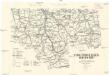
Turistická mapa Bezkyd [sic]
1 : 150000 Pobeskydí (Česko) Riegler, Karel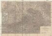
Special-Karte der Mährisch-Schlesischen Beskiden
1 : 75000 Moravskoslezské Beskydy (Česko a Slovensko) Hadaszczok, Johann R. Papauschek
Bezkydy
1 : 100000 Moravskoslezské Beskydy (Česko a Slovensko) Wagner, Josef Pohorská jednota Radhošť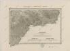
II. vojenské mapování 11
1 : 144000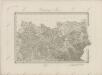
II. vojenské mapování 6
1 : 144000
Frýdek
1 : 75000 Frýdek-Místek (Česko : oblast) Zeměpisný ústav ministerstva vnitra
Frýdek
1 : 75000 Frýdek-Místek (Česko : oblast) Vojenský zeměpisný ústav
Frýdek
1 : 75000 Frýdek-Místek-oblast (Česko) Vojenský zeměpisný ústav
Český Těšín a Frýdek
1 : 75000 Frýdek-Místek (Česko : oblast) Vojenský zeměpisný ústav
Teschen, Mistek und Jablunkau
1 : 75000 Frýdek-Místek (Česko : oblast) Jersche K. u. k. militär-geographisches Institut
Místek - Frýdek a okolí

Český Těšín a Frýdek
1 : 75000 Frýdek-Místek (Česko : oblast) Vojenský zeměpisný ústav
Místek-Frýdek a okolí
1 : 75000 Frýdek-Místek (Česko : oblast) Vojenský zeměpisný ústav
III. vojenské mapování 4161
1 : 75000
III. vojenské mapování 4161
1 : 75000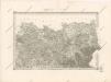
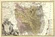
Special - Karte der Markgrafschaft Maehren und des Herzogthums Schlesien
Umgebungen von Teschen
1 : 144000 K.K. Militärisches Geographisches Institut