Maps of Stredočeský

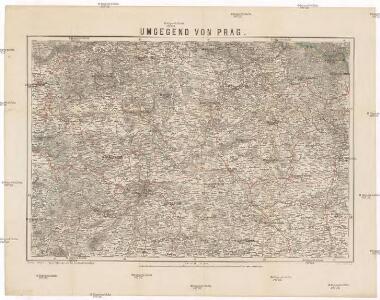
Umgegend von Prag
1 : 325000 Praha-oblast (Česko) Engelhardt, Friedrich Bernhard Simon Schropp'sche Hof-Landkartenhandlung
Umgegend von Prag
1 : 325000 Praha-oblast (Česko) Engelhardt, Friedrich Bernhard Simon Schropp'sche Hof-Landkartenhandlung
Umgegend von Prag

[Karte vom Preussische Staate und den angränzenden Ländern, östlich von Berlin]
1 : 280000 Čechy severní (Česko) Engelhardt, F. B. Bembé Simon Schropp und Comp.
Naleziště nejstarší keramiky v Čechách jako stopa prvního osídlení
Čechy (Česko)
Středočeský kraj

[Severní Čechy]
Čechy severní (Česko)
Středočeský kraj

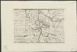
Uibersichtskarte für die Turnau-Kraluper Eisenbahn
1 : 423000 Kralupy nad Vltavou-oblast (Česko)
Prag mit den Umgebungen
1 : 570000 Praha (Česko) Kettner, Carl C. W. Enders
Prag mit den Umgebungen
1 : 570000 Praha-oblast (Česko) Enders, C. W. C.W. Enders
Kraj pražský

Carte Topographique D ́Allemagne

Uebersichts-Karte des Eisenbahnzuges der Süd-Norddeutschen Verbindungsbahn von Pardubitz nach Reichenberg
Liberec (Česko : oblast)
[Železniční tratě severovýchodních Čech]
Polsko
Charte ehemaliger Burgen & Vesten im Rakonitzer, Kauřimer und Berauner Kreise Böhmens
1 : 550000 Beroun-oblast (Česko) Heber, Franz Alexander C. W. Medau
Charte ehemaliger Burgen & Vesten im Rakonitzer, Kauřimer und Berauner Kreise Böhmens
Rakovník-oblast (Česko) Heber, Franz Alexander Netopil, Fr. C.W. Medau
[Střední Čechy]
1 : 220000 Čechy střední (Česko) Wagner, Jan Eduard F. Kytka
Střední Čechy
1 : 220000 Čechy střední (Česko) Wagner, Jan Eduard F. Kytka
Příloha kalendáře "Národních listů" na rok 1909
1 : 200000 Praha-oblast (Česko) Kotyška, Václav Hanf, Norbert Julius Grérg
Nová mapa království Českého
1 : 200000 Čechy střední (Česko) Kotyška, Václav Hanf, Norbert Bursík & Kohout
[Nová mapa království Českého
1 : 200000 Čechy střední (Česko) Kotyška, Václav Hanf, Norbert Bursík & Kohout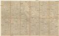
Mapa Království českého
1 : 200000 Čechy střední (Česko) Kotyška, Václav Hanf, Norbert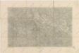
Nová mapa království Českého

Střední Čechy
[Map of the battle near Prague, 1757]
[S.l.] : [s.n.]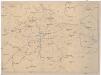
[Isochronická mapa okolí Prahy]
Praha (Česko : oblast) Pohl, J.
Isochronická a isochorická mapa okolí pražského
1 : 400000 Praha (Česko : oblast) Pohl, J.
Special-Karte des Prager Kreis resp. politi. Karolinenthaler Verwaltungsbezirkes nach der politischen Eintheilung Böhmens v. Jahre 1868
1 : 204000 Karlín (Praha, Česko) Schmidt, Eduard