Maps of Tiszasziget
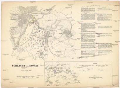
Schlacht von Szöreg am 5ten August 1849
1 : 60600 Szeged (Maďarsko)
Torokkanizsa.
from Spezialkarte der osterreichisch-ungarischen Monarchie.
Kistelek und Szeged.
from Spezialkarte der osterreichisch-ungarischen Monarchie.
Törökkanizsa
1 : 75000 Novi Kneževac, Wojwodina
Zone 20, Kol. XXII, Umgebung von Szeged und Kistelek, uit: [Geologische Specialkarte der im Reichsrathe vertretenen Königreiche und Länder der österreichisch-ungarischen Monarchie] / geologische Aufnahmen der königl. ung. Geologischen Anstalt
1 : 75000 Annotatie: Verantwoordelijkheidsvermelding in 1909 veranderd in: Königliche Ungarische Geologische Reichsanstalt; Sommige bladen in het Frans; Annotatie geografische gegevens: Coördinaten gebaseerd op nulmeridiaan van Ferro (Hierro) Königliche Ungarische Geologische Reichsanstalt; Königliche Ungarische Geologische Anstalt Budapest : [Königliche Ungarische Geologische Anstalt]
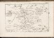
Kistelek
1 : 75000 Komitat Csongrád
Zone 20, Col. XXII, Environs de la ville de Szeged, uit: [Geologische Specialkarte der im Reichsrathe vertretenen Königreiche und Länder der österreichisch-ungarischen Monarchie] / geologische Aufnahmen der königl. ung. Geologischen Anstalt
1 : 75000 Annotatie: Verantwoordelijkheidsvermelding in 1909 veranderd in: Königliche Ungarische Geologische Reichsanstalt; Sommige bladen in het Frans; Annotatie geografische gegevens: Coördinaten gebaseerd op nulmeridiaan van Ferro (Hierro) Königliche Ungarische Geologische Reichsanstalt; Königliche Ungarische Geologische Anstalt Budapest : [Königliche Ungarische Geologische Anstalt]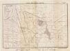
Lambert-Cholesky sheet 1263 (Beba Veche)
1 : 20000 Romanian military topographic map sheet under Lambert-Cholensky projection Direcția Topografică Militară geo-spatial.org Direcția Topografică Militară
Segedin
1 : 200000 Szeged (Maďarsko) Kartografska radionica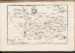
C. Csanád
Ungarn Csanád (Megye)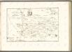
C. Csongrád
Ungarn Komitat Csongrád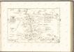

Bács-Bodrog vármegye térképe
1 : 450000 Kogutowicz, Manó Magyar Földrajzi Intézet
C. Torontal
Ungarn Serbien Komitat Torontal

Siedlungsgebiet der Deutschen nach dem Nachbarschaftsindex für das Komitat Bács-Kiskun 1980
Bács-Kiskun Deutsche, Siedlung Bottlik, Zsolt
Serben in der Südlichen Tiefebene 1980
Großes Ungarisches Tiefland (Süd) Serben, Siedlung Bottlik, Zsolt
Kroaten im Komitat Bács-Kiskun 1980
Bács-Kiskun Kroaten, Siedlung Bottlik, Zsolt
Siedlungsgebiet der Deutschen nach dem Nachbarschaftsindex für das Komitat Bács-Kiskun 1880
Bács-Kiskun Deutsche, Siedlung Bottlik, Zsolt
Kroaten im Komitat Bács-Kiskun 1880
Bács-Kiskun Kroaten, Siedlung Bottlik, Zsolt
Generalkarte von Zentraleuropa

Siedlungsgebiet der Deutschen nach dem Nachbarschaftsindex für das Komitat Bács-Kiskun 1941
Bács-Kiskun Deutsche, Siedlung Bottlik, Zsolt
Serben in der Südlichen Tiefebene 1941
Großes Ungarisches Tiefland (Süd) Serben, Siedlung Bottlik, Zsolt
A horvátok aránya és száma Bács-Kiskun megyében 1880-ban
Bács-Kiskun Kroaten, Siedlung Bottlik, Zsolt
Kroaten im Komitat Bács-Kiskun 1941
Bács-Kiskun Kroaten, Siedlung Bottlik, Zsolt
A horvátok aránya és száma Bács-Kiskun megyében 1941-ben
Bács-Kiskun Kroaten, Siedlung Bottlik, Zsolt
A szerbek aránya és száma a Dél-Alföldön 1880-ban
Großes Ungarisches Tiefland (Süd) Serben, Siedlung Bottlik, Zsolt
A horvátok aránya és száma Bács-Kiskun megyében 1980-ban
Bács-Kiskun Kroaten, Siedlung Bottlik, Zsolt