Maps of Turkey
Carte de la partie septentrionale de l'Empire Otoman
1 : 1420000 osmanská říše Rizzi Zannoni, Giovanni Antonio Arrivet
Carte de La Russie D'Europe.
1 : 6700000 Vivien de St Martin, L.
Küstenländer des Schwarzen Meeres
1 : 8880000 Černé moře-oblast Renner Kleinknecht
KÜSTENLÄNDER des SCHWARZEN MEERES
1 : 8880000 Černé moře (oblast) Renner Kleinknecht Bibliographisches Institut
Süd-Russland und Kaukasien
1 : 3500000 Kavkaz-oblast J. Schlacher
Grece. Caucase et Crimee.
1 : 2000000 Jouvet et Cie.
The Black Sea and surronding countries”
1 mapa. Datat entre 1840 i 1849. Hughes, William
Reliefkarte des Schwarzen Meeres, einschließlich der Dardanellen und der Kaukasus
Dardanely (Turecko : průliv) Franckh'sche Verlagshandlung
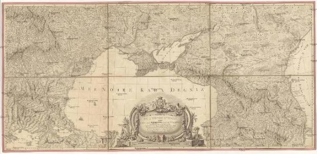
Carte des environs de la Mer-Noire où se trouvent l'Ukrayne, la Petite Tartarie, la Circassie, la G
1 : 2500000 1 Karte auf 2 Blatt : Kupferdruck ; 50 x 92 cm Robert de Vaugondy, Didier chez Delamarche rue du Foin près celle de la Harpe au collége de M.e Gervais

Karta teatra vojny v Turcii v 1828 i 1829 godach
Balkánský poloostrov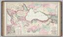
Vicinity of the Black Sea.
1 : 3787000 Gray, Ormando Willis
Nova et accurata Tartariae europaeae seu minoris et in specie Crimeae delineatio geographica / manu
1 : 2900000 1 Karte : Kupferdruck ; 48 x 56 cm [Matthäus Seutter]
[Ost-Europa in 6 Blättern, Blatt 6]
Handatlas über alle Theile der Erde und über das Weltgebäude Stieler, Adolf Justus Perthes
[Ost-Europa in 6 Blättern, enthaltend: Norwegen, Schweden, Russland, Kaukasien und die Türkei, Blatt 6]
Hand-Atlas über alle Theile der Erde und über das Weltgebäude Stieler, Adolf Justus Perthes
[Ost-Europa, Blatt 6]
Adolf Stieler's Handatlas über alle Theile der Erde und über das Weltgebäude Stieler, Adolf Justus Perthes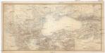
KARTE der europäischen Türkei und des Gebietes des schwarzen Meeres
1 : 3500000 Turecko Schneider, Theodor Kaiser, Josef Franz Jos. Fanz Kaiser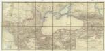
Karte der europäischen Türkei und des Gebietes des schwarzen Meeres
1 : 3500000 Turecko Schneider, Theodor Kaiser, Josef Franz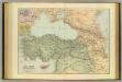
Asia Minor, Caucasus, Black Sea.
1 : 3220177 Stanford, Edward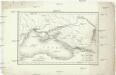
Carte du pourtour septentrional de la Mer Noire
1 : 5000000 Černé moře-oblast Lapie, Pierre Arnoul Firmin Didot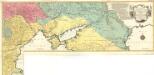
Carte Geographique representant le Théatre de la Guerre entre les Russes les Turcs, et les Polonois Confédérés
1 : 1600000 Mollova mapová sbírka Lotter, Tobias Conrad Lotter, Georg F. Lotter, Tobias Conrad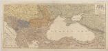
[Kaart], uit: Oorlogskaart van Turkije, Zuid-Rusland en grenslanden
1 : 2250000 Annotatie geografische gegevens: Legenda Amsterdam : Seyffardt's Boekhandel
Pontus Euxinus et quae adjacent
1 : 4440000 Bospor (Turecko : průliv) Spruner, Karl von Justus Perthes
Nova et accurata Tartariae Europaeae seu minoris et in specie Crimae delineatio geographica
1 : 3000000 Krym (Ukrajina) Seutter, Matthäus Probst, Johann Michael Ioh. Michael Probst
Nova et accurata Tartariae Europae seu minoris et in specie Crimae delineatio geographica
1 : 3000000 Černé moře-oblast Seutter, Matthäus Probst, Johann Michael Ioh. Michael Probst
Nova et accurata Tartariae Europae seu minoris et in specie Crimae delineatio geographica
1 : 3000000 Krym (Ukrajina) Seutter, Matthäus Probst, Johann Michael bey Ioh. Michael Probst
Nova et accurata Tartariae Europaeae seu minoris et in specie Crimeae delineatio geographica
1 : 2900000 Krym (Ukrajina) Seutter, Matthäus sumtibus Matthaei Seuterri
Nova et accurata Tartariae Europaeae seu minoris et in specie Crimeae delineatio geographica
1 : 2900000 Krym (Ukrajina) Seutter, Matthäus sumtibus Matthaei Seuterri
Nova et accurata Tartariae Europaeae seu minoris et in specie Crimeae delineatio geographica
Černé moře-oblast Seutter, Matthäus Netopil, Fr. sumtibus Matthaei Seuterri