Maps of Královehradecký
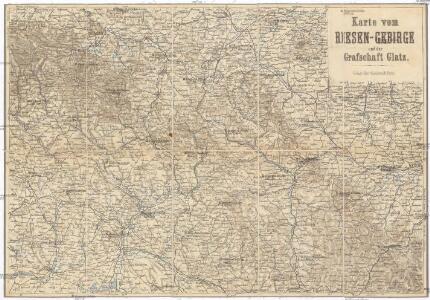
Karte vom Riesen-Gebirge und Grafschaft Glatz
1 : 250000 Kladsko-oblast (Polsko) Albert Goldschmidt
Königgrätz (Schweidnitz)
1 : 300000 Čechy východní (Česko) Hübl Frokr
Reisekarte für die Umgebung von Adersbach und Wekelsdorf
1 : 853000 Adršpach (Česko : oblast) Carl André
Übersichts Charte de Winterquartiere der beiden Armeen an der böhmisch-schlesischen Grenze im Winter 1760/61
1 : 600000
Operations Charte für die ersten Ereignisse des Feldzuges von 1761 in Schlesien
1 : 400000
Karte der Umgegend von Gräfenberg
1 : 110000 Lázně Jeseník (Česko) Hennings, Th. Th. Hennings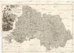
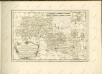
PROVINCIA REGINOHRADECENSIS et COMITATUS GLACENSIS
Hradec Králové-oblast (Česko) Bernardi, Augustin Augustin Bernardi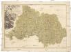
Provincia Reginohradecensis et comitatus Glacensis
Kladsko-oblast (Polsko) Müller, Johann Christoph Winkler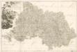
M. Provincia Reginohradecensis et Comitatus Glacensis

Sbírka map a diagramů použitých na mírových konferencích v Paříži v letech 1919 - 1920
Bidschower und Konigrätzer Kreis...

A. Bidschover und B. Königingratzer Kreis samt der Grafschaft Glatz
1 : 200000 Hradec Králové-oblast (Česko) Peter Franza
A. Bidschover und B. Königingratzer Kreis samt der Grafschaft Glatz
1 : 200000 Hradec Králové-oblast (Česko) Peter Franza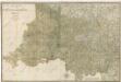
Bidschower und Konigrätzer Kreis...

Regni Bohemiae Circuli Biczoviensis et Regionhradecensis...

Charte vom Königgrätzer Kreise ...

Kriegsschauplatz Nordböhmen 1866
1 : 200000 Čechy severní (Česko) K. u. k. militär-geographisches Institut
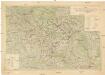
Atlas Bohemiae

Region Královehradecký
1 : 350000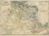
Charte ehemalinger Burgen u. Festen im Bidžower u Koeniggrätzer Kreise Böhmens

Kraj Hradecký
Území Východočeské elektrárny akc. spol. Hradec Králové II
1 : 200000 Čechy východní (Česko) Vojenský zeměpisný ústav
Region Královehradecký
1 : 350000
Kraj hradecký
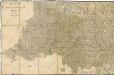
Provincia Reginohradecensis et Comitatus Glacensis
1 : 233000 Mollova mapová sbírka Erber, Bernardinus Winkler, Johann Christoph Kurzböck, Josef von

[A. Bidschover und B. Königingratzer Kreis samt der Grafschaft Glatz]
1 : 175000 Hradec Králové-oblast (Česko) Franza, Petr Peter franza [sic]
A. Bidschover und B. Königingratzer Kreis samt der Grafschaft Glatz
1 : 175000 Hradec Králové-oblast (Česko)
Special-Karte des Königgrätzer Kreis - resp. politischen Verwaltungsbezirkes in Boehmen
1 : 230000 Hradec Králové-oblast (Česko) Schmidt, Eduard Wend. Morauer
Special-Karte des Königgrätzer Kreis - resp. politischen Verwaltungsbezirkes in Boehmen
1 : 231000 Hradec Králové-oblast (Česko) Schmidt, Eduard Wend. Morauer