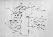
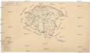
Maps of Hungary
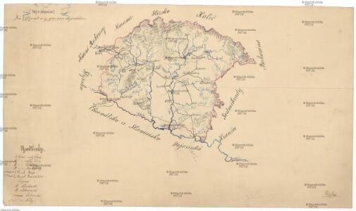
Řeky a železnice
Maďarsko Břečka, J.
Hvngariae regnum
1 : 1200000 Maďarsko
Regnum Hungariae in Omnes suos Comitatus
1 : 1100000 Mollova mapová sbírka Visscher, Nicolaes Jansz. Visscher, Nicolaus
Hvngaria Regnvm
1 : 1100000 Mollova mapová sbírka Blaeu, Willem Janszoon Blaeu, Iohann
Hvngaria Regnvm
1 : 1100000 Mollova mapová sbírka Blaeu, Willem Janszoon Blaeu, Iohann
Hvngaria
1 Karte : Kupferdruck ; 35 x 43 cm Mercator; Hondius Henricus Hondius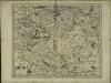
Hvngaria
1 Karte : Kupferdruck ; 35 x 43 cm Mercator s.n.
Hungaria Regnum
1 : 3000000 Mollova mapová sbírka Blaeu, Willem Janszoon Blaeu, Iohann
Hungaria Regnum. [Karte], in: Novus Atlas, das ist, Weltbeschreibung, Bd. 1, S. 196.
1 Karte aus Atlas Blaeu, Joan Blaeu, Willem Janszoon
Charte des Koenigreichs Ungarn mit Einschluss der Koenigreiche Croatien u. Slavonien
1 : 2250000 Chorvatsko Bendowsky, Thomas Liechtenstern, Joseph Marx von

Novissima et accuratissima totius Hungariae tabula
1 : 2300000 Evropa jihovýchodní Duval, Pierre Danckerts, Justus by Justus Danckers
Novissima et accuratissima totius Hungariae tabula
1 : 2300000 Maďarsko Duval, Pierre P. Du Val
Tabvla Nova Inclyti Hvngariae
1 : 2000000 Mollova mapová sbírka Mikoviny, Sámuel Landerer z Füskutu, Ján Michal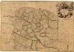
Hungary
1 : 860000 Mollova mapová sbírka Senex, John Senex, John
Hungaria Regnum. [Karte], in: Le théâtre du monde, ou, Nouvel atlas contenant les chartes et descriptions de tous les païs de la terre, Bd. 1, S. 227.
1 Karte aus Atlas Blaeu, Willem Janszoon und Blaeu, Joan Blaeu, Willem Janszoon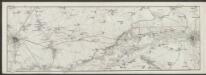
Hungaria. [Karte], in: Gerardi Mercatoris Atlas, sive, Cosmographicae meditationes de fabrica mundi et fabricati figura, S. 412.
1 Karte aus Atlas Mercator, Gerhard Montanus, Petrus
Le Royaume d'Hongrie - Hungaria
Ungarn, Slowakei Briet, Philippe
Karten zur ungarisch-türkischen Grenzlinie : Karte 2 Grenzlinie 1606-1657
Ungarn, Osmanisches Reich, Grenze
Regnum Hungaria in Omnes suos Comitatus
Hungaria Regnum. [Karte], in: Theatrum orbis terrarum, sive, Atlas novus, Bd. 1, S. 105.
1 Karte aus Atlas Blaeu, Joan Blaeu, Willem Janszoon
HVNGARIA | REGNVM
Amsterdami | Apud Guiljelmum et Johannem Blaeu

Regnum Hungariae
1 : 2200000 Mollova mapová sbírka Bruggen, Johann van der Brugge, Johannes van der
Regnum Hungariae
1 : 2200000 Mollova mapová sbírka Pfeffel, Johann Andreas Pfeffel, Johann Andreas
Novissima et Accuratissima Hungariae Tabula In suas partes divisa J.U.M.
1 : 1700000 Mollova mapová sbírka
Karte der Königreiche Ungarn, Croatien, Slavonien und den Militärgränzen
1 : 850000 Chorvatsko Raffelsperger, Franz im Typographischen Landkarten-Verlage
Hvngariae descriptio
1 : 3400000 Uhersko Lazius, Wolfgang Ortelius, Abraham A. Ortelius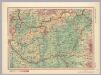
Hungary. Pergamon World Atlas.
1 : 1500000 Polish Army Topography Service