Maps of Weißkirchen in Steiermark

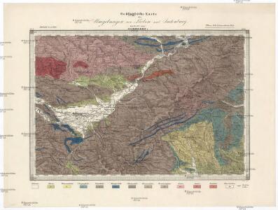
Geologische Karte der Umgebungen von Leoben und Judenburg
1 : 144000 Morlot, Adolph von David
Koflach und Voitsberg.
from Spezialkarte der osterreichisch-ungarischen Monarchie.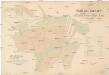
Drainage-Anlagen
Dokonál, Vincenz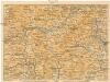
[Graz und Umgebung]
1 : 500000 Štýrský Hradec (Rakousko : oblast) Wagner & Debes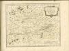
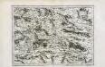
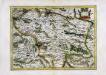
Stÿriae Ducatus Fertilisimi Nova Geographica Descriptio
1 : 200000 Mollova mapová sbírka Vischer, Georg Matthaeus Trost, Andreas
Leoben und Bruck a.d. Mur.
from Spezialkarte der osterreichisch-ungarischen Monarchie.
Judenburg.
from Spezialkarte der osterreichisch-ungarischen Monarchie.
St. Johann am Tauern.
from Spezialkarte der osterreichisch-ungarischen Monarchie.
Karte der Umgebung Graz
1 : 150000 Štýrský Hradec (Rakousko : oblast) Reis, Johann Georg Rothaug, Johann Georg Kartogr. Anst. von G. Freytag & Berndt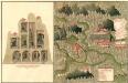
Plan des C. und 5. Bergwerg St. Ulrich an Unter Frauen Bach in Hutthal, in Unter Carnt;
Mollova mapová sbírka Geyer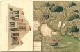
Plan des in Ober Carnten Gold Bergwergs Velach
Mollova mapová sbírka Geyer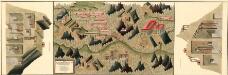
Plan des silber und blei Bergwergs Drul und Mitterdorf, in ober Crain Freiherrn von Rastern
Mollova mapová sbírka Geyer
Der noerdliche Theil von Untersteyermark oder der Graetzer Kreis
1 : 250000 Dolní Rakousko (Rakousko) Kindermann, Joseph Karl Junker, Christoph Franz Xaver Miller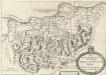
Des Ertzhertzigtumbs Viertl ob Wiener wald. Dis Viertl hat weid und Vich Zucht Auch vil weins und traides frucht
Mollova mapová sbírka Vischer, Georg Matthaeus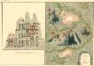
Plan des Bergwergs Nabloch und Hirn
Mollova mapová sbírka Geyer
Generalkarte von Zentraleuropa
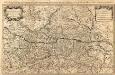
Partie du Cercle d'Austriche Scavoir l'Archiduché d'Austriche Divisé en Haute et Basse
1 : 510000 Mollova mapová sbírka Sanson, Guillaume Jaillot, Alexis Hubert
Das in dem Ertzhertzogtumb Vnter Osterreich.
1 : 250000 Mollova mapová sbírka Vischer, Georg Matthaeus Hoffmann, Jakob
Das in dem Ertzhertzogtumb Vnter Osterreich.
1 : 250000 Mollova mapová sbírka Vischer, Georg Matthaeus Hoffmann, Jakob
General-Karte des Herzogthums Steyermark
1 : 288000 Oltenie (Rumunsko) Schönfelder, E. von C. J. Wawra Kunst und Landkartenhandlung
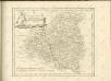
Der westliche Theil von Obersteyermark oder der Judenburger Kreis
1 : 250000 Horní Rakousko (Rakousko) Kindermann, Joseph Karl Junker, Christoph Franz Xaver Miller

Vermehrte und Verbesserte Landkarten des Königreichs Ungarn :
1 : 500000 Mollova mapová sbírka Stier, Martin Böner, Johann-Alexander Endter, Martin
Kronland Steyermark
1 : 600000 Štýrsko (Rakousko) C. Flemming
Charte von Innerösterreich oder den vereinigten Herzogthümern Steyermark und Kaernten
1 : 725000 Korutansko (Rakousko) im Kunst und Industrie Comptoir
Stiria Steyrmarck. [Karte], in: Novus Atlas, das ist, Weltbeschreibung, Bd. 1, S. 213.
1 Karte aus Atlas Blaeu, Joan Blaeu, Willem Janszoon
Stiria
1 Karte : Kupferdruck ; 29 x 40 cm Mercator; Hondius Henricus Hondius