Maps of Slovakia
Neueste Karte von Galizien und Lodomerien nebs dem oesterreichischen neuen Antheil von Polen
1 : 1110000 Halič (Polsko a Ukrajina) Müller, Franz Artaria und Compagnie
Poland - South. Pergamon World Atlas.
1 : 1250000 Polish Army Topography Service
Blatt III, uit: Geologische Übersichts-Karte der Österreichisch-Ungarischen Monarchie / nach den Aufnahmen der K.K. Geologischen Reichsanstalt bearb. von Franz Ritter von Hauer ; gezeichn. von Eduard Jahn
1 : 576000 Annotatie geografische gegevens: Gebaseerd op veldwerk in de jaren 1850 tot 1865 Hauer, Franz Ritter von; Jahn, Eduard; Kaiserlich-Königliche Geologische Reichsanstalt, Wenen Wien : Beck
Geologická mapa Československé republiky

Internationale Weltkarte 1:1000 000
1 : 1000000 Krakov-oblast (Polsko) Generalstab des Heeres, Abteilung für Kriegskarten und Vermessungswesen
Československá socialistická republika

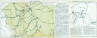
Zweite Offensive in Polen
1 : 4000000 Polen Feldzug, Weltkrieg <1914-1918>
Mapa průměrných ročních srážek republiky Československé za období 1876 - 1902

Erste Offensive in Polen
1 : 4000000 Polen Feldzug, Weltkrieg <1914-1918>
Théatre de la guerre actuelle, en Allemagne, en Pologne et en Turquie. n4, Cracovie, Warsovie et Breslau
1 : 900000 Chanlaire, Pierre Grégoire 1758-1817 Paris : chez l'auteur P. G. Chanlaire
Übrige Länder der ehemaligen Österreich-Ung. Monarchie
1 : 900000 Halič (Polsko a Ukrajina) Koch, Wilhelm Opitz, Carl Arnd
Strategische Übersichts-Karte des polnisch-litaurischen Armee-Bewegungraumes

Strassen- und Eisenbahnkarte des oesterreichischen Kaiserthumes
1 : 864000 Blatt 3 Schaller, G. K.K. Militärisch-Geografisches Institut, Karten-Evidenthaltungs-Abteilung
Republika Československá

Post und Eisenbahnkarte der Österreichisch-Ungarischen Monarchie

Národnostní mapa Republiky československé
Boháč, Antonín
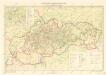
Galizien, Karpathen, Bukowina nebst anschließendem Ungarn, Russland u. s. w.
Ravenstein, Hans
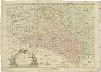
Ungarn. Comitate: Sohler, Trentschin, Thurocz, Arva, Liptau, Zips, Járos, Zemplin. Gallicien Kreise: Wadowicz, Bochnia, Szandecz, Jaszlo, Tarnow
Ungarn Verkehrsweg
[Polen]
1 : 800000 Polsko S. Hirzel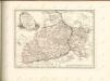
Nr. 13. Einfälle in Russisch-Polen
Polen Weltkrieg <1914-1918>
Nástěnná mapa Československé republiky
Machát, František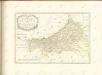
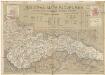
Šolcova mapa Slovenska
1 : 550000 Bratislava (Slovensko) Mareš, Vojtěch Šolc
Oesterreichisch-Ungarische Monarchie

Partie Septentrionale du Royme. de Hongrie tirée de divers Autheurs.
1 : 880000 Mollova mapová sbírka Sanson, Nicolas Sanson, Nicolas
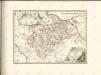
Partie Meridionalle du Rme. de Hongrie tirée de divers Autheurs
1 : 880000 Mollova mapová sbírka Sanson, Nicolas Mariette, Pierre
Wandkarte der Čechoslovakischen republik
Machát, František