Maps of Algeria

Carte d'une parte de l'Afrique
1 : 5860000 Afrika severozápadní Lapie, Pierre
Archipelagus atlanticus cum suis insulis Canariis, Hesperidibus et Azoribus
1 : 1
L'Afrique 1.
1 : 10000000 Brue, Adrien Hubert, 1786-1832
Partie occidentale de l'ancien continent depuis Lisbonne jusquà la Riviere de Sierra Leona, avec l'Isle Madere, les Isles Canaires, et celles du C. Verd
1 : 11500000
Spezial - karte von AfricaSektion West-Sahara (1)
1 : 4000000 1 full d'1 mapa en 10 fulls i estoig Hermann Habenicht; Justus Perthes
167-168. Africa, West. The World Atlas.
1 : 7500000 USSR (Union of Soviet Socialist Republics).
Africa NW.
1 : 10000000 Andree, Richard; Times (London, England)
Barbariae et Guineae maritimi à freto Gibraltar ad fluvium Gambiae cum Insulis Salfis Flandrisis et Canaricis
1 : 55000000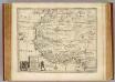
Negroland, adjacent countries.
1 : 10000000 Bowen, Emanuel
Afrika
1 : 7500000 Afrika severozápadní Domann, Bruno Justus Perthes
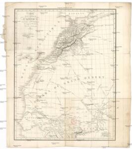
Sahara occidental et central
1 : 4000000 Afrika severozápadní Meunier, Alexandre imp. photo-métallo Millet
Nord-Ouest de l'Afrique.
1 : 12100000 Vivien de St Martin, L.
[135][138] Barbariae et Guineae Maritimi ..., uit: Atlas sive Descriptio terrarum orbis
Annotatie: Gedigitaliseerde versie. Amsterdam. Heiloo : Picturae (vervaardiger), 2015. tiff-bestand. Gedigitaliseerd: 07-01-2015; Origineel: Universiteitsbibliotheek Vrije Universiteit (XL.05127.-) ; Netherlands; Titelpagina ontbreekt Wit, Frederik de Amsterdam : Frederick de Wit
De cust van Barbaria, Gualata, Arguyn, en Geneheo, van Capo S. Vincente tot Capo Verde
1 : 6000000 Annotatie: Uit: De lichtende columne, ofte zeespiegel ... - Amsterdam : Anthony Jacobsz., 1644 [Amsterdam : Anthony Jabobsz.]
Pascaart, Waer in men claarlyck zien can, alle havens rivieren droogten, gelegen tußchen C.S. Vincent en C. Verde [...] [Karte], in: Het vijfde Deel Des Grooten Atlas : Vervatende De Water-Weereld, S. 182.
1 Karte aus Atlas Jansson, Jan Jansson, Jan
Pascaart, Waer in men claarlyck zien can, alle havens rivieren droogten, gelegen tußchen C.S. Vincent en C. Verde [...] [Karte], in: Novus atlas absolutissimus, Bd. 9, S. 239.
1 Karte aus Atlas Janssonius Offizin
A chart of the coast of Barbaria with the western, Canaria, & Cape de Verd, isles
1 : 6000000
Routes de caravanes du Sahara Occidental
1 : 8000000 Soller, Charles; Société de géographie commerciale de Paris Paris : Société de Géographie Commerciale de Paris
De cust van Barbaria, Gualata, Arguyn en Geneheo van Capo S. Vincent tot Capo Verde
1 Karte : Kupferdruck ; 42 x 53 cm Doncker bÿ Hendrick Doncker boecverkoper en graadboog-maker inde Nieuwe-brug-steech
Partie occidentale de l'Afrique
1 : 9600000 Afrika západní Bonne, Rigobert André
Karte von der westlichen kuste von Africa : von der strasse bey Gibraltar bis zu dem XI grade norderbreite ...wahrnehmungen entworfen
1 : 1
A chart of the western coast of Africa, from the Straits of Gibraltar to eleven degrees of north latitude, including the Canary & Cape Verd Islands
1 : 13000000
Spezial-Karte von Afrika
1 : 4000000 Blatt 1 Habenicht, Hermann Perthes
de Vlaamsche en Canarische Eylanden [Karte], in: De Nieuwe Groote Vermeerderde Zee-Atlas ofte Water-Werelt, S. 55.
1 Karte aus Atlas Doncker, Hendrick
Barbariæ et Guineæ maritimi à freto Gibraltar ad fluvium Gambiæ
1 Karte : Kupferdruck ; 47 x 56 cm Renard apud L. Renard
De cust van Barbaria, Gualata, Arguyn en Geneheo van Capo S Vincente tot Capo Verde
1 : 6000000
Paskaart van de cust van Portugal, Barbaria en Genehoa, beginnende van d'Barlenges tot aan C. Verde met al zyn Diepte en Drooghte dus ver Naaukeurig opgesocht door Ervaren Stuurlieden
1 : 5200000
CHARTE von NORD-AFRICA
1 : 10090000 Afrika severní
Charte von Nord-Africa
1 : 10090000 Afrika severní