Maps of Israel

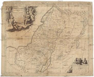
Iudaea, seu Terra Sancta quae hebraeorum sive Israelitarum in suas duodecim tribus divisa, secretis ab invicem regnis Iuda, et Israel expressis insuper sex ultimi temporis ejusdem terrae provinciis
1 : 600000 Izrael Sanson, Guillaume Schenk, Pieter Pierre Schenk
Iudaea, seu Terra Sancta quae Hebraeorum sive Israelitarum in suas duodecim tribus divisa, secretis ab invicem regnis Iuda, et Israel expressis insuper sex ultimi temporis ejusdem terrae provinciis
1 : 600000 Izrael Sanson, Guillaume Schenk, Pieter Pierre Schenk
Palestina nynější

Palästina
Volksschul-Atlas über alle Teile der Erde Lange, Henry Druck und Verlag von Georg Westermann
Palestina za doby soudců a králů

Tabula Moderna Terre Sancte [Karte], in: [Clavdii Ptholomei Cosmographi ...], S. 311.
1 Karte aus Atlas Nicolaus Germanus [und Ptolemaeus, Claudius]
Iudaea seu terra sancta
1 : 600000 Izrael Sanson, Guillaume Cordier, Louis apud Hubertum Iaillot
Douze Tribus d'Israel.
1 : 1030000 Bonne, Rigobert, 1727-1794
Palaestina
Schul-Atlas der alten Welt bei Justus Perthes
Palaestina.
1 : 1400000 Anville, Jean Baptiste Bourguignon d, 1697-1782
Tabula Moderna Terre Sancte [Karte], in: Claudii Ptolemei viri Alexandrini mathematice discipline philosophi doctissimi geographie opus [...], S. 272.
1 Karte aus Atlas Waldseemüller, Martin [und Ptolemaeus, Claudius] Übelin, Georg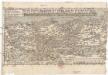
Nova totivs Palestinae sev Terrae Sanctae descriptio pagella vna ita vt bibliorvm volvminibvs congrvat
1 : 755000 Palestina Jenichen, Balthasar Ausfeld, Johann Carl
't Land Kanaan benevens Gilead verdeelt onder de XII stammen Israëls waar in de gelegendheid en uitgestrektheid van ieder erfdeel word aangewezen
1 : 700000 door W.A. Bachiene J. van Jagen mapp. sculpsit, et figur. apposit. sculpturam curavit ; J.C. Philips fecit. Uitgegeven te Gorinchem : by Nicolaas Goetzee
Iudaea seu Terra Sancta quae Hebraeorum sive Israelitarum in suas duodecim tribus divisa, secretis ab invicem regnis Iuda et Israel expressis insuper sex ultimi temporis ejusdem terrae provinciis
1 : 615000 Izrael Sanson, Guillaume Mortier, Pieter apud Petrum Mortier
Kaart van 't land Kanaan / naar de beste waarnemingen tot verstand van Num. XXI:14-31 ontworpen door R. Schutte ; J. van Jagen sculps. 1766
1 : 800000 Annotatie: Waarschijnlijk blad uit zakatlas Schutte, Rutger; Jagen, J. van Te Amsterdam : by J. Loveringh
Karte von Palästina
1 : 515000 Jeruzalém Velde, Charles William Meredith van de Justus Perthes
Royaume d'Herode.
1 : 2300000 Houze, Antoine Philippe
Palestine ou Terre Sainte.
1 : 610000 Lapie, M. (Pierre), 1779-1850
Karte des Heiligen Landes
1 : 310000 Izrael Möller, Arnold Wilhelm A.W. Möller

Typus Chorographicus, Celebrium Locorum In Regno Iudae Et Israhel. [Karte], in: Theatrum orbis terrarum, S. 438.
1 Karte aus Atlas Ortelius, Abraham Vrients, Jan Baptista
Karte von Palaestina
1 : 1030000 Jeruzalém Klöden, Karl Friedrich von Mare, Carl bei August Rücker
[Karte von Palästina]
1 : 500000 Palestina Leway, G.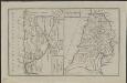
Schul-Atlas für die alte Erdbeschreibung : zur allgemeinen Schul-encyclopädie gehörig
J. H. Campe Zusammensetzung und Zeichnung von [...] Dufour, unter Leitung von Heusinger ; gestochen von Frentzel. Braunschweig : Schulbuchhandlung
Palestine sous Constantin le Grand, 330 apres J.C.
1 : 2750000 Houze, Antoine Philippe
La Terre Sainte sous Salomon.
1 : 2800000 Houze, Antoine Philippe
Afbeelding van 't Joodsche land toen het aan de heerschappy der Romeinen onderworpen, met derzelver vergunning bestiert wierd, door koning Herodes den Groten, en deszelfs nageslagt : strekkende tot opheldering der geschiedenis van Christus
1 : 900000 door W.A. Bachiene J. van Jagen mapp. sculpsit, et figur. apposit. sculpturam curavit ; S. Fokke fecit. te Gorinchem : by Nicol: Goetzee
A map of Palestine or the Holy Land : with the division into tribes and provinces / by A.H. Dufour
1 : 1100000 Annotatie: Engraved for "Three years in the East". &a Dufour, Auguste Henri [S.l. : s.n.]
Palestine & Adjacent Countries.
1 : 1160000 Mitchell, Samuel Augustus