Maps of Southwest

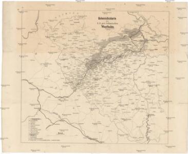
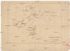
Uebersichtskarte der k.k. priv. böhmischen Westbahn
1 : 320000 Čechy západní (Česko)
Prag, Eger, Budweis, Linz, München, Regensburg
1 : 750000 Cheb (Česko : oblast) Fendl, Josef K. u. k. Militärgeographisches Institut
Prag, Eger, Budweis, Linz, München, Regensburg
1 : 750000 Cheb (Česko : oblast) K. u. k. militär-geographisches Institut
Prag, Eger, Budweis, Linz, München, Regensburg
1 : 750000 Cheb (Česko : oblast) K. k. militär-geographisches Institut
B.2. Prag, Eger, Budweis, Linz, München, Regensburg

Übersichtskarte von Mittel - Europa

Strassenkarte des Koenigreiches Boehmen

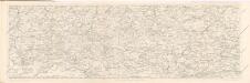
Uibersichtskarte der projektirten böhmischen Süd-West-Bahn
Čechy (Česko)
Des Königreiches Böhmen Mitte, Süden und Westen
1 : 750000 Čechy (Česko) Berghaus, Heinrich Karl Wilhelm Berghaus, Hermann Justus Perthes
Bez titulu – Wielandova mapa Čech, Moravy a Slezska

Grossdeutsches Reich Sudetenländer
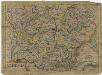
Bohemia
1 : 1600000 Česko Keere, Pieter van den
Freytag & Berndt ́s: Auto-Strassenkarten

Sbírka map a diagramů použitých na mírových konferencích v Paříži v letech 1919 - 1920

Přehlední mapa navržené české jího-západní-dráhy [sic]
Čechy jihozápadní (Česko)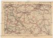
Deutsches Reich, Tschecho-Slowakei
1 : 600000 Německo Koch, Wilhelm Opitz, Carl Arnd
Karte der Holzartenverbreitung in Protektorat Böhmen und Mähren
Svoboda, Pravdomil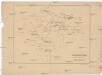
Stará hradiště v Čechách.
Čechy (Česko) Lego, František Filipovský, Karel
Südlicher Theil von Boehmen...
Nejstarší hroby v Čechách
Čechy (Česko)
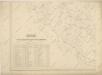
Mapa správního rozdělení ČSR: Západočeský kraj
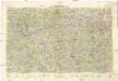
Hydrografische Uibersichtskarte der Flüsse, Bäche und sonstigen Gewässer im Königreiche Boehmen
Neubertova generální automapa Republiky československé
1 : 200000 Cheb (Česko : oblast) Soukup, Jan V. Neubert a synové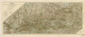
Šumava generální mapa značených cest turistických

Sect. 24: Regensburg, uit: Geologische Karte des Deutschen Reichs in 27 Blaettern / [von] Richard Lepsius ; Red. von C. Vogel
1 : 500000 Annotatie: Blad 18 ontbreekt; Een aantal bladen op linnen; Een aantal bladen gereviseerd 1913-1914; Annotatie geografische gegevens: Met schaalstokken o.a. in kilometers; Legenda Carl Vogel 1828-1897 Gotha : Justus Perthes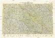
Neubertova generální automapa Republiky československé
1 : 200000 Klatovy (Česko : oblast) Soukup, Jan V. Neubert a synové
Pars III. proponit exteriores præfecturas dicasterio Straubingensi subjectas cum limitibus regni Bohemiæ adjacentis
1 Karte : 54 x 52 cm Heinrich Ludwig Broenner
[Čechy]
1 : 390000 Čechy (Česko)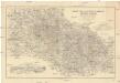
Karte des Bayrischen und des Böhmer-Waldes
1 : 250000 Bavorský les (Německo) Waltenberger, Anton Dressel, H. Waldverein